State ID: CA
3 letter designator: ORC
Fire name: Silverado
Location: Santiago Canyon Road x Silverado Canyon Road; Irvine, CA
Reported acres: 5
Rate of spread: moderate
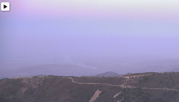
Report on Conditions: smoke and fire showing from multiple alert webcams. Downed powerlines into the brush.
Structure threat: not currently
Resources: ORC 2nd alarm, CNF & CNF T3 ST, AA52, T73, T74, T103, T101, Command Post @ Irvine Park.
Hazards: downed powerlines, high winds.
Weather: high wind warning & red flag warning.
Radio channels:
Scanner link: https://www.broadcastify.com/webPlayer/23313
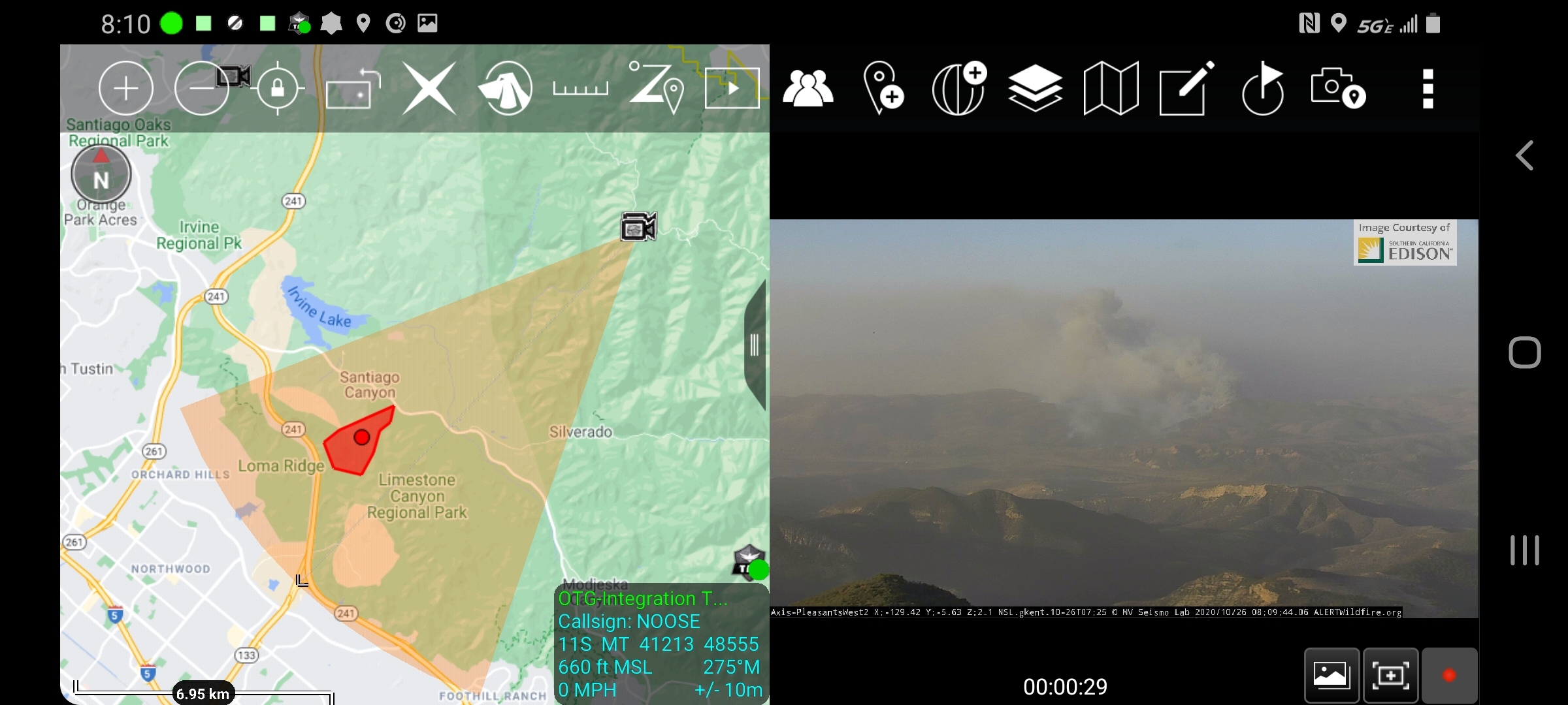
Webcam link: http://www.alertwildfire.org/orangecoca/index.html?camera=Axis-PleasantsWest2&v=7a7f1a7
http://www.alertwildfire.org/orangecoca/index.html?camera=Axis-SantiagoWest&v=7a7f1a7
Agency Website:
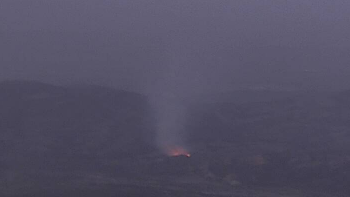
Callers advised it was started by electrical wires down. RP reports 50 x 50 spot.
5 acres, moderate ROS, wind driven. Silverado IC.
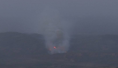
Now reporting 10 acres, rapid ROS, potential for extended attack.
100 acres in light to medium fuel with extreme ROS, per overhead size up from copter.
Per IC…fire is 1/8 mile from hitting the 241 and 1 mile north of the 133.
Putting in T1 ST’s into the Portola Parkway area already.
ICP is located at Irvine Lake
Per ORC D3…fire is at the 241 and requesting Cal Trans to close it
Requesting 5 T1 ST’s immediate need. Fire about to cross 241.
IC requesting 5 immediate need T1 ST’s to report to Portola Parkway
Fire has crossed 241 and is well established. Requesting 20 engines immediate need to Portola x Orchard Hills for structure protection.
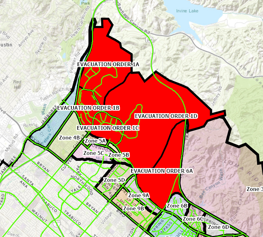
Now establishing evacuations of Orchard Hills per Div M. https://goo.gl/maps/4xAcKyh2QAzFLpDm8
Estimated fire map for the Silverado. As always this is for discussion and it not meant as a tactical tool, it is for discussion and orientation and was created solely from remote sensing with no on site validation.
Shutting down all tankers due to wind shear.
Winds in 20’s and gusts in 30’s, no super close active NWS stations with data though. Closest is John Wayne airport which shows wind sustained at 26, G 33, RH of 8%.
4 additional Type I STEN requested now.
Look at Bell Canyon RAWS. It is just up the hill.
Yeah, I did, but data in the table wasn’t matching.
Fremont Canyon on NWS San Diego shows the following: RH of 11 winds ENE 45, G74
Fremont Canyon RAWS will be the most representative RAWS for this area. It was 45mph g74mph at 0751hrs.