
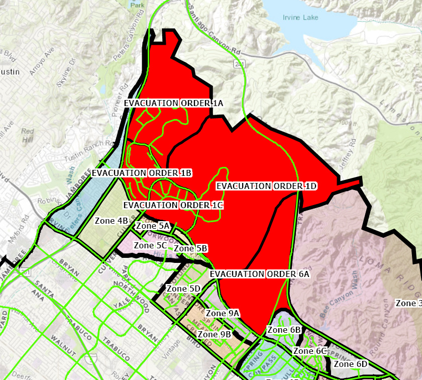
Now establishing evacuations of Orchard Hills per Div M. https://goo.gl/maps/4xAcKyh2QAzFLpDm8
2 Likes
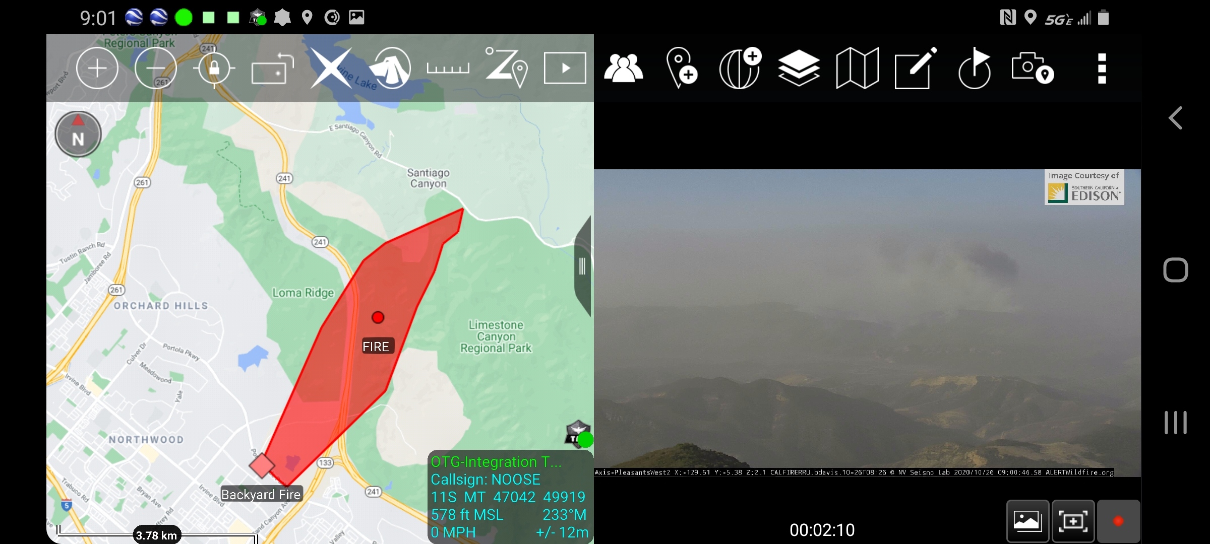
Estimated fire map for the Silverado. As always this is for discussion and it not meant as a tactical tool, it is for discussion and orientation and was created solely from remote sensing with no on site validation.
6 Likes
Shutting down all tankers due to wind shear.
4 Likes
Winds in 20’s and gusts in 30’s, no super close active NWS stations with data though. Closest is John Wayne airport which shows wind sustained at 26, G 33, RH of 8%.
1 Like
4 additional Type I STEN requested now.
Look at Bell Canyon RAWS. It is just up the hill.
1 Like
Yeah, I did, but data in the table wasn’t matching.
Fremont Canyon on NWS San Diego shows the following: RH of 11 winds ENE 45, G74
Fremont Canyon RAWS will be the most representative RAWS for this area. It was 45mph g74mph at 0751hrs.
2 Likes
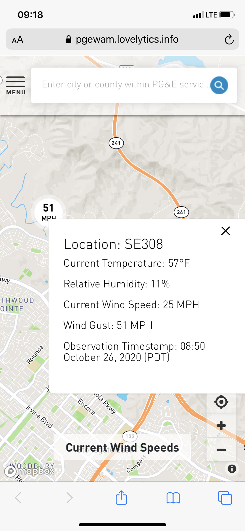
SCE Santiago Canyon weather station: Temp 55, RH 11%, winds 30mph gusts to 54mph at 0853.
Updated map for discussion. Estimated as of 0840 from air. Not for tactical decision making.
4 Likes
That’s about right for Fremont on a cold Santa Ana.
That is the same section of homes that burned in the last 2 fires ORC has had in there. It always follow the exact same foot.
2 Likes
I have seen SCE weather stations and wonder how accurate they are. Their setup does not comply with NWS guidelines. I look for NWS approved sites or CDEC sites just for accuracy.
2 Likes
Live video here: https://ktla.com/news/local-news/wind-driven-brush-fire-sparks-in-santiago-canyon-area-residents-between-tustin-and-foothill-ranch-urged-to-be-vigilant/
1 Like
Twitter reports fire has jumped portola parkway. Ground shot videos showing pretty extreme conditions still occurring.
2 Likes
ABC7 Is saying new reports from officials is approx. 500 Acres revising from the earlier report of 2,000 acres.
Just saw this “new” start. Don’t see any aircraft overhead, not even an air attack. Grounded due to wind?