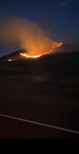
State ID: CA
3 letter designator:PNF
Fire name: ADAMS
Location: SCOTTS RD OFF OF HWY 395
Reported acres:45
Rate of spread:MROS
Report on Conditions:
Structure threat: 1 structure
Resources:
Hazards:
Weather: RED FLAG WARNING IN EFFECT UNTIL 2100 Monday.
Radio channels:
Scanner link:
Webcam link: http://www.alertwildfire.org/shastamodoc/index.html?camera=Axis-Constantia&v=81e003f
Agency Website:
1 Like
78 degrees, 28% RH and winds are WSW at 9 mph with gusts to 28 mph. There is one structure in the area. Map
1 Like
This thing just spotted over the line in outflow winds and looks to be off and running. Good view here.
http://www.alertwildfire.org/blmnv/index.html?camera=Axis-FortSage&v=81e003f
5 Likes
Awesome 1hr time lapse
5 Likes
Recovering fire behavior and resource tracking from footage from the two Alertwildfire cameras on the CA-PNF-Adams fire using our browser-based Realtime.Earth tool. Hoping to release soon. Cross posted in “emerging tech”
8 Likes
Do you still have the original photo? We’d like to know the exact time and lens properties from the EXIF.
Can you email original to share@realtime.earth?
2 Likes
Amazing, thank you. Looking forward to seeing more of this.
3 Likes


