State ID:CA
3 letter designator:PNF
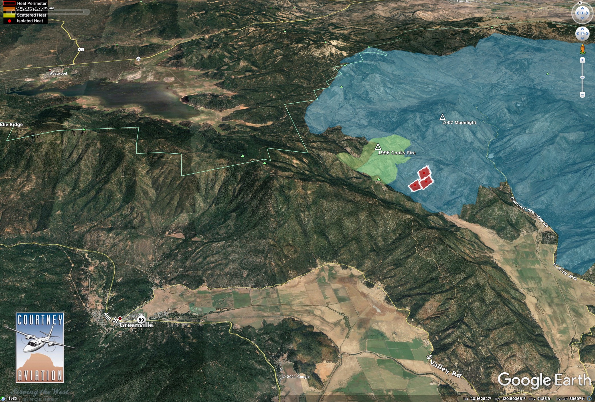
Fire name: Evans
Location: north arm of Indian valley Evans peak
Reported acres: 15+
Rate of spread: unknown
Report on Conditions: moonlight fire scar lightning caused.
Structure threat: unknown
Resources:BC-25 CR-5 FSM DZ-2 PNF E-2 GIR E-22 PNF E-320 PNF E-324 PNF E-330 PNF E-35 PNF E-9905 FSM E-9906 FSM WT-2 PNF
Hazards:
Weather:
Radio channels:
Scanner link:
Webcam link:
Agency Website:
4 Likes
Per CAD now 75 acres.
3 Likes
VIIRs has it (PNF-Evans) here.
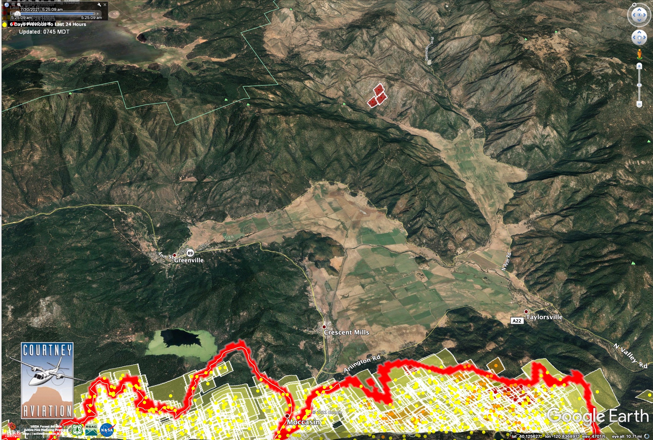
It’s burning next to an area that has burned twice in past 25 years. Light blue is 2007 Moonlight Fire.
6 Likes
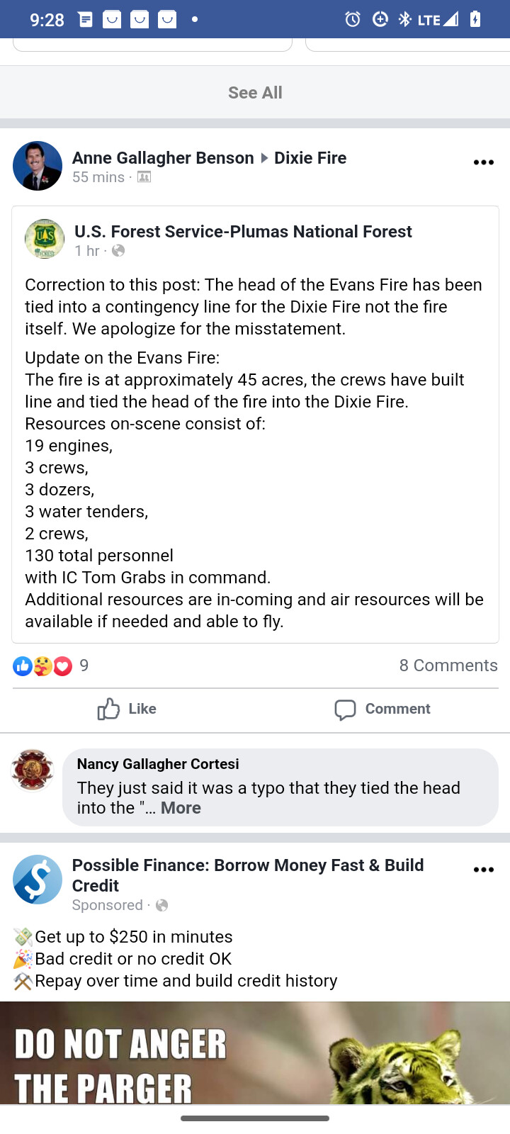
Update from the Plumas national forest: 45 acres and crews have tied the head into the Dixie fire contingency line.
4 Likes
Where did you find this?
Luckily it started where they had dozer line going in already.
3 Likes
Plumas national forest and inciweb say 85 acres and being managed as part of the Dixie.
3 Likes
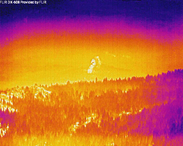
Now that it’s a little clearer it’s visible from dyer mountain.
ALERTWildfire | Shasta Modoc
1 Like
The fire 50 acres and 10% contained per the evening update.
https://m.facebook.com/USFSPlumas/?tsid=0.9959224783489631&source=result
3 Likes
125 acres according to Dennis burns east zone update.
3 Likes
That is a spot further north.
1 Like
You are correct, it is a spot from the dixie
2 Likes