The local departments around quincy all got toned out for immediate need structure protection, any info? Did something blow out?
Yeah, it’s Meadow Valley.
Not sure on the details yet.
3 Likes
Mandatory evacuations in place for Meadow Valley.
3 Likes
sounds like 1 engine responding from almanor.
2 Likes
Bucks lake area, increased activity showing.
1 Like
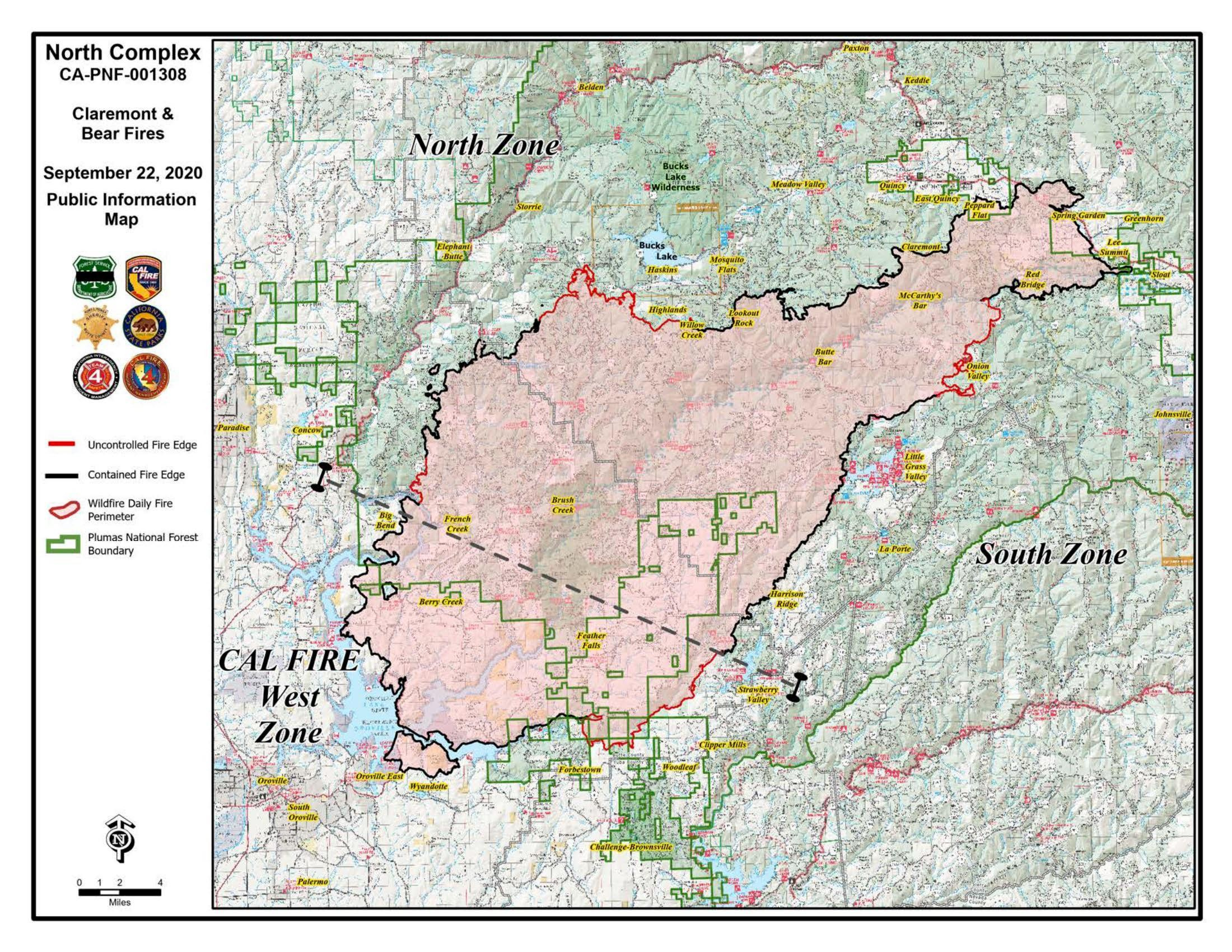
They got a 200 plus acre spot fire running North East of Red Mountain. With today’s expected gusty conditions they understandably worried . Resources are stretched pretty thin . Going to be a challenging day according to the morning USFS updates
https://www.facebook.com/USFSPlumas/videos/975876216262434/?so=channel_tab&rv=all_videos_card
4 Likes
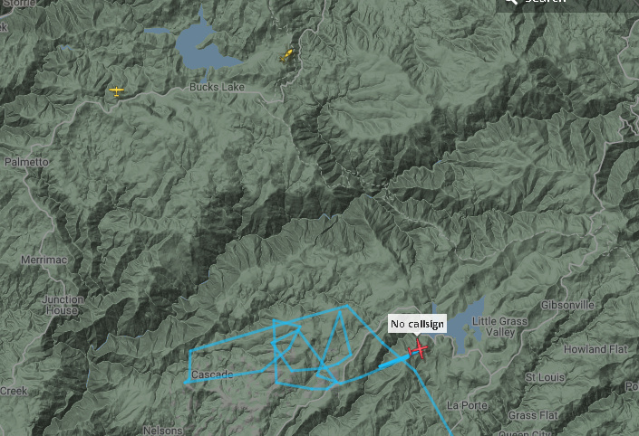
The Metroliner is flying the south section by Strawberry and there is a chopper working near bucks lake with a spotter plane… Winds have started to pick up as forcasted.
1 Like
Not a lot of growth on the fire except on eastern flank near La Porte Road, which has steady, but not spectacular growth. The finger that blew out under southwest winds south of Bucks Lake on 9/14 continues to spread slowly through short-range spotting, and this area was the reason they evacuated Meadow Valley yesterday. Even though it is a long ways from the community, they were playing it safe with the forecast wind event, and said due to a lack of resources they might have to abandon perimeter control on this part of the fire if it kept overwhelming them with spotting. This info per Jake Cagle’s very detailed operational briefings on the PNF Facebook Page, which should be the standard PIO product on every large fire, IMHO.
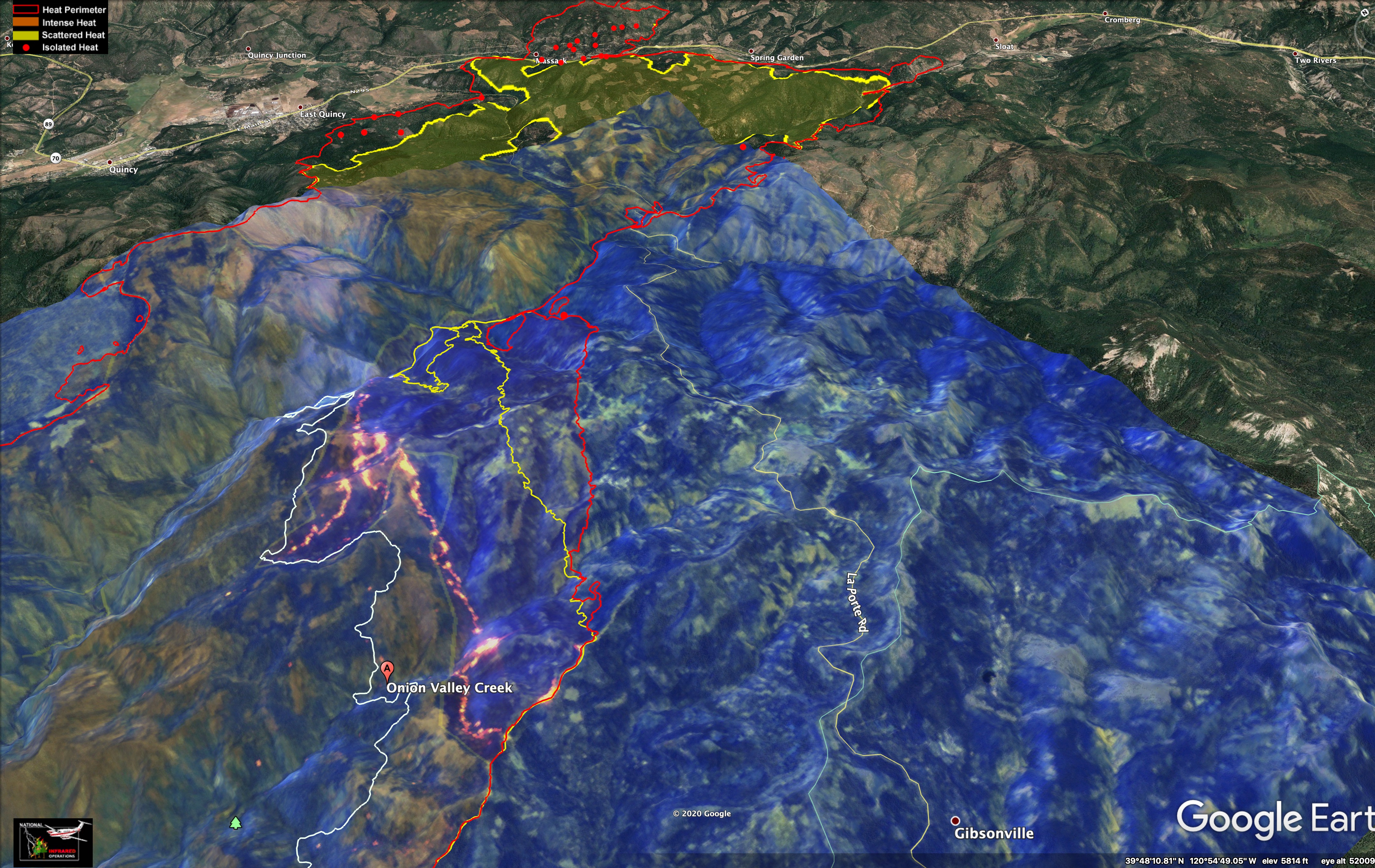
Here are IR maps with red line showing fire perimeter from 9pm last night, 9/17/2020. The yellow line is where the fire was on 9/17/2020 at 3am, and the white line was captured on 9/14/2020 at 12:30 am. The satellite image in the background was from 2pm on 9/16/2020.
View over La Porte Road, looking north.
Looking southeast, south of Bucks Lake.
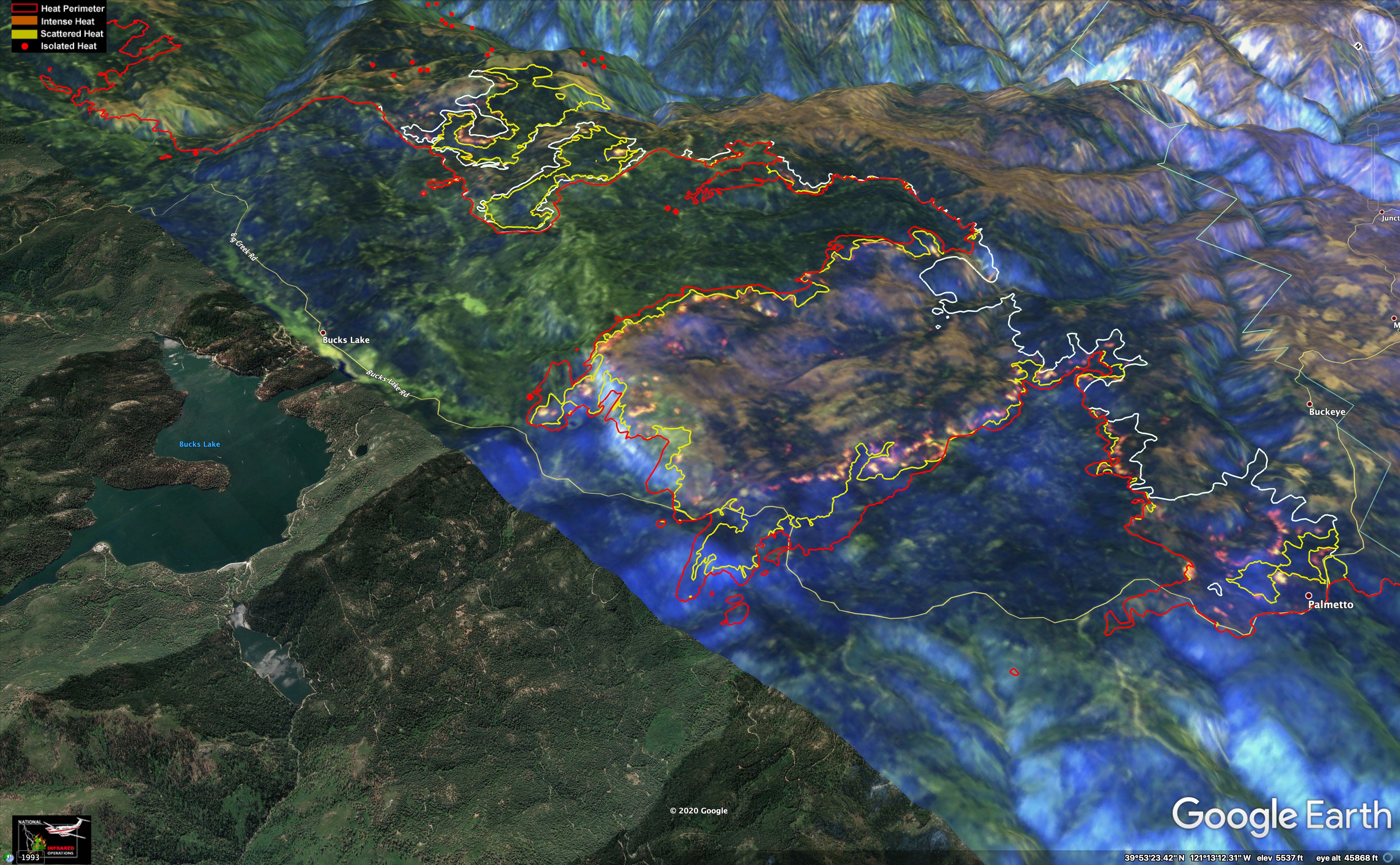
Data sources: IR lines from NIROPS, base image from European Space Agency.
9 Likes
Thank you for these images!! Agreed re: Jake Cagle’s reports. Concise, informative and lays rest to rumors.
2 Likes
1 Like
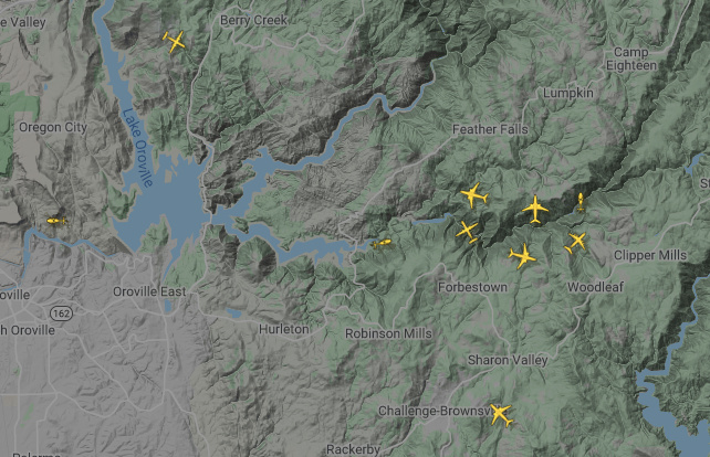
Skies are crowded this afternoon. Lots of activity overhead
2 Likes
Above are links to some outstanding drone footage of the fire area… you can see the intensity of the fire .
7 Likes
Thanks for the above links! Quite stunning/sobering.
1 Like

this sort of explains what all the air traffic yesterday and today have been up to.
10 Likes

Sounds like there will be some additional help in the air tomorrow
6 Likes