Appears to be some heat just east of Bangor on Modis, but a gap between it and the main fire. Time stamps would allow for fire travel to that point. Anybody know if this is separate/spot/or if the fire has moved that far south? It’s only 5 miles.
Believe thats the Willow Fire in NEU…started around 1am
2 Likes
Yeah, definitely the NEU-Willow Fire, spotted by night time Air Attack last night at 1am at 50 acres. No other reports at the time, and well outside the hot part of the smoke column at the time. However not within the PSPS area, which is just east of the ignition area. Not implying anything, and the existing outages there all started about 1.5 hours later, just painting the big picture.
3 Likes
Any word on station 51 in Feather Falls? 52 is the volunteer apparatus storage and further up the road is the seasonal station 51.
From a friend station 51 is ok
3 Likes
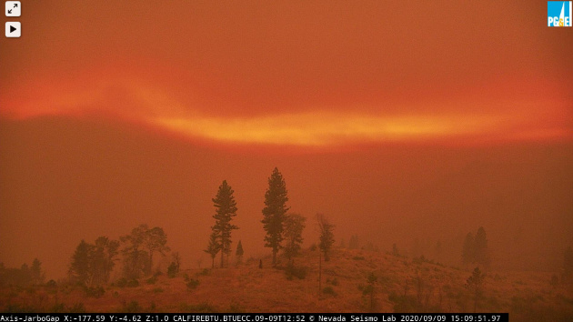
Watching the Lexington Hill cam 15 minute loop, great look on the shifting winds
3 Likes
Here is what you were talking about:

10 Likes
Checking on the RAWS in the area throughout Tuesday evening and noticed most managed to survive and dodge the path of this thing, as well as maintain battery in negligible solar conditions.
Except for IRAWS 59 on Franklin Hill. It took a glancing blow in the 3pm hour Tuesday. With a 15min resolution, it last reported 89F NNE23G42 at 3:05pm. It skipped two reports and came back at 350pm at 125F and no wind. The wind has been CALM since, probably dismembered a sensor, but reporting for duty nonetheless.
Yes, I’m self-aware of my seeking out fire cam and RAWS survival (and non survival) in these fires. The 2018 MNF Ranch had a few amazing RAWS survivals. I’m 20+ years in IT, and maybe, just maybe I like to see the machine finally take a little heat…
11 Likes
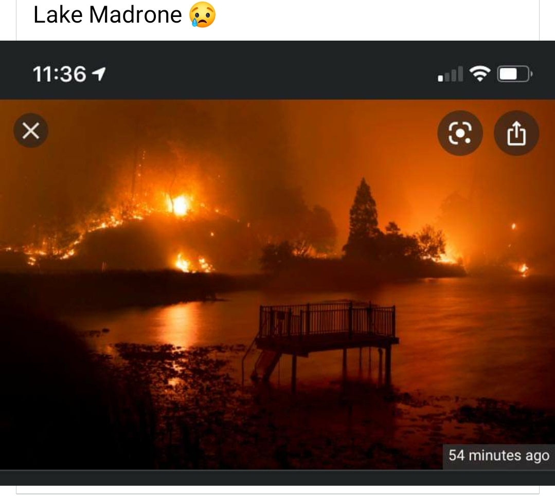
Looking for any intel on cabins on Toyon Trail, North West side of Lake Madrone, Branch XXIII? looking at todays Ops map the fire went through there Tuesday but is showing the fire edge close by.
You cannot look at these fire maps and say someone’s place burned down. These maps show the fire’s outward perimeter and do not reflect what burned inside the perimeters. There may be islands of unburned fuelbeds and always hope that suppression crews were fighting house to house as the fire went by and were successful a lot of the time in protecting the structures.
8 Likes
Yes, hence my question, it’s clear from the ops map and MODIS that the fire went through the area, I was just looking for specific intel on that street, if structures were lost or saved/spared. Thanks!
1 Like
I just realized that 19 years ago, at this exact time, Big Bend Mountain was on fire, too. I was in Durham at the Poe Fire ICP, and we were listening to news of the second plane hitting the twin towers. We’ll never forget 9/11.
12 Likes
Got this intel on Lake Madrone: “All houses on toyon trail (southwest side) are intact, Lakeside way coming I n at north gate houses survived. Inner lake madrone is hit and miss. As always, this could change as I am not there any more.”
4 Likes
Is there a suggested scanner channel for this? It’s federally managed and CAL FIRE is also participating. I’ve been listening to the Butte County Sheriff and CAL FIRE station on Broadcastify (https://www.broadcastify.com/webPlayer/31474) and I noticed the Scan California Live Scanner isn’t covering it.
Any other suggestions? Alas I do not have a “real life” scanner at this time, just digital. (I’m looking at them…but god it’s overwhelming!)
Thank you!
1 Like
Maybe this one…

Backburning.
2 Likes
hopefully…successful
3 Likes