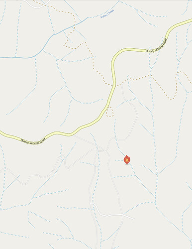
Any intel on this smoke?
wouldnt this be in the dixie scar?
another fire where?
Watch Duty now has it as being .05 miles south of the Valley Creek Trailhead, LaPorte.
No name, just listed as “Vegetation Fire”
Oh my bad, I meant the south near the Moccasin peak cam ALERTCalifornia - Moccasin Peak 1
This is PNF Ravine. East of Sly Creek Res.
Sounds like they are having trouble finding the actual fire, asking for night AA if it exists
No night AA but a BTU engine responding will have a night flying drone. I know nothing about these, anyone have a comment?
I assume this it.
Cam…https://alertca.live/cam-console/1612
A night flying drone, is just a drone. A valuable tool as long as the airspace is clear. Put it at 400 feet and get an idea of real time fire spread. If it has IR/FLIR you can see spots and fire perimeter with incredible detail.
That’s it.
still having access issues?
I don’t think anybody has made it to the actual fire yet. Heard dispatch giving them the same coords over the radio as before from the camera crosses but somehow they can’t find how to get into it.
hopefully they do soon looks like steep country
Fire looks a little bigger
Seems to have been put out overnight

