
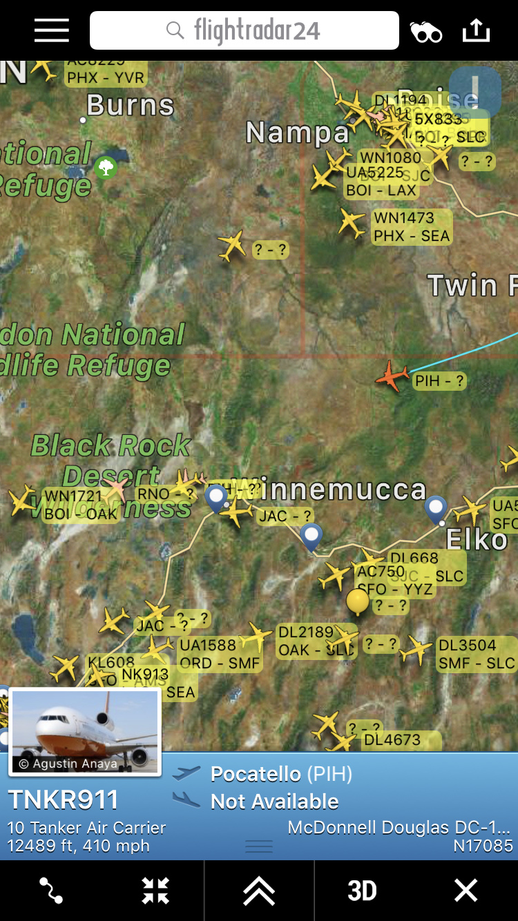
Is the on the CA side??
Yes very much on the CA
Very much in CA. Plumas County
1 Like
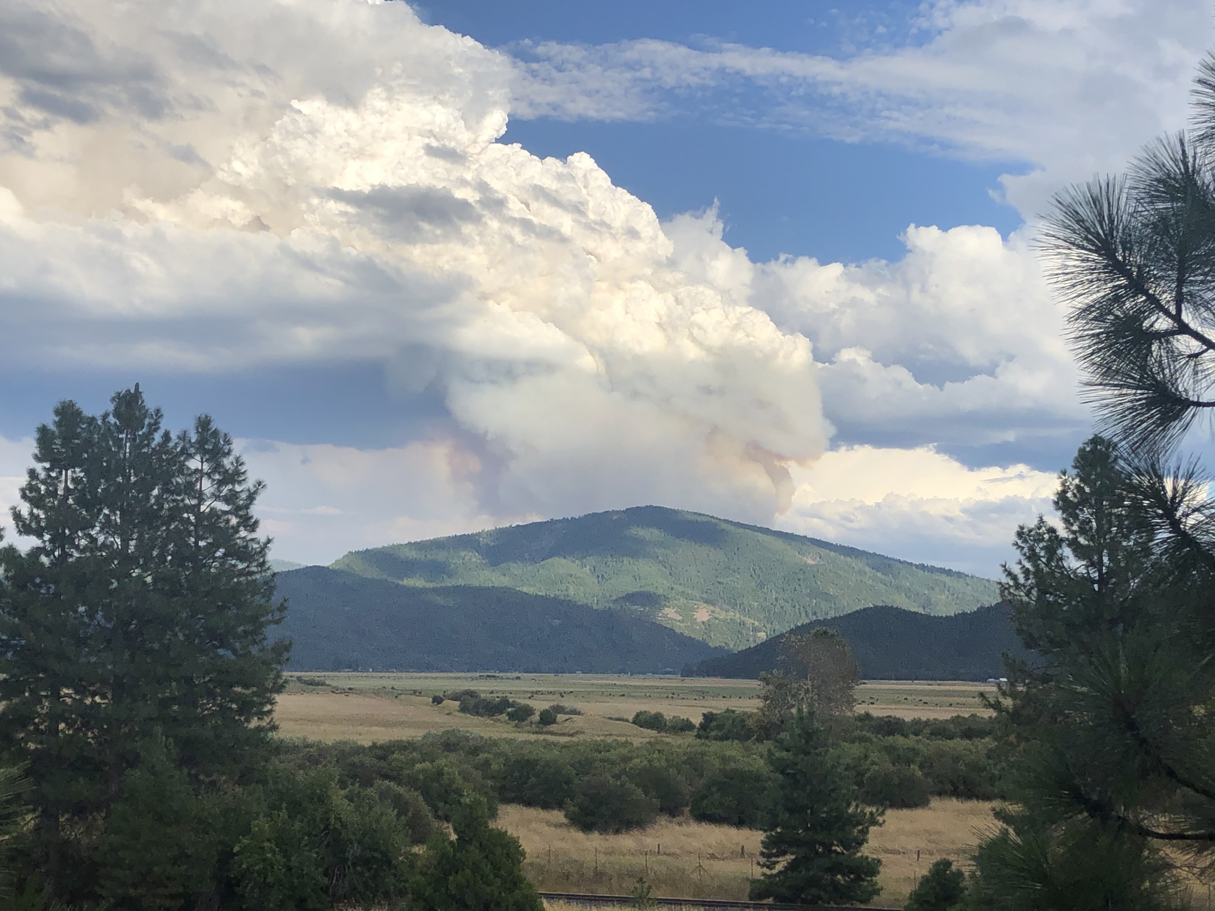
It is just south of moonlight burn scar!
5 Likes
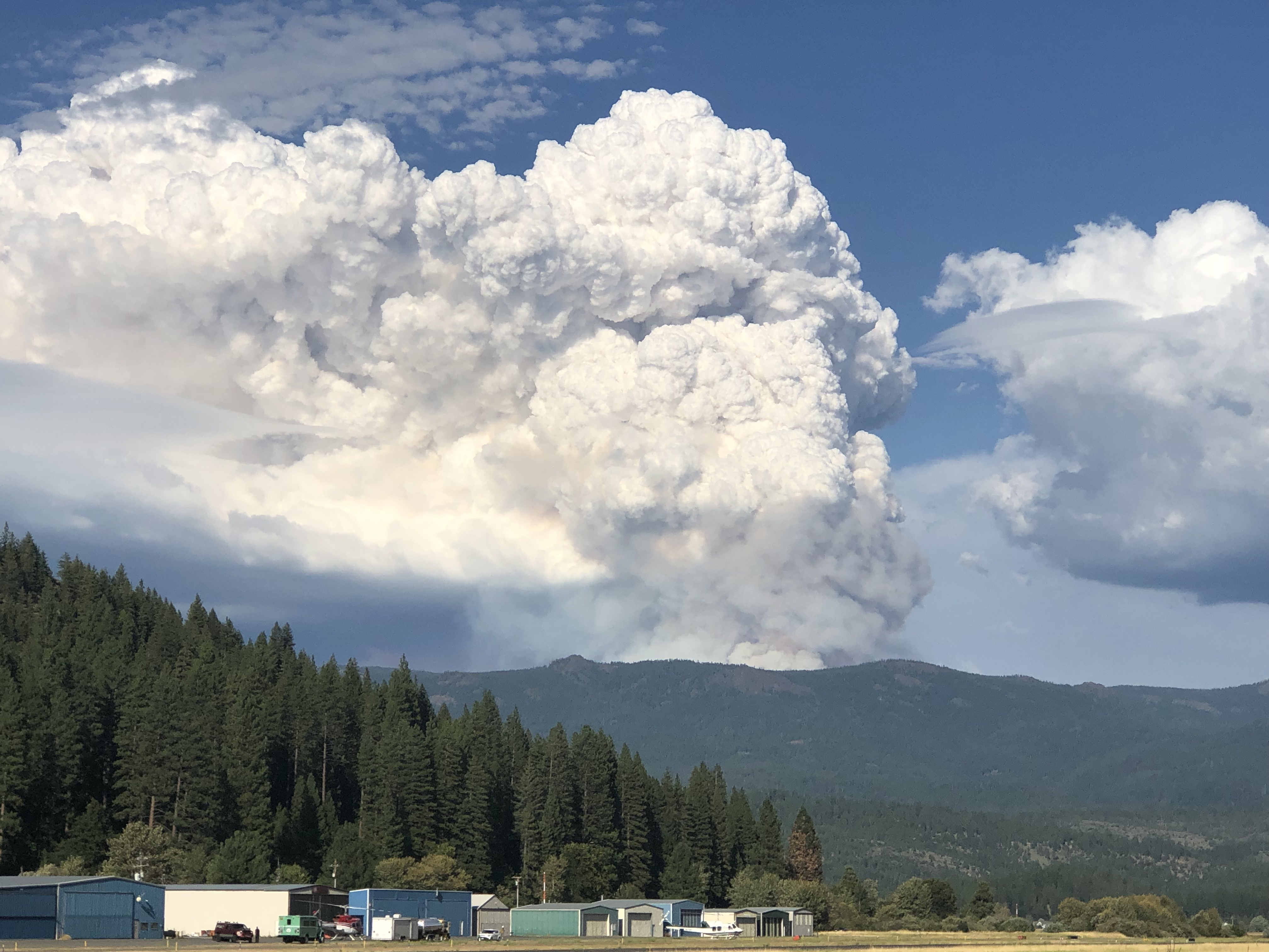
It’s showing up on the VIIRS satellite with detections at about 1300hrs.
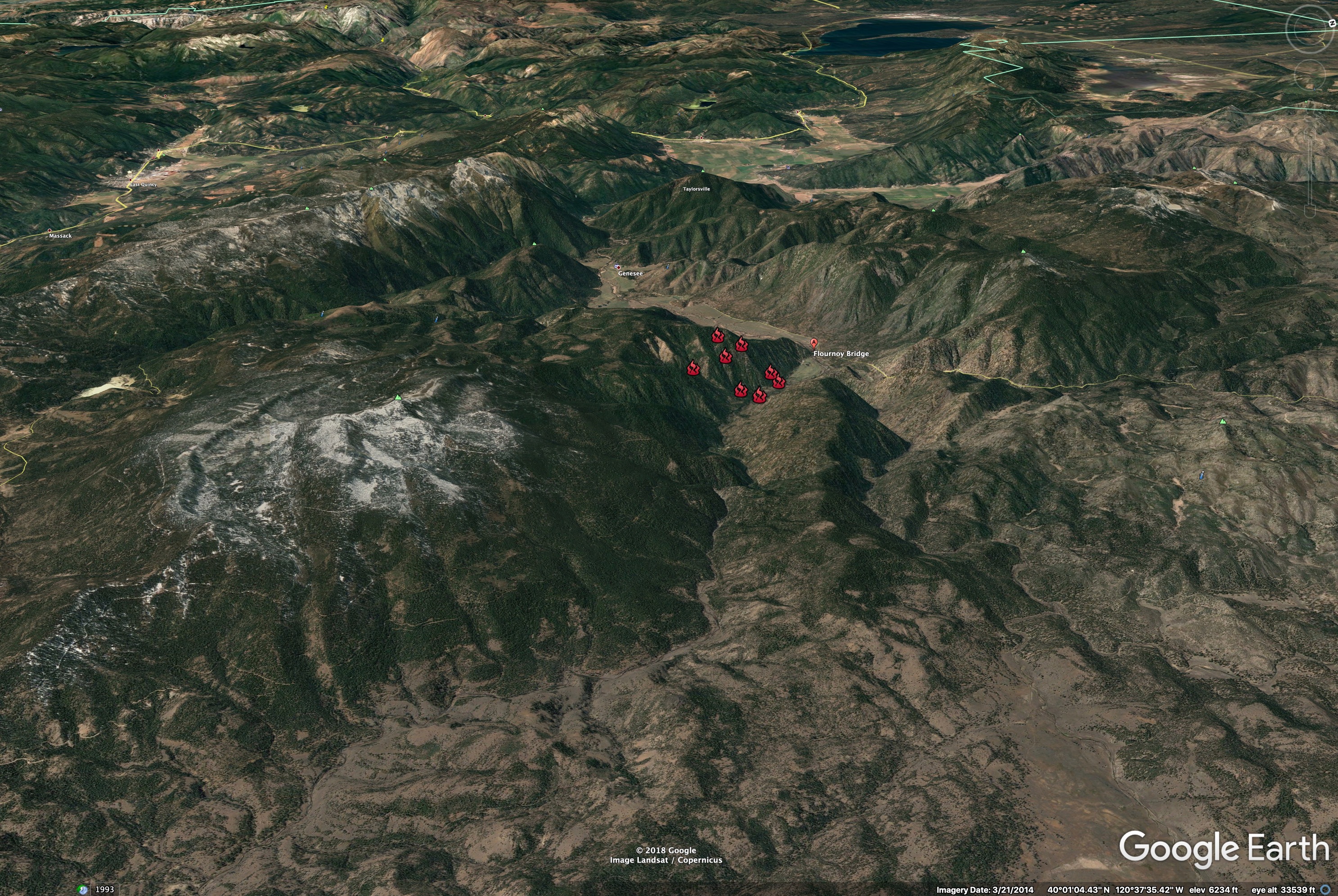
This view is looking West over Flournoy Bridge.
Genesse Store in center of the image.
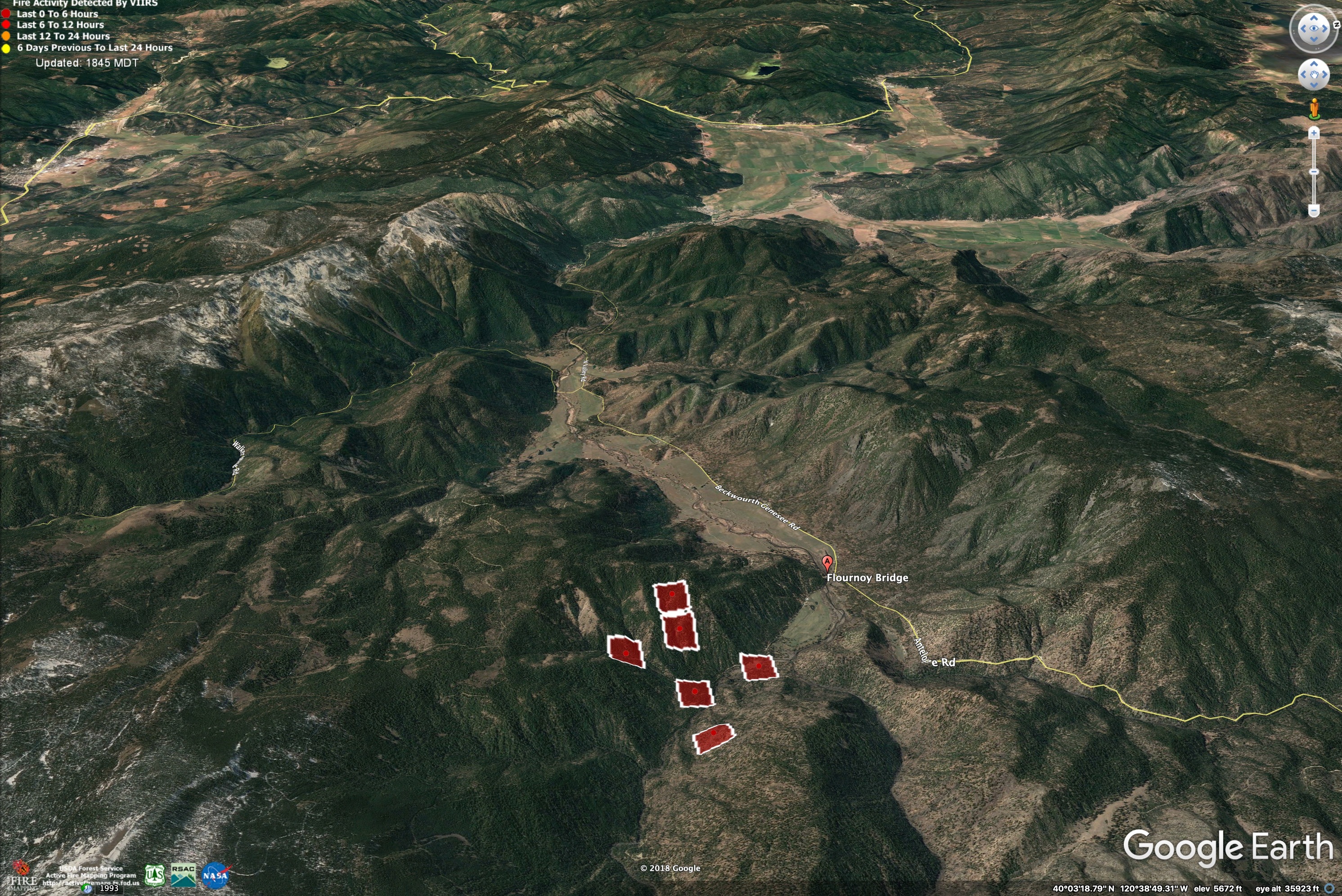
Indian Valley in upper right, Quincy in upper left.
4 Likes
The moonlight actually burned across the north end of antelope lake clear to Stoney ridge!
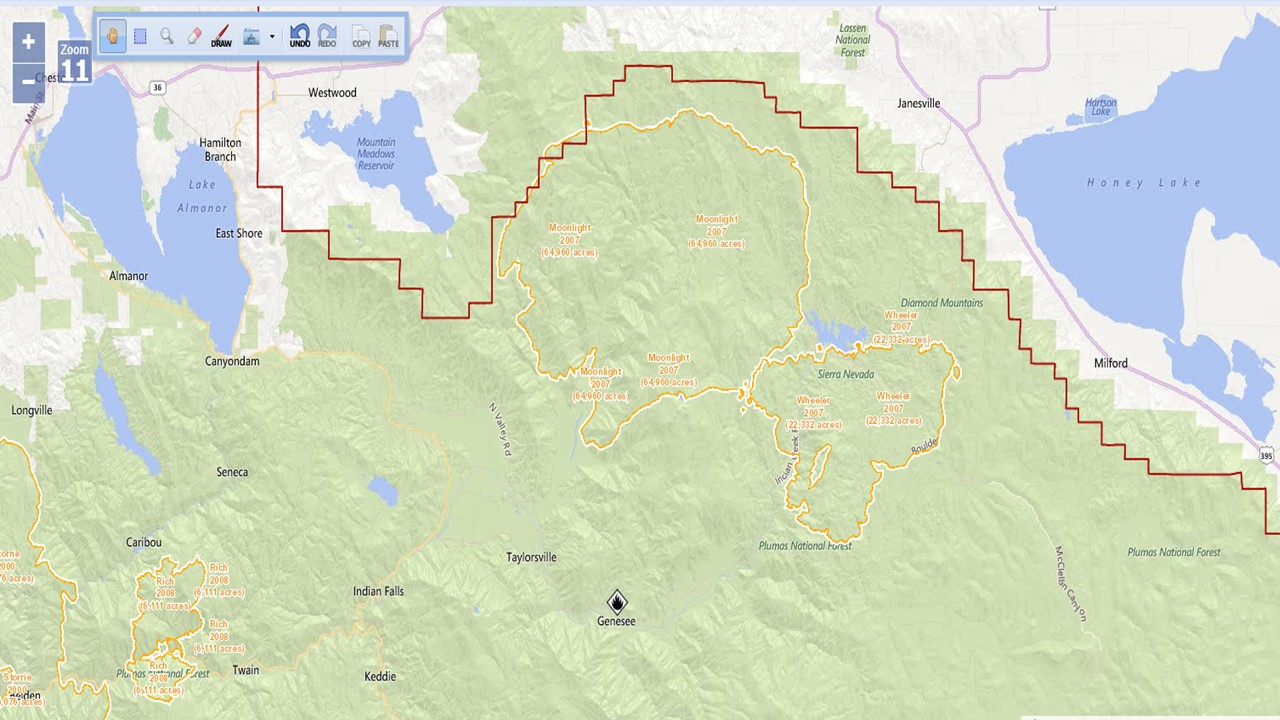
That fire history overlay is the data that is in the SCOUT program…
No mentioning that M word anymore! But in the latter days of the fire access was from the Taylorsville area.
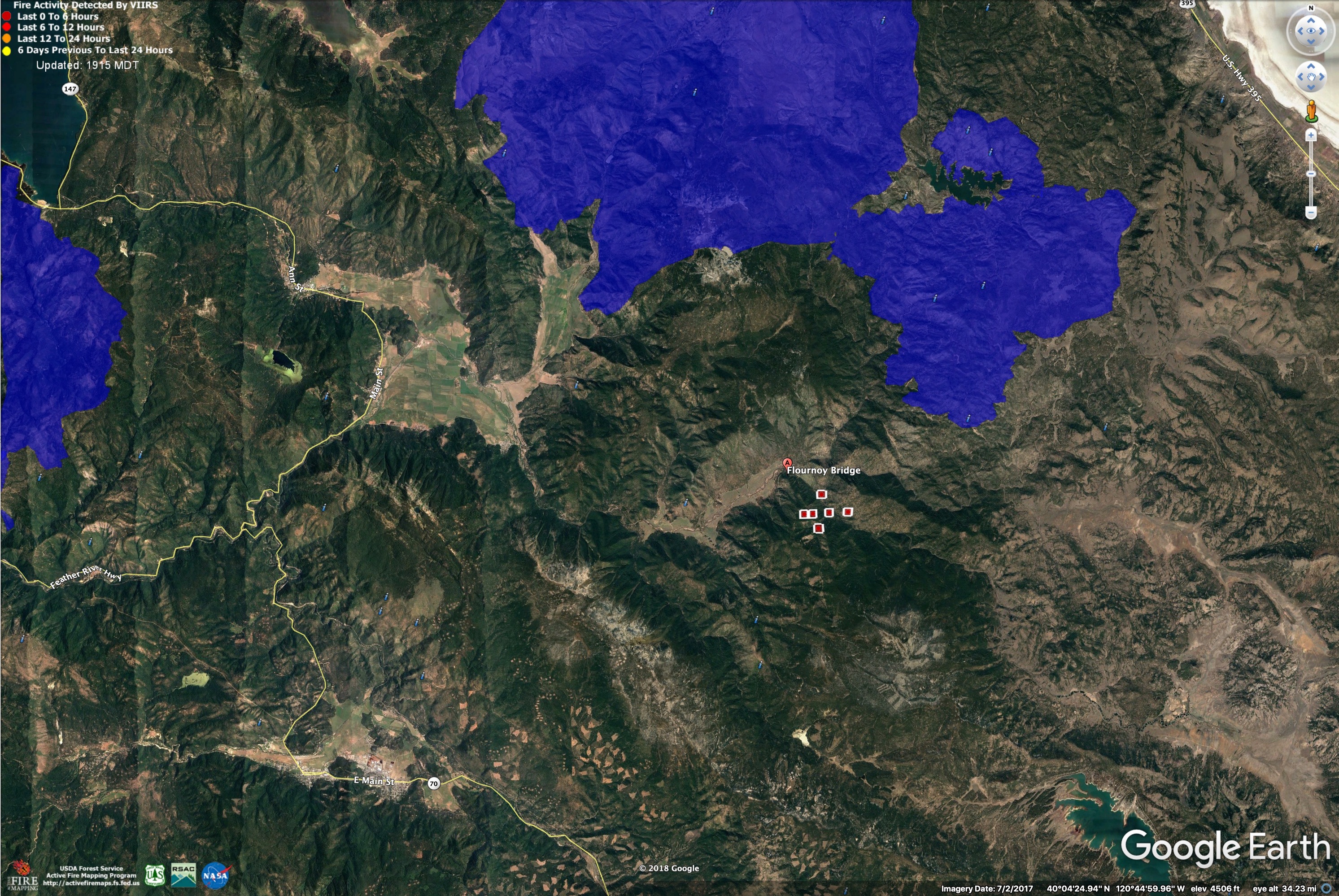
Here is a map of Moonlight and Antelope Fires (dark blue, both 2007).
Antelope Complex is on the right. Moonlight is about 6 miles north of current fire location (red squares).
Red squares show Walker Fire at 1300 9/4/2019.
1 Like
I think the fire on the left is the Chips Fire. The Moonlight was never on the west side of Hwy. 89. and did burn down to and around the east shore of Antelope Lake.
1 Like
You are correct about the Chips footprint…
2 Likes
Any acreage updates?
1 Like
NOPS has it at 200 acres as of 1830, but judging by the column it’s much bigger.
1 Like
PNF Facebook post put it at 750 acres.
1 Like
There is history of rapid fire growth in the canyons of the NE part of the Plumas. The nearby Antelope Complex burned about 7,500 acres in its initial run in 2007, and Moonlight ran 20,000 acres on the third day. The Haines Index is pretty low for next few days, though, and it looks like we’ll have decent humidity recoveries, 30% chance of wetting rains…
This fire is in an interesting spot on the landscape, right on the transition from the big old mixed conifer forests on the steep North slopes of Mount Ingalls to the dry, rocky, open Eastside Pine of the high valleys. This area can be pretty exposed to east winds, but it looks like the forecast is pretty stable with South and SW winds for the next few days.
Spot Forecast for Walker…USFS
National Weather Service Reno NV
453 PM PDT Wed Sep 4 2019
Forecast is based on forecast start time of 1700 PDT on September 04.
If conditions become unrepresentative…contact the National
Weather Service in Reno.
.DISCUSSION…
Thunderstorms will remain just east of the fire area this evening,
but more thunderstorms are possible after midnight tonight through
Thursday morning. There will be a threat of thunderstorms through
1500 on Thursday. Outside of thunderstorms, winds will generally
be southwest in the afternoons and evenings with above average
humidity. Much drier air is anticipated for Friday and Saturday
with a bit breezier afternoon winds.
.REST OF TODAY…
Sky/Weather…Mostly cloudy. Isolated showers and
thunderstorms east of the fire.
Max Temperature…85 in the valley to 78 at 5500 feet falling
to near 70 by 2000.
Max Humidity…25-30% rising to 35-40% by 2000.
20-Foot Winds…Southwest winds 9-12 mph with gusts to 20 mph.
Gusty and erratic winds expected near
thunderstorms.
LAL…2.
Chc Wetting Rain…5%.
Mixing Height…6800 ft agl.
Transport Winds…Southwest around 10 mph.
Ventilation…Good.
Haines Index…3.
.TONIGHT…
Sky/Weather…Mostly cloudy. Isolated showers in the evening.
Scattered showers with isolated thunderstorms
overnight.
Min Temperature…50-55 in the valley to near 60 at 5500 feet.
Max Humidity…71-74% in the valley to 50% near 5500 feet.
20-Foot Winds…Southwest winds 9-12 mph in the evening
becoming downslope 2 to 5 mph. Gusty and
erratic winds expected near thunderstorms.
LAL…2.
Chc Wetting Rain…20%.
Mixing Height…6800 ft agl in the evening then 200-500 ft agl.
Transport Winds…Light winds.
Ventilation…Poor to good.
Haines Index…3.
.THURSDAY…
Sky/Weather…Partly cloudy then becoming mostly cloudy.
Scattered showers and thunderstorms until
1500.
Max Temperature…83-86 in the valley to 75 at 5500 feet.
Min Humidity…26-29%.
20-Foot Winds…Upslope 3-7 mph becoming southwest 10-15 mph
with gusts to 25 mph in the early afternoon.
Gusty and erratic winds expected near
thunderstorms.
LAL…4.
Chc Wetting Rain…30%.
Mixing Height…8700-9700 ft agl.
Transport Winds…South around 10 mph.
Ventilation…Poor to excellent.
Haines Index…3.
$$
Forecaster…Wallmann
(SOURCE: https://www.weather.gov/spot/monitor/)
4 Likes