
Team 14 is being prepositioned in Redding. Still haven’t decided yet if they will have them take this fire.
1 Like
Some fire footprints. Credit Cal Topo for the map. The little stars right of center are the VIIRS hits as of now.
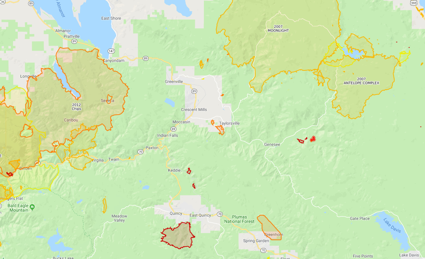
2 Likes
Probably waiting to see if it gets some
Precip on it…30% chance tomorrow but also a RFW in place so lets see what good ol Mother Nature brings
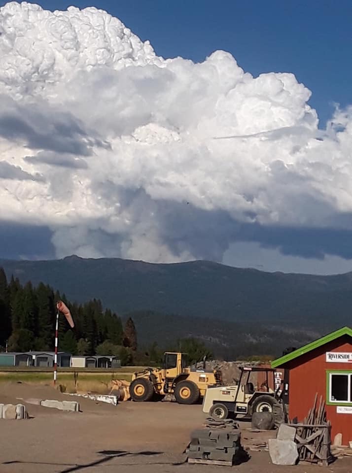
Phone shot from Red Bluff just after sundown. (Pink lit on horizon, middle of shot) Normally wouldn’t be too impressive except it’s the first legit pryoCb we’ve had this season up here.
4 Likes
IA CREATED*
1 Like
Well all of a sudden Mother Nature turned on fire season.
7 Likes
Well it’s about time! Oh wait… it’s fall…
2 Likes
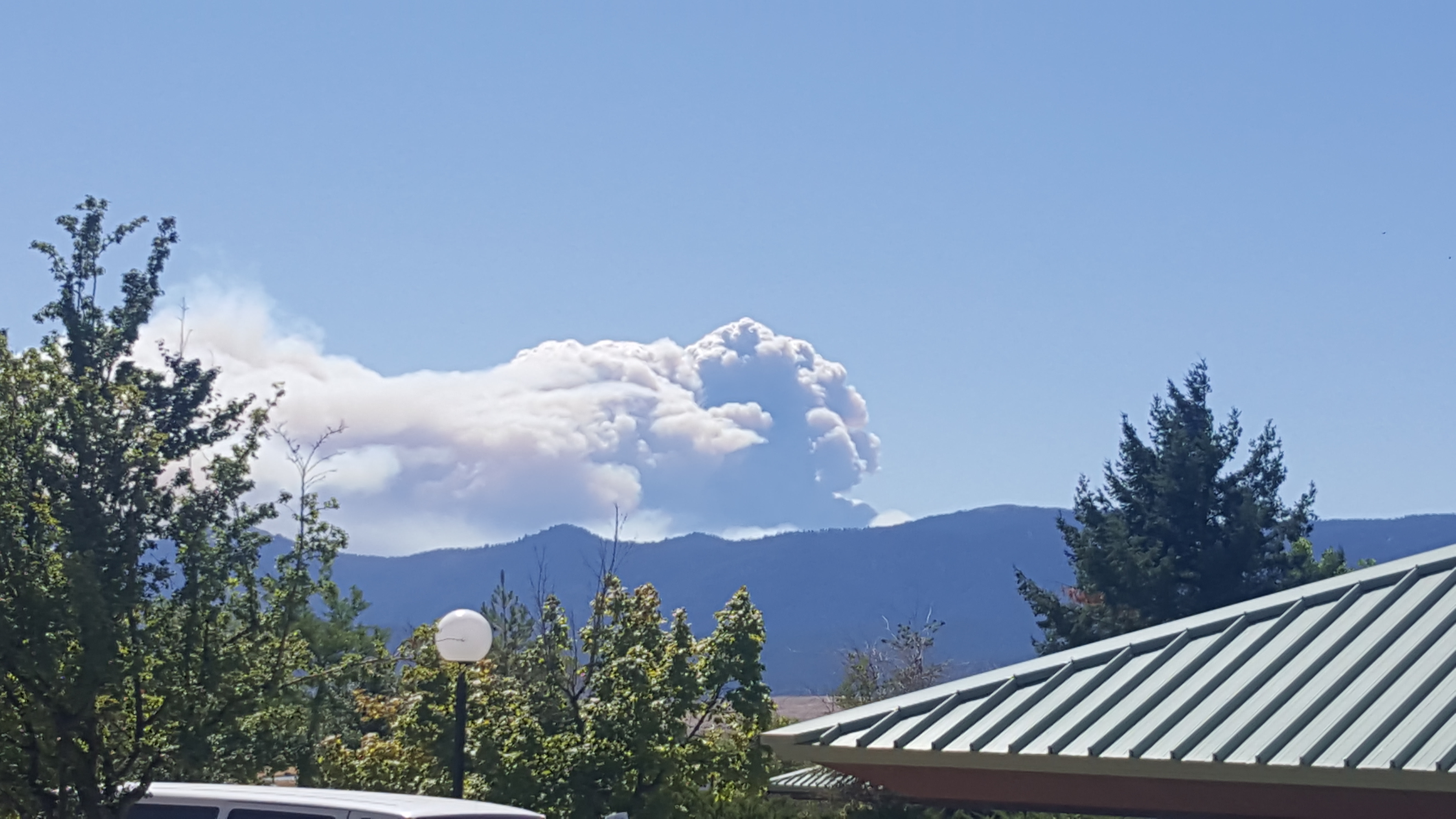
Boom goes the dynamite.
1 Like
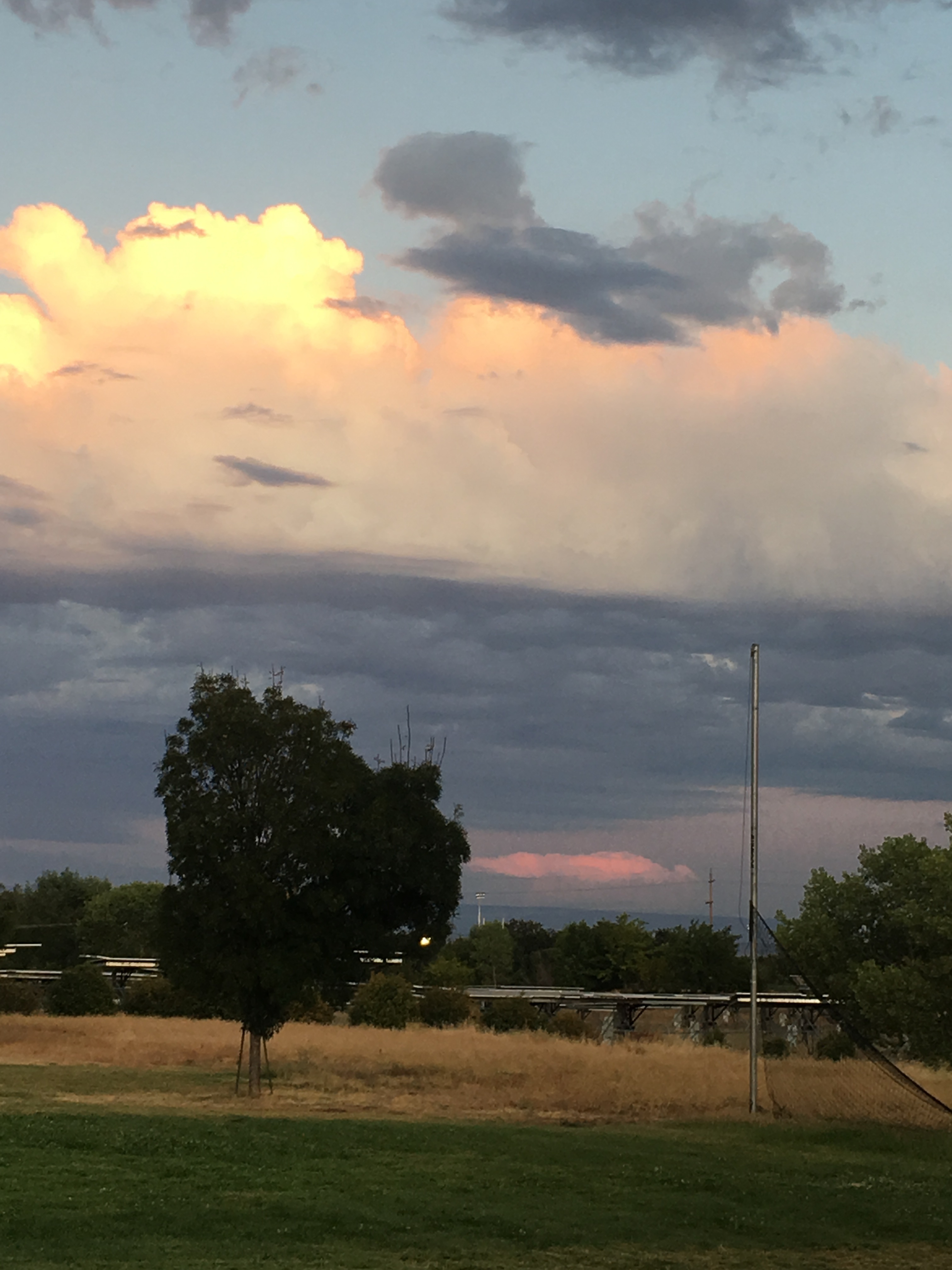
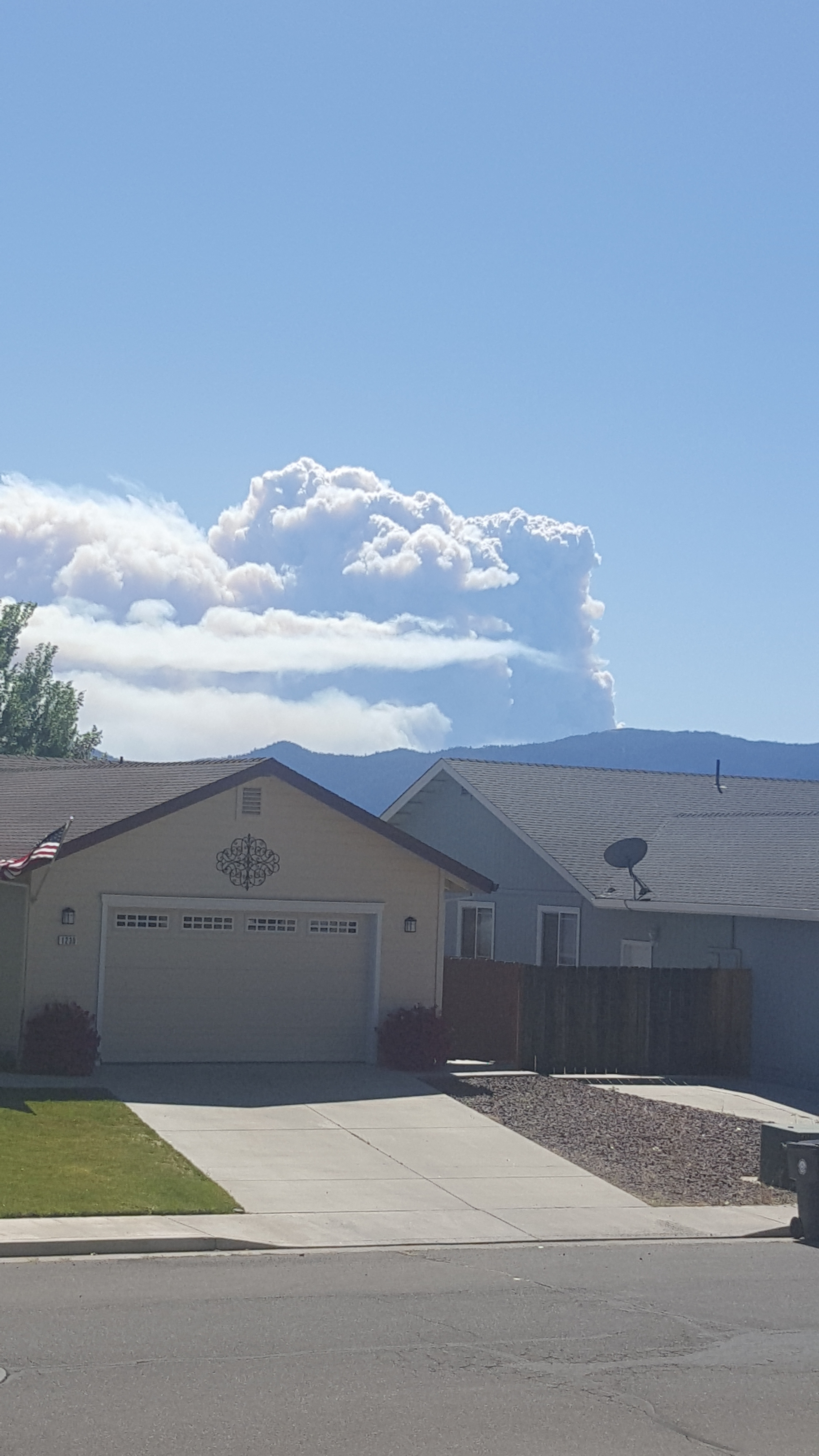
Where is the picture above (house in foreground) taken from
1 Like
First pic I posted was taken from Lassen College. 2nd picture was taken from the Diamond mountain Casino area in Susanville at about 12:40 pm about 20 mins or so after the first posted pic.
2 Likes
Any structures out in front of this thing?
To the east just a few isolated ranches and associated buildings. To the west the small community of Genesee and more ranches. About 10 miles to the west the community of Taylorsville. Structures to the west are mostly in flats with large ares of grass and little brush/timber.
2 Likes
What direction is the movement?
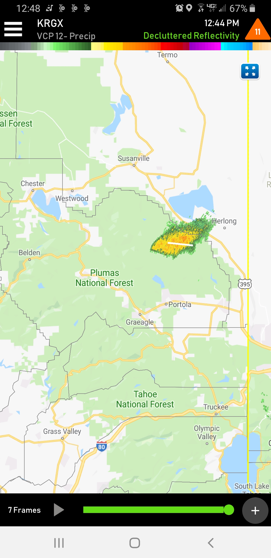
Yeah, I agree based on that radar shot.
Its moving east towards honey lake and if we recall history moving to where the eagle fire burn over happen. Heads up along the front country
4 Likes
For sure. I saw that video at the first of my career (1993). Scary stuff.
1 Like