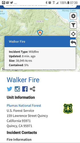
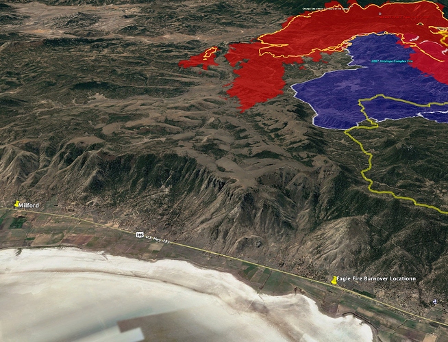
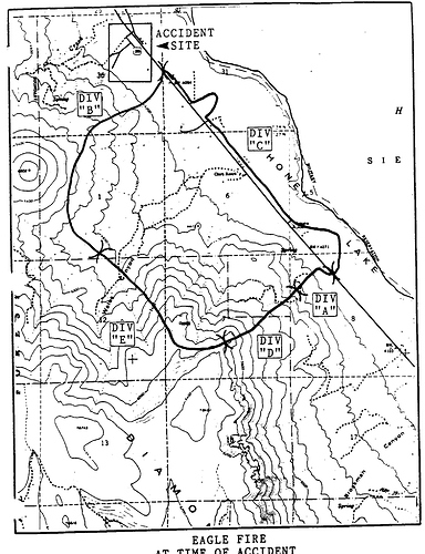
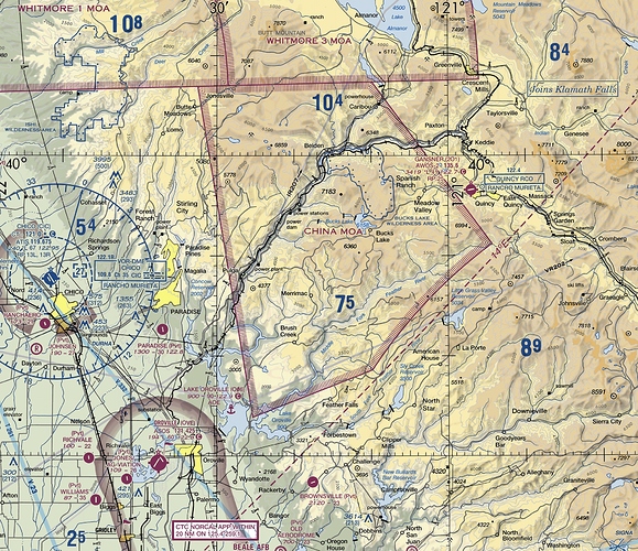
The south finger of this fire is pointing right at the site of the infamous 1989 Eagle Fire burnover. There were 3 separate burnover incident in the course of a single afternoon (July 8, 1989)…
Eagle Fire Investigation Report, here: https://www.wildfirelessons.net/HigherLogic/System/DownloadDocumentFile.ashx?DocumentFileKey=782380c8-f51d-4dcf-9adf-f100101c0a01&forceDialog=0
Location of Eagle Fire burnover relative to Walker Fire:
Check out how the topography between the fire and accident location funnels the prevailing westerly winds.
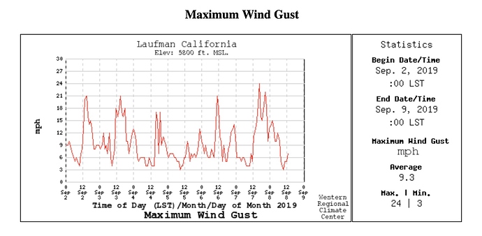
Wind gust summary for last week at Laufman RAWS, about 6 miles from SE finger of the fire:
https://wrcc.dri.edu/cgi-bin/wea_graph2.pl?stn=CLAU&mon=09&day=2&yea=19&ndy=07&graphset=M&imagesize=S&scale=A&pcodes=AVA&pcodes=AVR&pcodes=MWS&pcodes=MXW&pcodes=RAD&pcodes=PRE - 18-20-mph gusts out of the west just about every afternoon.
2 Charlie ST from XSD reassigned to the Walker while enroute to the Red Bank
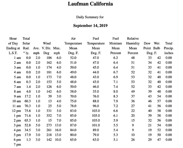
Temperature is down 10 degrees from this time yesterday on the Laufman RAWS, winds/gust are quite a bit lower, too. RH at 1400hrs is 27 today vs 19 at same time yesterday.
https://wrcc.dri.edu/cgi-bin/rawMAIN.pl?caCLAU
Fort Sage camera is still smoked in…
Laufman hasn’t seen the sun in 2 days.
Not a lot of state equipment assigned to this one. Must not be near the SRA yet. Only a few dozers and 1 or 2 Charlie’s assigned.
At least 1 golf went last night, I’d assume as things start to demob off the Red Bank some will get assigned
My understanding is, while that funnel is a factor the escarpment down slope wind is a function of surface heating to the east creating a down slope wind that falls off the escarpment accelerating as it does enhancing the predominately SW/W wind… On the Eagle that funnel may have contributed more to the sheer enhancing the vertical vortex development.
That SE corner of the fire may have stalled out in Stoney cr. But, I would not turn my back on it. That spot fire to the south could be trouble in a couple of days.
Anyone have a link to the IAP?
Fed Fire, no IAP posted online!
XSJ 4176C was just reassigned from the Red Bank. I’m sure quite a few more will be as well.
Babbit Peak Cam showing a good rip right now. Is this too far south for the Walker?
This is a fire in NV that it is aimed at currently. There is an IA for it in the Great Basin Threads.
This seems to be putting up some good smoke Is this a burning op or interior burning or is it getting sporty on them?
Saw a post on FB they punched out 2 scoopers and 3 LAT’s to the fire so I think it’s getting squirrelly on them
Laufman RAWS showed RHs in the single digits this afternoon. It’s not far south of the fire.
Source: https://wrcc.dri.edu/cgi-bin/rawMAIN.pl?caCLAU
I saw a gray military colored T-tail 4-jet cargo looking plane headed that direction twice yesterday but I don’t think there is any such air tanker. Probably just a coincidence?
I can’t imagine what they would be doing? I know that the Air Guard at Mather and Travis AFB both have mobilization centers for various groups. Both could overfly the GV area if they’re going to bases in Nevada🤷♂️

