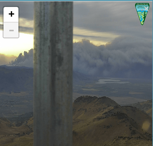
In 1983 the Elephant fire started in Elephants Playground and ran through Doyle on Hwy 395 a few days latter. The fuel type is different now (35 years recovery) IMHO still flammable. Light cloud cover for a couple of days, lower temps, slightly higher RH but SW winds before 2 fronts passing to the north next few days. If it gets to the escarpment it can race down the east side. South of the Eagle fire but pretty much same situation. I’m estimating still 10+ miles from escarpment.
I see a lot of single type 3 engines coming from states like NM, AZ, CO, NV and MT for this fire. Are these all agencies that contract with the USFS to send equipment?
pyrogeography has posted an excellent screen shoot of last nights (early this morning) IR flight on the IA page for the Walker, with Moonlight and Antelope complex burn area overlays. Great view of distance to the escarpment to the east if the Walker makes an end run around the Antelope complex.
I think a lesson learned from the Eagle Fire burnover could be to not try and hold wind-driven fires at 395, rather let them burn to Honey Lake.
Feds Don’t ( personal info)
CalFire Yes
24,000. Heck of a burning op.
Looks like it might make it close
SW pretty much into monsoon season; NR pretty slow season for their engines (tho Lolo IHC assigned to Walker?); probably same for GB so they can provide Fed engines.
Yep, saw an Arizona 'shot crew rolling in Thursday and thought the same thing.
Other IA’s going on, but this thing is pinned down and on the move.! Cannot tell because of column density, but appears to be about to roll off the infamous “escarpment”
Flagstaff IHC & Bear Jaw, San Carlos #1, Navajo Scouts (all T2-IA) either here or heading this way
Has to be getting closer to SRA if running to the East
SRA resources enroute.
Copy could end up being zoned if it keeps going
Any idea on what there ordering up?
The SRA doesn’t start until you get within about 2 miles of US-395.
They have a mtz 2 Miles each side so it does not need to hit sra for lmu to get involved
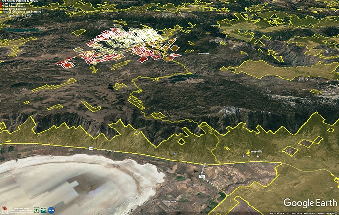
Here is a map of SRA (Yellow) with MODIS heat detections. I don’t have any better intel from today, MODIS doesn’t look to have updated since about 1300…
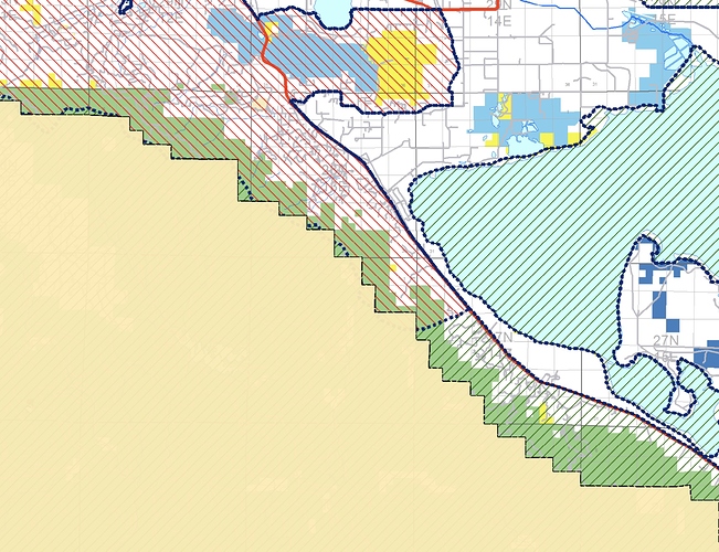
If the fire does push that far east, it might hit the eastside on Federal Direct Protection Areas. Fed DPA is about everything left of the (395) label on the map, above.
Federal DPA in green crosshatch, State DPA in red.
Source: https://ftp.nifc.gov/public/incident_specific_data/california_statewide/DPA/DPA_Maps/DPA2019_CountyMaps_LassenCounty_ArchD_port.pdf
I would be surprised if they don’t have a liaison making all the planning meetings.
I’m sure. They did this during the Moonlight.


