State ID: CA
3 letter designator: SLU
Fire name: River
Location: S River Road; Paso Robles, CA
Reported acres: 6
Rate of spread: moderate
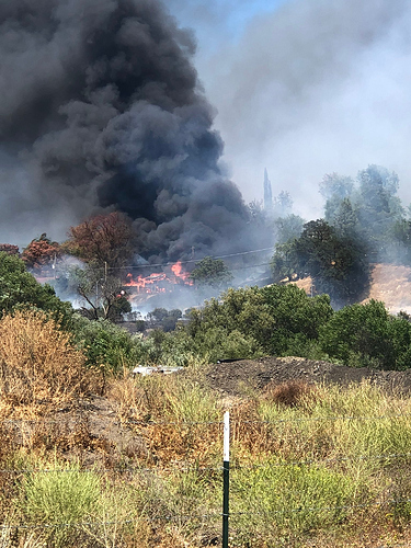
Report on Conditions: multiple structures involved.
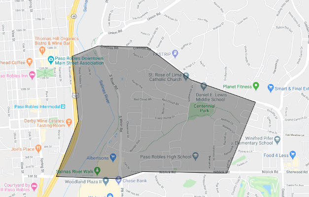
Structure threat: yes, evacuations Navajo, Cheyenne, Shoshone, and Capital Hill neighborhoods
EVACUATION MAP: https://twitter.com/slocountyoes/status/1275203882495303680/photo/1
Evacuation center: Paso Robles Vets Hall, 240 Scott St in Paso Robles.
Resources:
Hazards:
Weather: Temp: 80-85 RH: 35% Wind: South gusting to 20 MPH.
Radio channels:
Scanner link: https://www.broadcastify.com/webPlayer/14671
Webcam link: http://cwwp2.dot.ca.gov/data/d5/cctv/image/us101stockdaleroad/us101stockdaleroad.jpg?=1592865001
http://cwwp2.dot.ca.gov/data/d5/cctv/image/us101sr46east/us101sr46east.jpg?=1592865001
Agency Website: https://twitter.com/slocountyoes
Live Video: https://keyt.com/livestream-2/
1 Like
River IC requesting 2 additional handcrews.
I believe this should be Paso city, not SLU
1 Like
Trying to find Unit ID info.
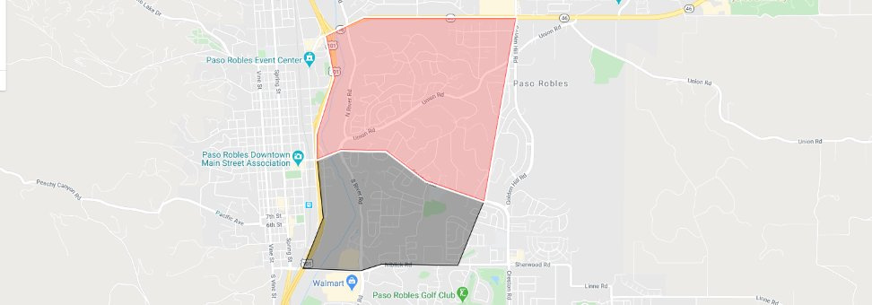
Update to River Fire, evacuation area has expanded per City of Paso Robles PD, Rolling Hill, Montbello Oaks, Kleck, all the way to Hwy 46 evacuate immediately.
https://twitter.com/slocountyoes/status/1275203882495303680/photo/1
2 Likes
PRF is Paso Robles Fire
4 Likes


