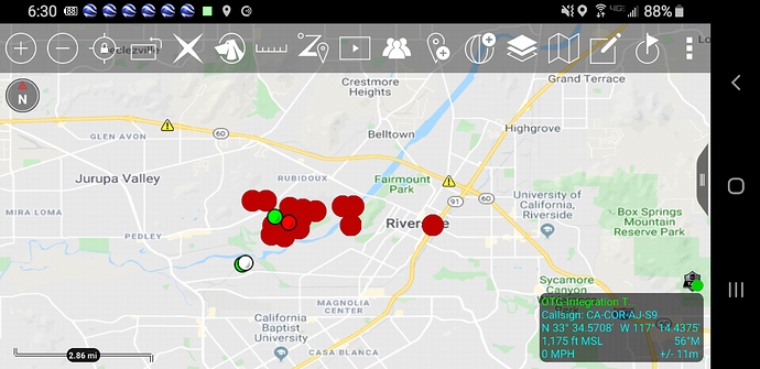
State ID:CA
3 letter designator:RRU
Fire name:46
Location:Jurapa Valley
Reported acres:
Rate of spread:
Report on Conditions:Reported at 12:39 AM (per RCFD website) now on 4th alarm. Wind on it but it seems to not have moved much in the past 30 mins.
Visible on the Box Springs1 camera.
Structure threat:
Resources:
Hazards:
Weather:
Radio channels:
Scanner link:https://www.broadcastify.com/listen/feed/19
Webcam link:http://www.alertwildfire.org/inlandempire/index.html
Agency Website:http://www.rvcfire.org/incidentInformation/IncidentFactSheets/Pages/default.aspx
UPDATE 3:45 A.M.: NEW MANDATORY EVACUATION ORDERS for residents South of Limonite Avenue, west of Crestmore, east of Van Buren and north of the Santa Ana Riverbottom.
Reported 75 acres at 0245, looks bigger on the Box Springs Mtn Cam.
Box Springs East cam:
http://www.alertwildfire.org/inlandempire/index.html
ABC live coverage:
Always, always divide by 4 or 5 on your acreage estimate at night. With the new science of cameras, it might be a factor of 10. When the sun comes up, you will be pretty close.
KTLA is streaming live.
AA-310 on scene, air tankers enroute.
Any update on containment or growth?
#46FIRE[UPDATE] 12:40 P.M.: All evacuation orders remain in place. The fire remains 300 acres and 5% contained. Following road closures in effect: Riverview Drive @ Rio Avenue Juan Diaz @ Riverview Drive Crestmore Avenue @ 46th Street Kern Drive @ Riverview Peralta @ Riverview
