A lot of areas are establishing type 3 IMTs to manage short term incidents as well as the initial evolving incident prior to a Type 1 IMT coming in and taking the incident. Most of these teams have type 1 qualified personnel on them as well. I know of the North Bay IMT AND the Sacramento Regional IMT as good examples of established type 3 teams outside of the federal system. Don’t mean to digress from the incident at hand.
6 Likes
Ahhh I gotcha. Awesome they have a local IMT-3
1 Like
Anyone got an updated acreage? And possibly a pocket card or nomogram?
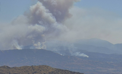
Night AA mapped it roughly to 1550 acres
Does any know where ICP is??
Noble creek park at 0100
1 Like
Thank you!!
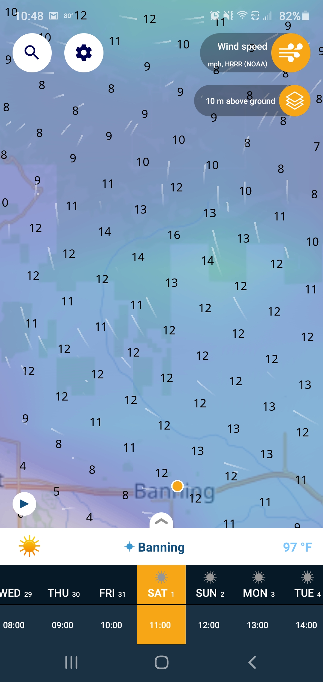
Monsoonal flow coming up the Coachella valley this morning
Muggy and reverse wind direction
1 Like
Looking at the camera for the Apple incident
http://www.alertwildfire.org/inlandempire/index.html?camera=Axis-RechePeak2&v=81e003f
it looks like there is a second smoke in the background. What is it?
1 Like
That’s one of three fires burning from yesterday . Fire #1 was contained but 2 and 3 continue to burn. It’s a branch within the Apple since it burned together .
2 Likes
Is this near the silver fire https://en.m.wikipedia.org/wiki/Silver_Fire
No, this on the border of Cherry Valley, Oak Glen and Yucaipa. Its a weird little section on the county line.
For those who know the area, it would appear that the air flow is moving it laterally to the East roughly along Bluff Rd. Is that fairly accurate?
1 Like
It’s waking up.
Nearby PWS reports 93.2 degrees RH 16% Winds SSE 8.1 MPH
3 Likes
Depends on what you mean “near”. Yes, it’s in the same Banning Pass roll area, but miles away. on the opposite side of I-10. Silver fire was south of towns in the pass, Cherry Valley is north side.
2 Likes
Typical air flow in the Pass area will be either 20mph east or 20 mph west. It is a E/W pass that sits between 2 large mountains (Mt San Jacinto & Mt San Gorgonio). The critical areas now will be homes on “the bench” = Bluff st area, a plateau-like ridgeline, and the entire north flank of the fire which now has only one rural road and a couple of fire trails between it and the entire remainder of the San Bernardino National Forest.
4 Likes
In essence yes. The Banning Pass almost always has wind out of the west daily. Unless the Santa Ana’s are blowing. The winds always tend to pick up in the afternoon when the desert gets hottest and the air movement increases towards the east. The first picture is current wind while the second is the forecast wind for 1500 today.

3 Likes
Yes, most of the day the winds flow directly East through the San Gorgonio pass. Bluff st runs north to south so almost of the time the winds are perpendicular to it. The lower we can keep this fire in terrain the better. If it continues to move north towards the forest were in for a long dangerous fight. Keep en eye on monson flow. If it develops at all the next few days we get winds pushing from the lower desert to the west through the fire area. This fire has extreme potential on top.of what it has already done.
2 Likes