It may get into mission creek, but not palm desert
3 Likes
Fox 11 chopper is back up.
5 Likes
Several air tankers (type ones) reassigned to fires in LAC/ANF, and another just starting SLO.
3 Likes
Figuratively speaking its unstoppable today (probably what he meant).
VLAT Tankers are on hold and Lead is off fire. Did not hear a relief come on scene.
Too much turbulence.
3 Likes
LATs and VLATS back up from hold working west side.
AA Request out of state copters but, each copter would require a manager. Cancelled that request.
C2 is relief Lead.
4 Likes
NEW EVACUATION WARNING issued for the area north of Morongo Rd, east of Millard Canyon Rd, and west of Whitewater Canyon Rd. posted on CDF Riverside County FB
4 Likes
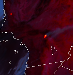
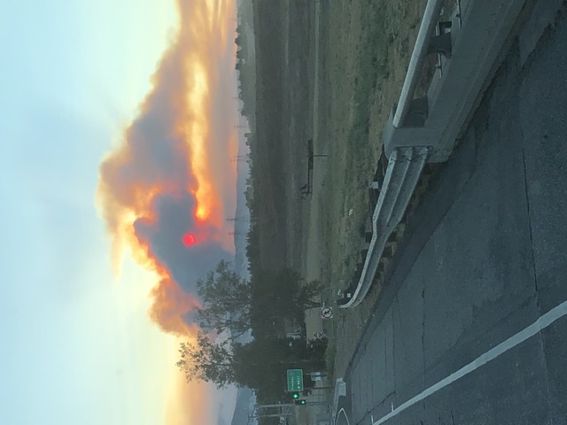
Showing white hot.
11 Likes
Is that the one in slo showing on same pic
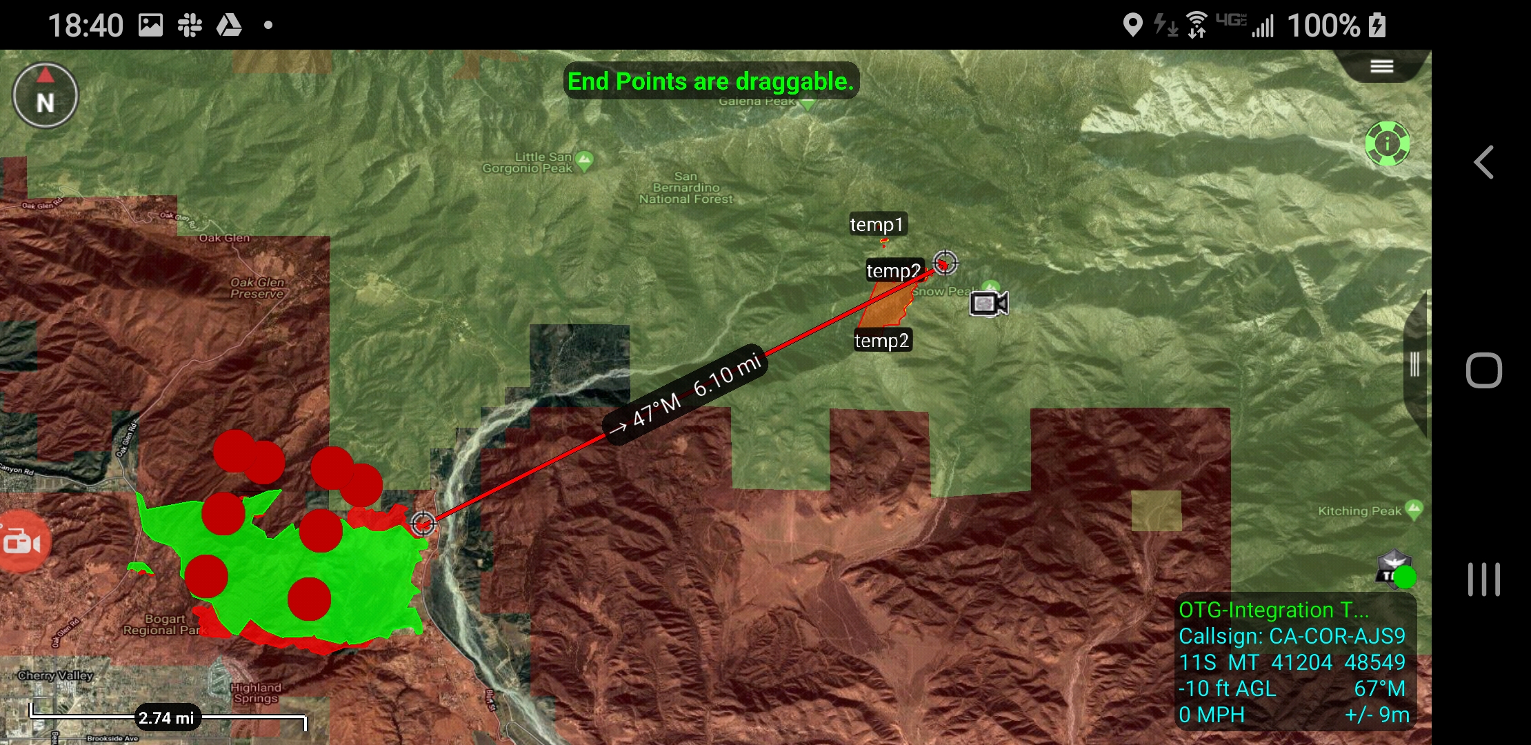
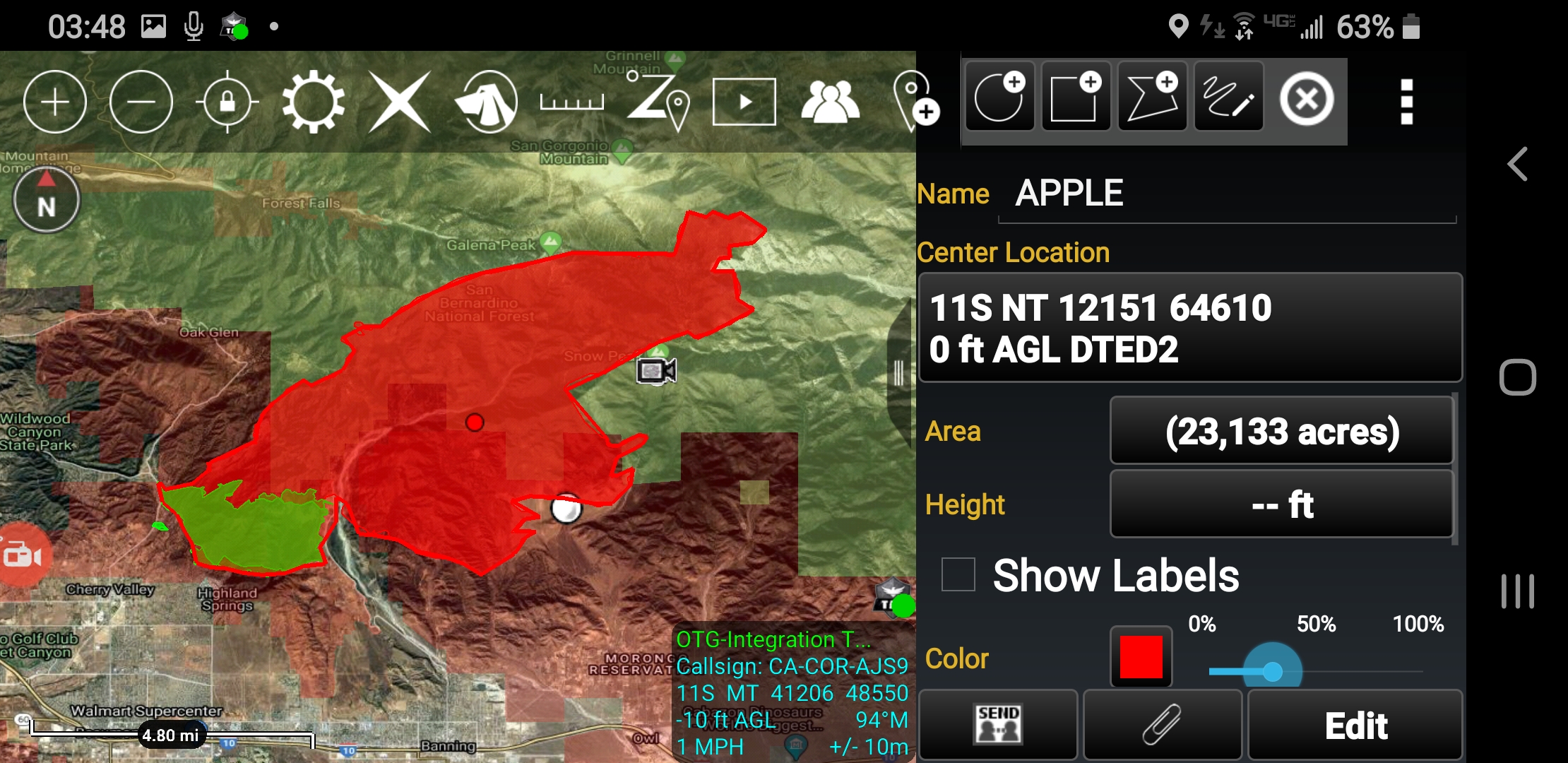
Yes it is, already over 2,000 acres
Update 8:00 p.m. 08/01/2020 - The Apple Fire is now 12,000 acres and remains 0% contained. Several EVACUATION ORDERS and warnings remain in place. Please visit www.rivcoready.org/ActiveEvents to search if your address is affected. http://www.rvcfire.org/_Layouts/Incident%20Information/IncidentInfoDetail.aspx?4558
4 Likes

1 Like
Also ABC is live again. Save the link, they reuse it whenever the copter is up.
6 Likes
Already waking up!
7 Likes
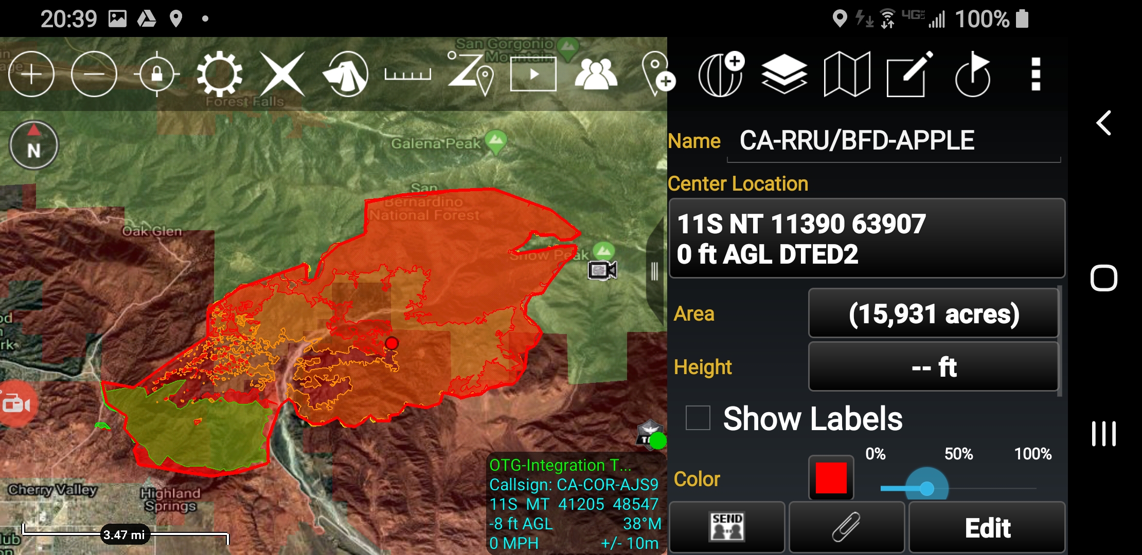
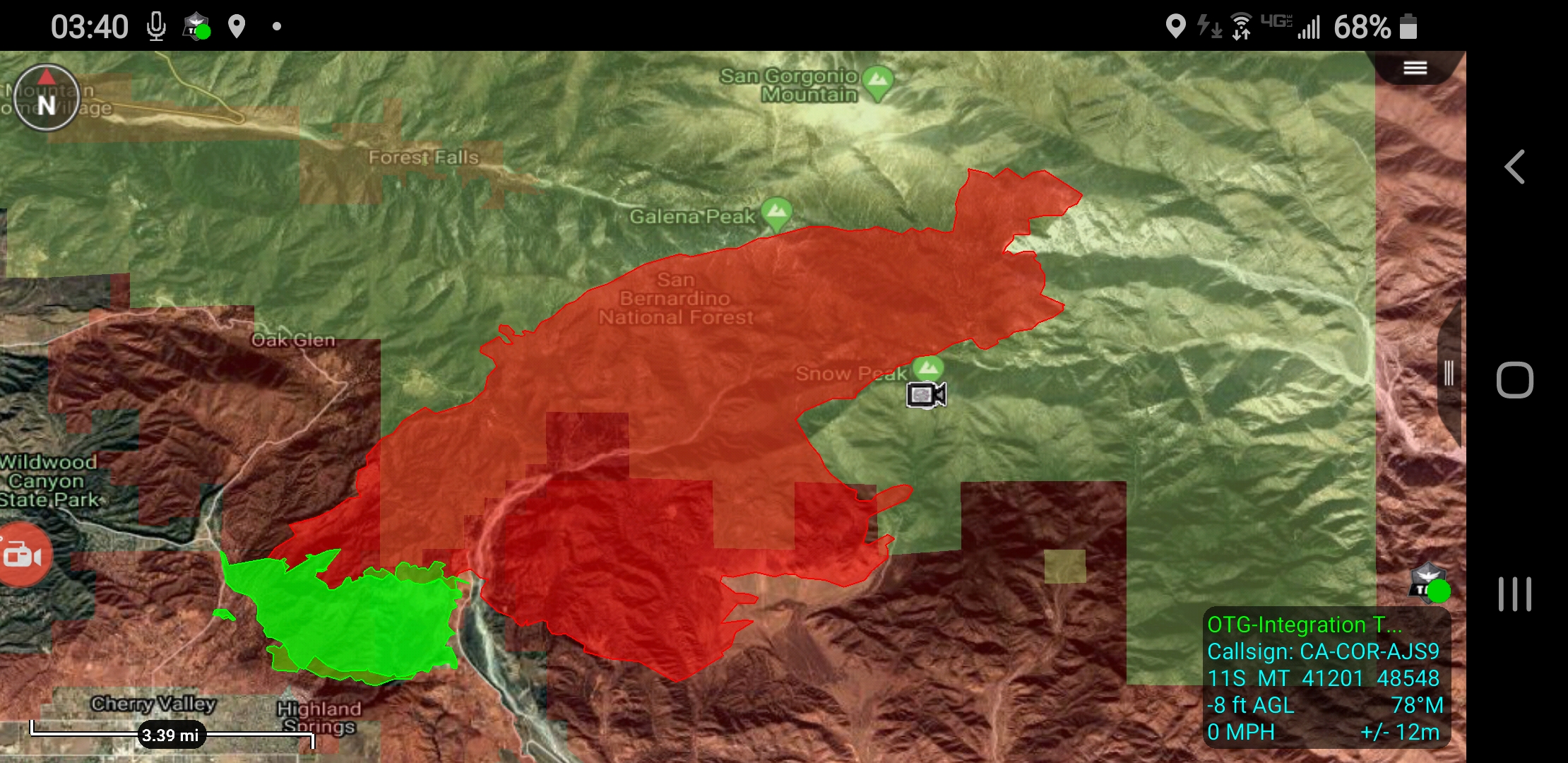
As of 0100 this morning 15,000 acres and 0% contained according to the RRU Incident page.
4 Likes
XLE 1280A enroute (Downey, La Habra Heights, Montebello, Santa Fe Springs +STEN, West Covina).
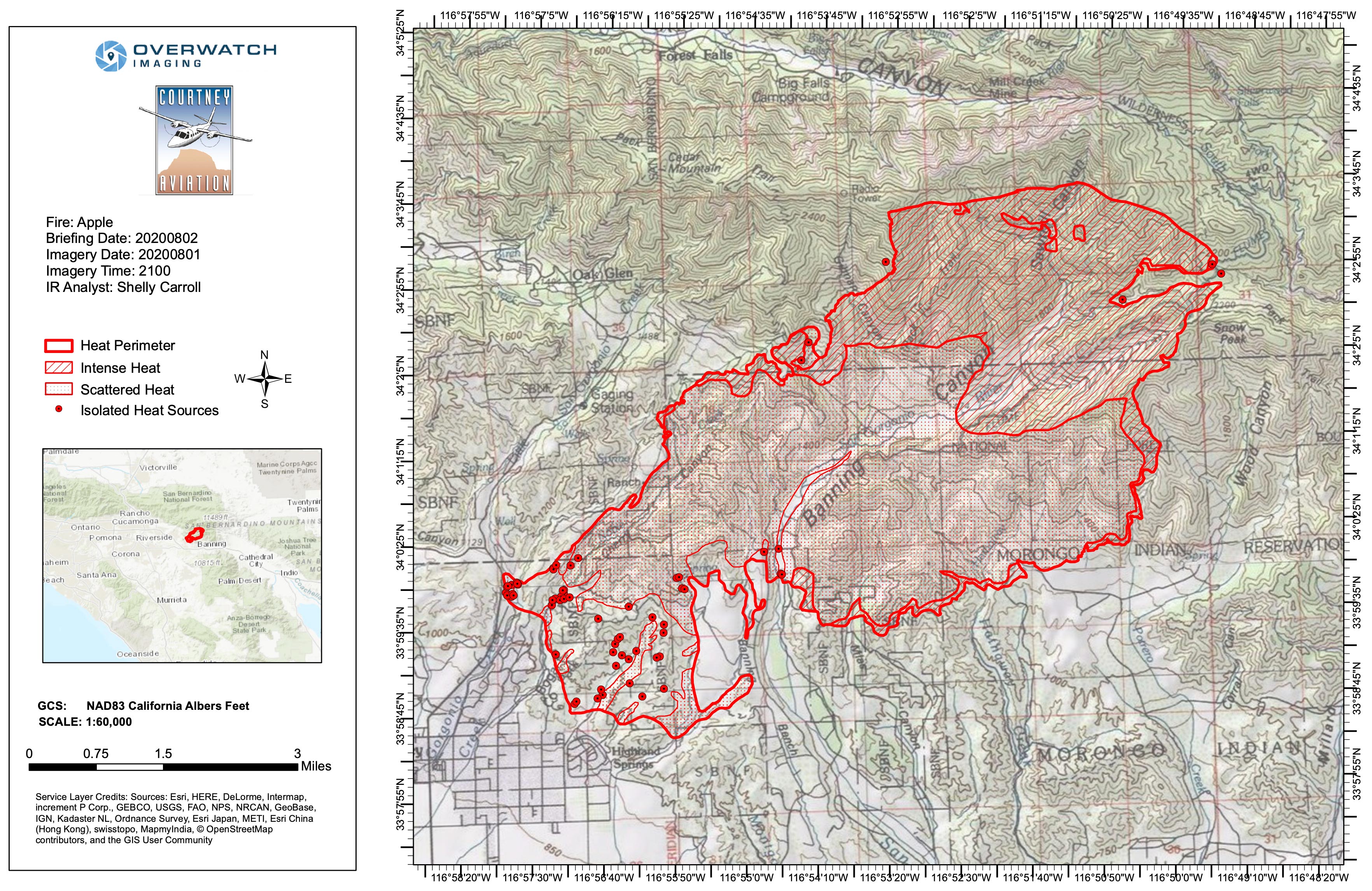
The FireMappers site with MODIS and VIIRS layers turned on show it has moved at least 3 or 4 sections to the NE since the NIROPS flight at 2100 hrs. last night.
https://napsg.maps.arcgis.com/apps/webappviewer/index.html?id=6dc469279760492d802c7ba6db45ff0e
3 Likes