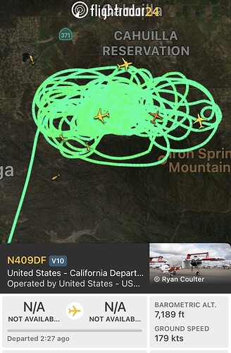
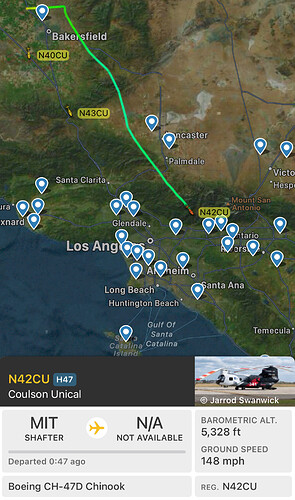
MAFFS require ASM or Lead. They won’t be mixed other aerial asset without one. There is a nationwide shortage of FS qualified ASM’s and it takes about two years of extensive training to sign off.
IMO - This is cool!! Your point touches on a bigger paradox / social condition within the (hidden) human factor leg of the fire triangle - if that any makes sense at all. We’ve now seen citizenry & seasoned fire folk have normalized the 40k acre runs. We’ve already normalized miles of linear movement in a day - this to me is worrying and worth shining a light on on at some point…
The C-130s are flying the Borel
My mistake:
T910 enroute SBD, been working Fire in Kern County.
Now at 2,756 acres according to operations. Bonny took 3 days to get to 2,323 acres. Nixon eclipsed it in a matter of hours.
-MOD NOTE-
All, please stay on track, All the Mods are on duty or deployed. Please stay professional and don’t post info that is unfounded or un proven. This could be a worth while discussion but not in the middle of an active fire thread. Feel free to start a resource ordering thread. We are struggling to deal with all the flagged posts. I don’t have time to go back and delete everything. Thank you and please carry on with fire info and continue this discussion in the appropriate Thread.
I agree Group, let’s keep on the topic and quit slingin the “who dropped the ball.”
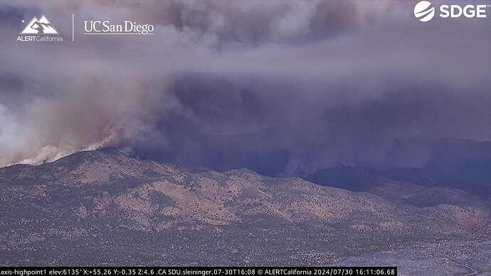
@ALERTCalifornia has another timelapse. Didn’t waste any time taking off in the baked fuels.
Still going? Not much traffic here but everyone might be out finally working? 
Extended frequencies assigned for RRU-Nixon
CDF CMD2
Air Tactics FM: 166.650
A/G: CDF A/G10 (159.375 t192.8)
AM Victors: 118.775, 123.175, 123.025 (TOLC)
CDF Tacs: 28, 29, 38, 39, 40
Looks like she backed down over the ridge into the next drainage and is off to the races again
Not far from SDU, from the highpoint cam you can see the Grove scar from last week.
If it extends far enough south and gets back in alignment with the winds, the fireline could be able to wrap itself around Bonny’s scar from the south and begin threatening communities again, unfortunately. Given how quick this thing moved, I wouldn’t doubt its ability to move like that again today.
If they can just hold on for 48 more hours the forecast is calling for wetting T-Storms in the area late Thursday and more than likely Friday. Forecast is for heat and humidity with possible high heat risk for certain areas. Like anvilhead and Dr. Swain said…August could be a bitch
Definitely well established spots.
Somewhere in there is San Diego County line, not sure on the suppression rules in the wilderness, nothing in there is worth life risk for sure.
The evacuation polygon touches the SD County line, it’s getting closer and closer. It is ripping through the wilderness and throwing spots pretty far out Southeast.
Is that a firing op to the east (right) of the high point ptz?


