State ID: CA
3 letter designator: RRU
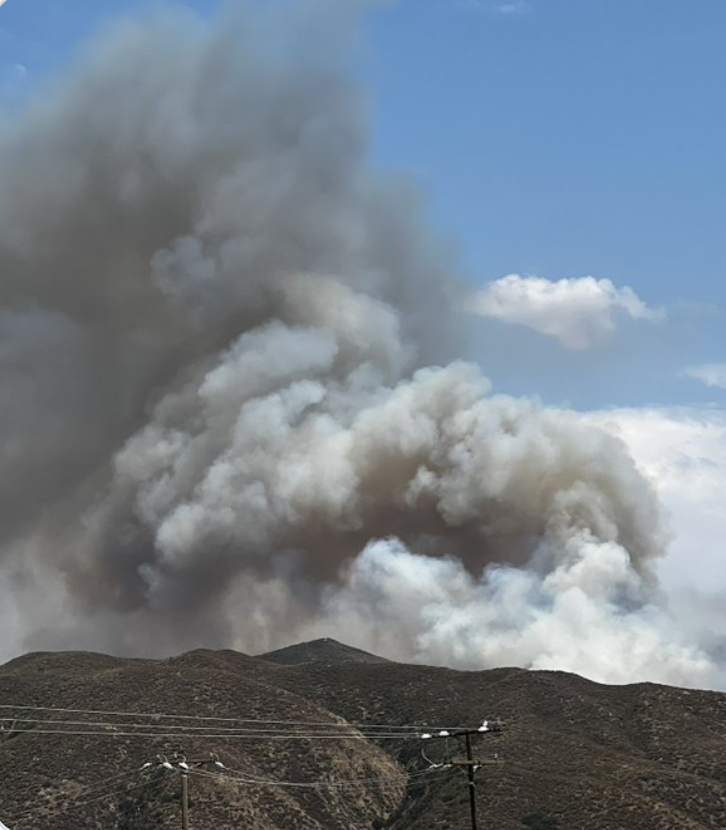
Fire name: Pauba
Location: Pauba
Reported acres: 25-30 acres
Rate of spread: Rapid
Report on Conditions: Requesting additional Aircraft and Crews
Structure threat: Yes, evacuating Vail Campground and Trail
Resources:
Hazards:
Weather:
Radio channels:
Scanner link: Cal Fire and Riverside County Fire - West
Webcam link: ALERTCalifornia
Agency Website:
IC RQ: 4 additional handcrews, one additional dozer
2 Likes
Sounds like this is getting into alignment and will threaten structures in an hour per AA.
2 Likes
AA asking for two LAT’s if available. Potential for 1,000 acres.
2 Likes
Perris advising closest LATs from Santa Maria
2 Likes
AA asking for 4 additional Tankers any type
2 Likes
40 acres, minimum 7 hours commitment. Ordering water & supplies
2 Likes
Ic asking for Vail Lake to be notified to evacuate their trails
4 Likes
Fire is heading towards Vail Lake, another 5 engines and 2 Handcrews ordered.
6 Likes
Command just requested 4 more Crews and 4 more dozers as well as Lead and VLAT.
3 Likes
Evacuations expanded to Vail Lake campground. Rq lower Hwy 79 closed in both directions. MKU and 175 meals ordered.
2 Likes
AA330 reported the fire has spotted across the ridge, Evacuation order for Vail Lake and Vail Lake campground.
4 Likes
IQ req 10 additional Type 3s
2 Likes
I am guessing this started at or near the Pauba Rd/Hwy 79 intersection and is burning generally east or southeast?
1 Like
N side of 79, working E
2 Likes
Evac Map per CalFire/RVC Fire FB
https://m.facebook.com/story.php?story_fbid=868658798622551&id=100064353174721&mibextid=cr9u03
3 Likes
Correct, Started on the East side of Pauba Rd a little North of the 79.
Mapped at 101 acres.
4 Likes
released LATs 180, 163 and Ramona S2s, keeping/using 2 S2s (sorry didn’t catch all the numbers)
4 Likes