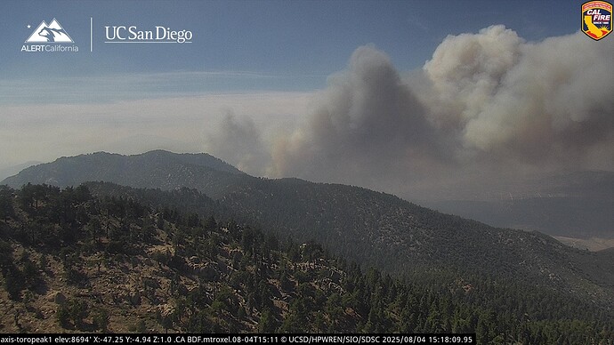
State ID: CA
3 letter designator: RRU
Fire name: Rosa
Location: Highway 74 near Rosa Truck Trail
Reported acres: 2
Rate of spread: moderate
Report on Conditions:
Structure threat:
Resources:
Hazards:
Weather:
Radio channels:
Scanner link: CAL FIRE/Riverside County Fire
Webcam link:
Cam link: ALERTWest - Sage Brush Flats ALERTWest - Toro Peak 1)
Agency Website:
Talks of closing highway 74 it sounds like
10 acres per air attack grass and brush fires spotted onto the east side of Highway 74.
2 additional tankers for total of 6
additional 15 engines 4 crews and 4 water tenders.
2 additional LATS for total of 8 tankers.
30 acres MROS with a structure threat on the left shoulder.
Now saying DROS, with potential for extended attack/ several hundred acres in heavy fuel.
4 additional dozers being requested
120 acres per WD
Nasty country, even for Dozers.
10 additional engines. 10 additional type 3s, 2 more crews. Right flank spot well established
300 acres per IC. 5 Fed engines for Fed mission being requested.
The potential on this thing is intense. This land has not burned in recorded history and there’s tens of thousands of acres of Toro Peak to the south of it. This fire has far more potential than the Flats Fire of 2021 east of Pinyon Pines ever had.
Copter Fill out Fresno ETA 3hrs. H-1VR
AA is asking for 1 Night Helco and 3 Type 1 night flying Copters due to significant fire growth and structures threatened.
1000-1200 acres per AA
Burning east with a DROS.
Likely to have down-slope winds there tonight, kinda like the Elsinore Effect? While sending ROS down to the desert floor.
