Cameras show the line looking pretty cold!
3 Likes
Done deal almost.
5 Likes
Sonoma Co has a LG Charlie headed to this… wonder if they’ll stop at the Gifford along the way…
3 Likes
This morning…
The fire has been mapped at 1,535.7 acres by Intel Aircraft. Their perimeter is visible on the Watch Duty map under the Active Fire Perimeters map layer. Fire is 5% contained…
3 Likes
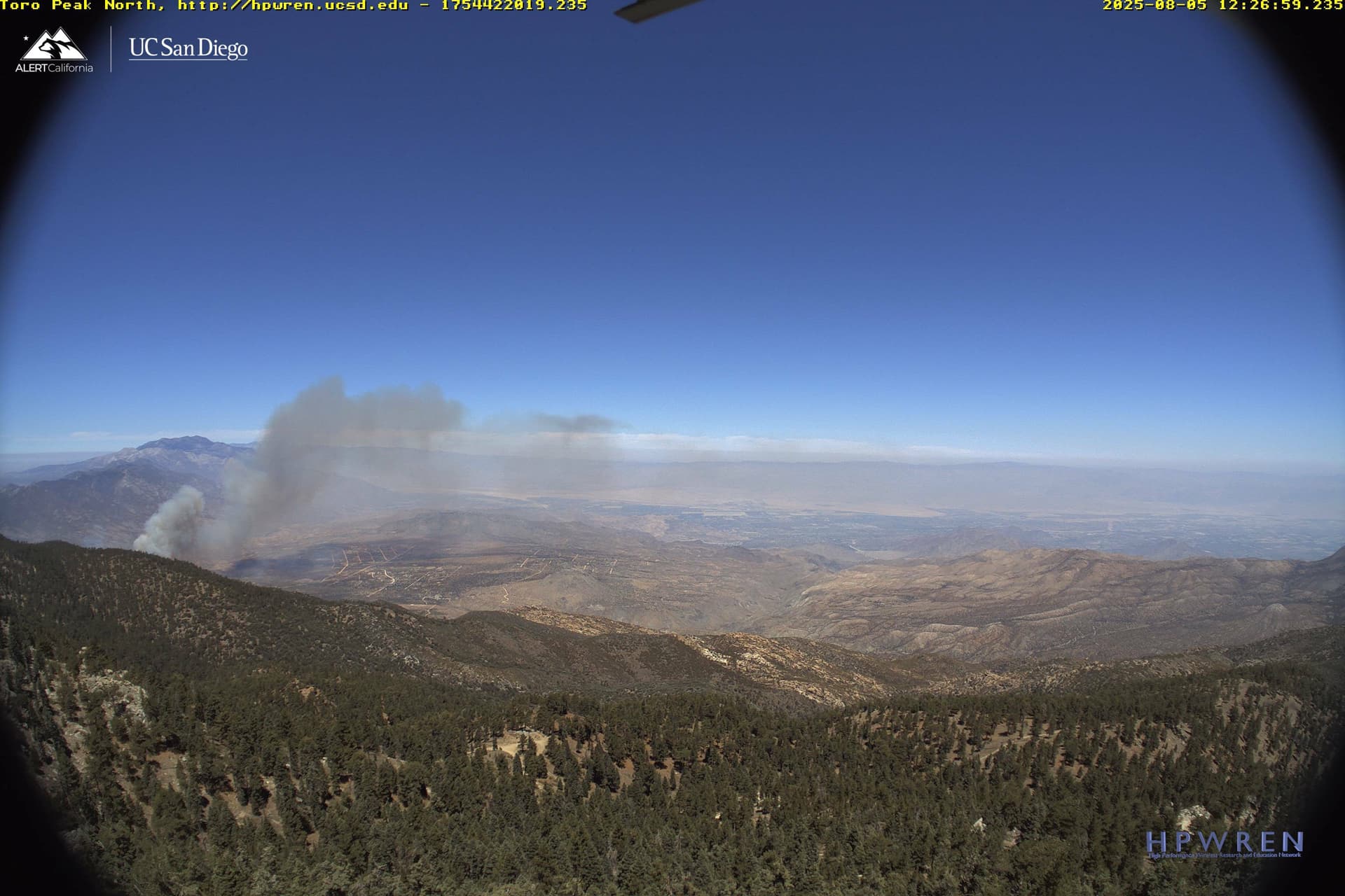
10 type 1 engines have been requested, immediate need, to the Pinyon Pines area, per radio traffic. See a current view of the fire above from the Toro Peak camera.
Fire is not done ![]()
4 Likes
Not done yet. IC just requested 10 T1’s immediate need to Pinyon Pines
3 Likes
![]()
![]() . Oh no.
. Oh no.
1 Like
It only takes one gust of wind, one degree of temperature increase, one dry piece of veg etc…isn’t over til it’s over. Stay safe
7 Likes
The fire has been mapped at 1,658.2 acres by Intel Aircraft. Their perimeter is visible on the Watch Duty map under the Active Fire Perimeters map layer.
3 Likes
The Rosa Fire is actively burning in steep, rugged, and remote terrain at moderate elevations, presenting limited access for ground resources and demonstrating a strong resistance to control efforts. Live fuels in the area are nearing critical moisture levels. There is no recorded history of major fire activity in this area.
The fire remained active overnight, with noticeable fire behavior continuing until approximately 2:00 am. Crews today will continue working the interior of the fire and around structures in the evacuation zones.
6 Likes
Any update on this fire?
2 Likes
Per CalFire: 1690 AC…21% containment
5 Likes
3 Likes