AA over the new fire at the 10 and the 60. Requesting 4 AT’s and copters with an immediate structure threat. AA saying now 4-5 homes already involved with 25-30 about to go
This might be BDU/BDC
AA over the new fire at the 10 and the 60. Requesting 4 AT’s and copters with an immediate structure threat. AA saying now 4-5 homes already involved with 25-30 about to go
This might be BDU/BDC
Per AA…50 acres, Dangerous ROS. At least 5 structures on the ground. Potential for major fire and at least 1000+
Requested two additional AT’s for a total of six “to start getting a handle on this thing. Massive potential”.
Could this be the Sandalwood incident in Calimesa?
Yes it is for sure
Per scanner, IC ordered a total of 8 rotor and 6 AT
Update 150 Acres RROS with numerous structures destroyed. Potential for 1500+ acres
RAWS at Riverside/March AFB
81 degrees, 6% RH, 14mph NNW G 21
Per scanner
IC sizeup current 100ac, potential for 1000-1500ac
Immediate evacuation for Live Oak Canyon* subdivision and “No Divert” placed on 4 air tankers for life safety.
Live Oak Canyon
Map of the area waiting for data source to update.
Live feed
What’s the most recent resource request?
Update map with rough estimate and area where structures have been lost. Will update when I get more intel.
https://caltopo.com/p/714K
IC requested 6 Water Tenders.
500 acres per IC.
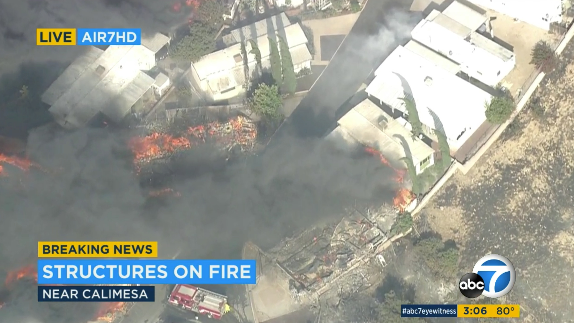
Update from ABC7 video.
https://caltopo.com/p/4H24 topo
https://caltopo.com/p/4D24 imagery
Rough estimate at 700-850 acres (NOT OFFICIAL only estimate from aerial video)