E/O Hemet:
2 Likes
Red Mountain Rd and Taffle Ranch Rd, 5-7 acres with an immediate structure threat.
3 Likes
AA requesting (2) additional air tankers any type.
3 Likes
Aircraft assigned: A310, T71, T72, T73, T76, H605, 9PJ
2 Likes
5 acres, DROS, immediiate structure threat at Red Mtn.
2 Likes
1 Like
Per AA: 20 acres, DROS, medium fuels, multiple structures threatened, potential 500+
3 Likes
Closer view from Red Mtn. https://ops.alertcalifornia.org/cam-console/2757
Run the play back and it has gotten across several roads already.
3 Likes
Previous post didn’t populate for me thanks for catching the duplicate! Now saying 25 acres structures being impacted..
2 Likes
IC: Requesting (10) additional engines, 5 of them type 3’s.
3 Likes
Red Mountain Camera is showing flames on the East side of fire.
I think the large firebreak AA is referring to might be Minto Way. A significant dirt road.
3 Likes
Fire is approximately 1 mile from the Forest border and about half a mile from the Fairview scar.
Edit: the left flank might be in the Fairview scar or at least a little finger of it.
4 Likes
We worked Minto way the night Fairview blew out, Depending on the fuel growth Minto might hold. Fairview burned up and held along Minto at Sage. Some of the Fairview did get up into Red Mountain.
5 Likes
Per AA the goal is to keep the fire south of Red Mtn Rd. Evac Orders have gone out. The last update from AA was 40 acres.
3 Likes
Homes and ranches are South of Red Mountain, not a lot of structures immediately North of Red Mountain Rd.
3 Likes
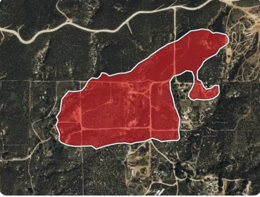
AA has canceled the 2 LAT’s responding. He advised 55 acres with Retardant most of the way around the fire.
6 Likes
This is a good testament to the status of the fuels out there, it’s only in the high 70s to low 80s and typical winds of 8-18mph and it burnt pretty well.
7 Likes
Some have been rolling their eyes at the pervasive use of DROS since June this season, but with Red Mtn cam’s great coverage, I clocked flame front at one point going 3.1ft per second with iron chasing after at 2.71ft per second. 
9 Likes
Yea that’s pretty slow
2 Likes