New fire near the Apple Fire. Whitewater area near the Fish Hatchery. The fire has grown to approximately 100 acres, burning at a moderate rate of spread in heavy fuels. This will be a Branch of the Apple fire but for tracking let’s put updates here.
2 Likes
The Snow Peak camera that covers the are is smoked it unfortunately.
1 Like
Palm Springs tram camera is too blurred
1 Like
The Tankers could not drop due to smoke conditions. We likely won’t see this on a Cam for now.
1 Like
Toro peak is showing smoke down to the ground coming off the apple fire.
http://www.alertwildfire.org/sierra/index.html?camera=Axis-ToroPeak1&v=81e003f
Yes, that is where it would be, but too smoked out to notice a new fire.
It’s a little windy.
https://www.wrh.noaa.gov/mesowest/timeseries.php?sid=WWAC1&num=72&banner=gmap&raw=0&w=325
1 Like
CHP CAD has it coming over the ridge to 62, lots of vehicles in the preserve trying to get out, thats a mess in there on a good day
1 Like
"It’s a little windy.
https://www.wrh.noaa.gov/mesowest/timeseries.php?sid=WWAC1&num=72&banner=gmap&raw=0&w=325 "
Yep. Can tell - the cameras clearing a bit. Although down in the valley it is still pretty variable.
Twitter pic of the Water:
Corrected - not a pic of the Water - was tweeted with the Water hashtag - I jumped gun. Apologies.
3 Likes
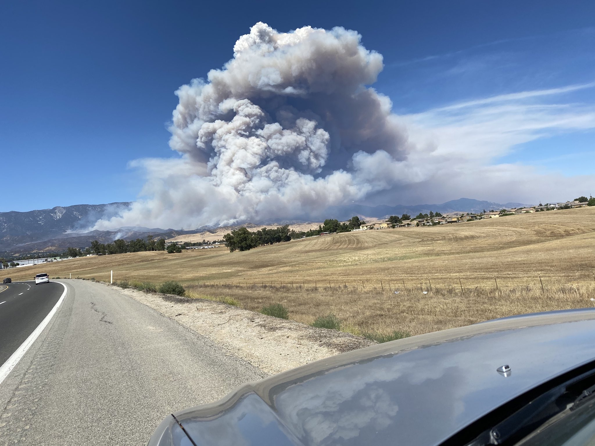
Apple, From 79 coming into Beaumont
1 Like
Look close to this screenshot. You can see the heat signature from the Water just East of the Apple.

5 Likes
Water would be well East of that
That’s the Water
already???
No, that’s about right!
1 Like
That’s the Apple taken from Hwy 79.
Maybe not - may have misinterpreted the tweet …terrain does not look right in the pic…
I was gonna say that picture looks like it’s from the top of Lamb’s Canyon, the column from the water is hidden behind that.
They mentioned a new start in Branch 3 I believe…wonder if that could be it
Water IC just ordered 2 Type 1 ST to report to HWY 62
2 Likes