CA-SBC-Plant

State ID: CA
3 letter designator: SBC
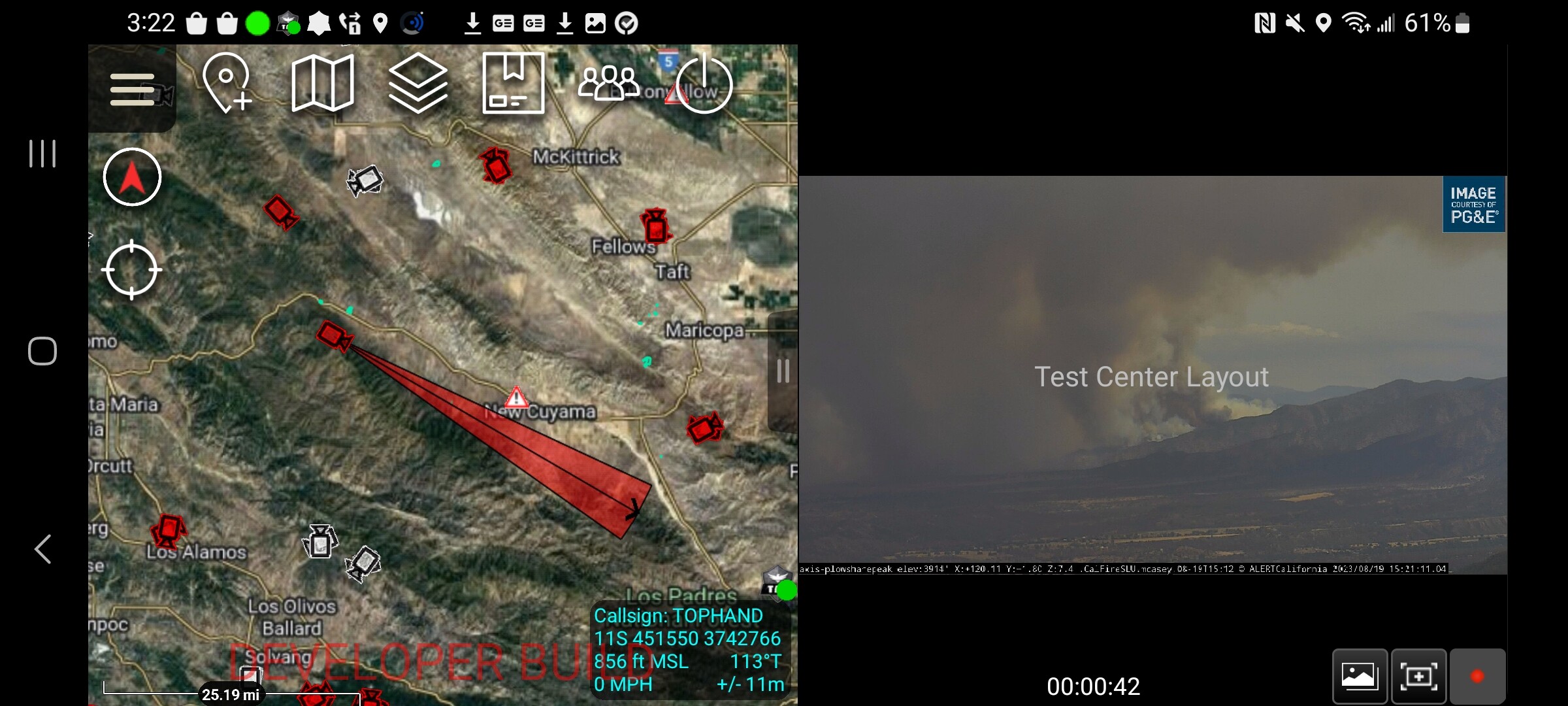
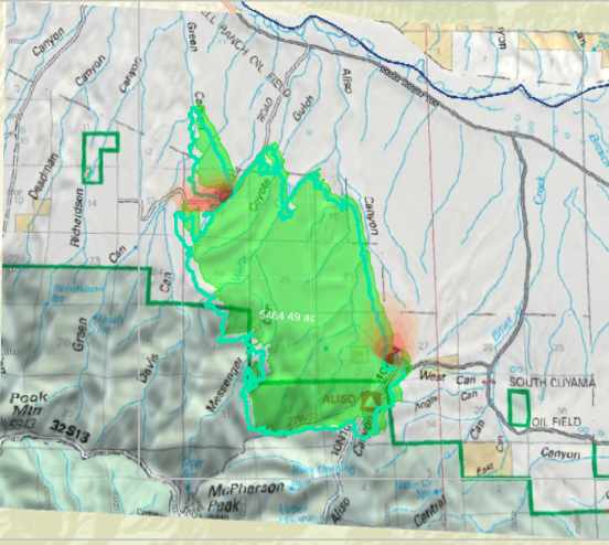
Fire name: Plant
Location: Foothill Road; New Cuyama, CA
Reported acres: 400
Rate of spread: rapid
Report on Conditions: wind driven; potential for 2,000 acres
Structure threat: are threatened
Resources: SBC, LPF, SLU, AA504, T74, T76, T78, T79, T911
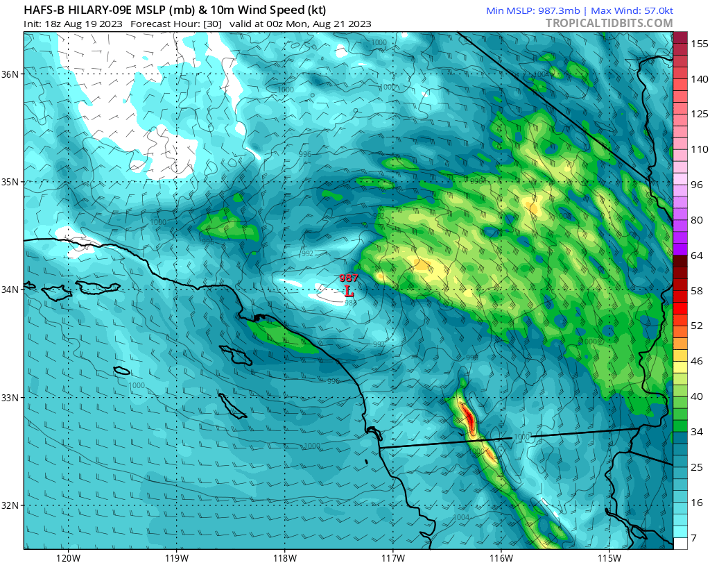
Hazards: tropical storm warning in effect near by to the east, potential for gusty winds from Hurricane Hilary
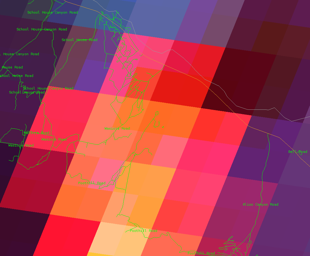
Weather: unstable atmosphere due to low pressure system and approaching tropical cyclone, gusty SE winds transitioning to NE winds this evening.
New Cuyama WX EW0673
Cuyama Valley RAWS
Radio channels:
Scanner link: Santa Barbara County Fire District Live Audio Feed
Webcam link: Plowshare Peak
McKittrick Summit South
Pelato Peak West
Mt. Abel 2

Agency Website:

5 Likes

Per SBSO Caltrans to close Hwy 166 at Hwy 101 in Santa Maria and at Chumash Gas just west of New Cuyama on the east.

5 Likes

5 Likes

Per division, fire to impact Wasioja area in 10-15 min.

4 Likes

The VLAT should be there within that time frame currently over coalinga.

5 Likes

It’s spotted over Wasioja Road.

6 Likes

6 Likes

The hurricane models are showing sustained NNE winds about 20-30 MPH tomorrow

4 Likes

Per ic fire is impacting structures “reports of structures on fire”

5 Likes

FIRIS Mapped at 5465 acres

7 Likes

image 1725 hrs

6 Likes

Seems like the smoke is laying down on the cams. Has anyone heard updates on fire activity? Dare I say it’s looking better?

3 Likes

Perimeter map

3 Likes

Spot weather report on command 70% chance thunderstorms throughout the night, erratic winds expected.

5 Likes

Modeled perimeter, 2 days from now:

5 Likes