State ID: CA
3 letter designator: SCR
Fire name: POWERLINE
Location: North Sacramento–> East of Sac Int’l Airport
Reported acres: 200ac potential for 1800
Rate of spread: Rapid
Report on Conditions:
Structure threat: Structure are threatened and have been lost
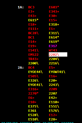
Resources:
Hazards:
Weather: Red Flag- 92F North Wind 25mph
Radio channels:
Scanner link: https://www.broadcastify.com/webPlayer/29667
Webcam link:
Agency Website: https://twitter.com/SacFirePIO
1 Like
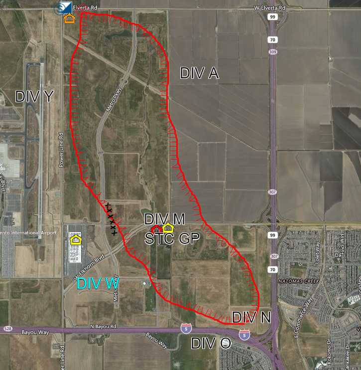
Shutting down I 5 between Hwy 99 and the Sac River
6 Likes
For progress has been stopped I 5 is now open transitioning to mop up
2 Likes
Thanks for the updates on this one! I work in Oakland, but live in the north natomas area. Haven’t been able to consistently listen to the scanner, but these updates definitely helped.
You bet…early est is 800-1000ac
2 Likes
Did E6 and E10 get pulled from their station or on a moveup?
They were on the fire…there was a point in time where there was no engines available in the city and only 5 trucks left…multiple grass fires at the same time…not to mention all of the other engines there on auto aid from Metro and West Sac
1 Like
But there were 8 medics available!
T-shirt vendor?
2 Likes
That’s a 1st 
2 Likes