I think I heard 10 Charlie strike teams for tomorrow. Was sort of broken.
3 Likes
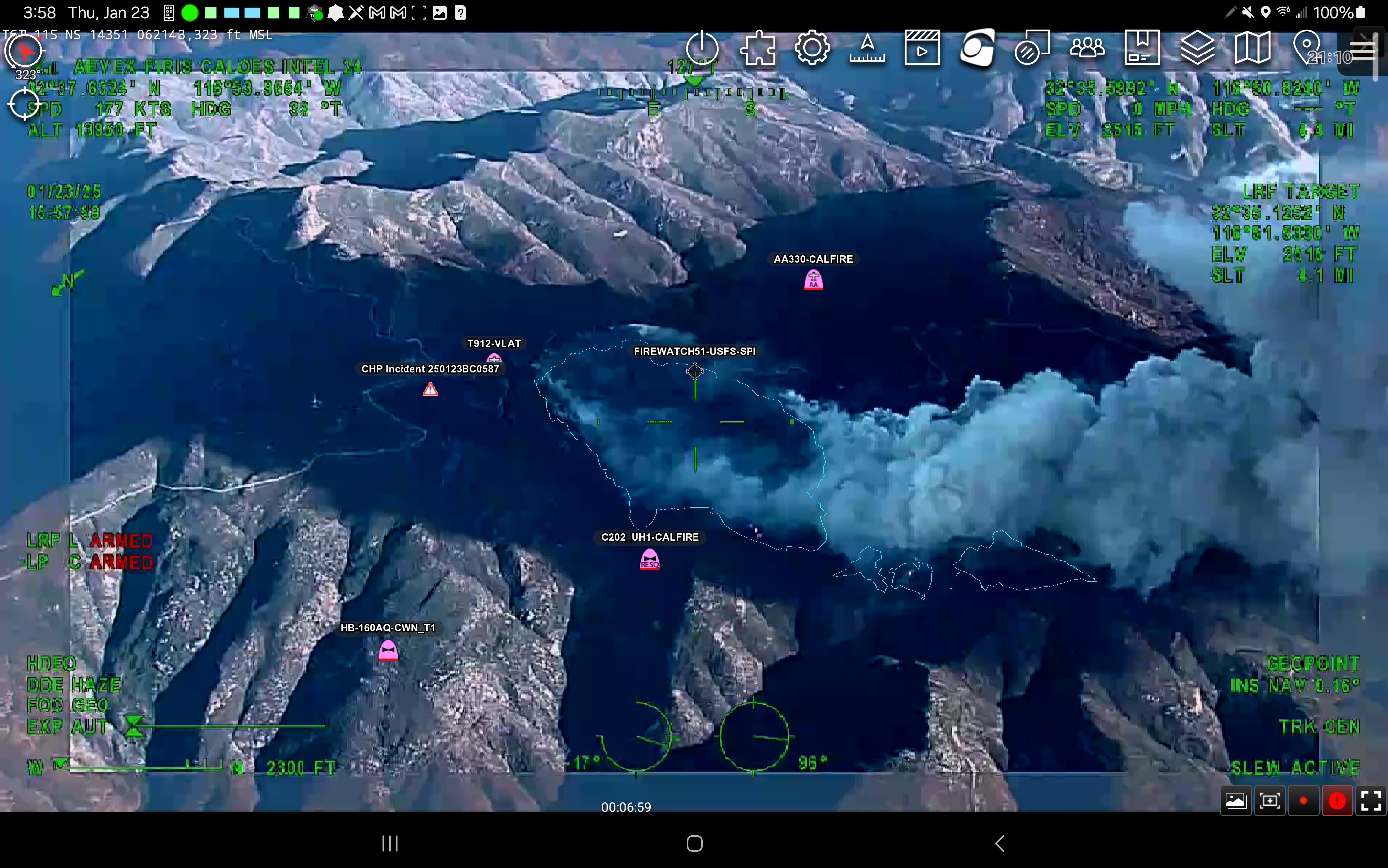
Intel24 is over the fire now. Should have updated perimeter soon.
3 Likes
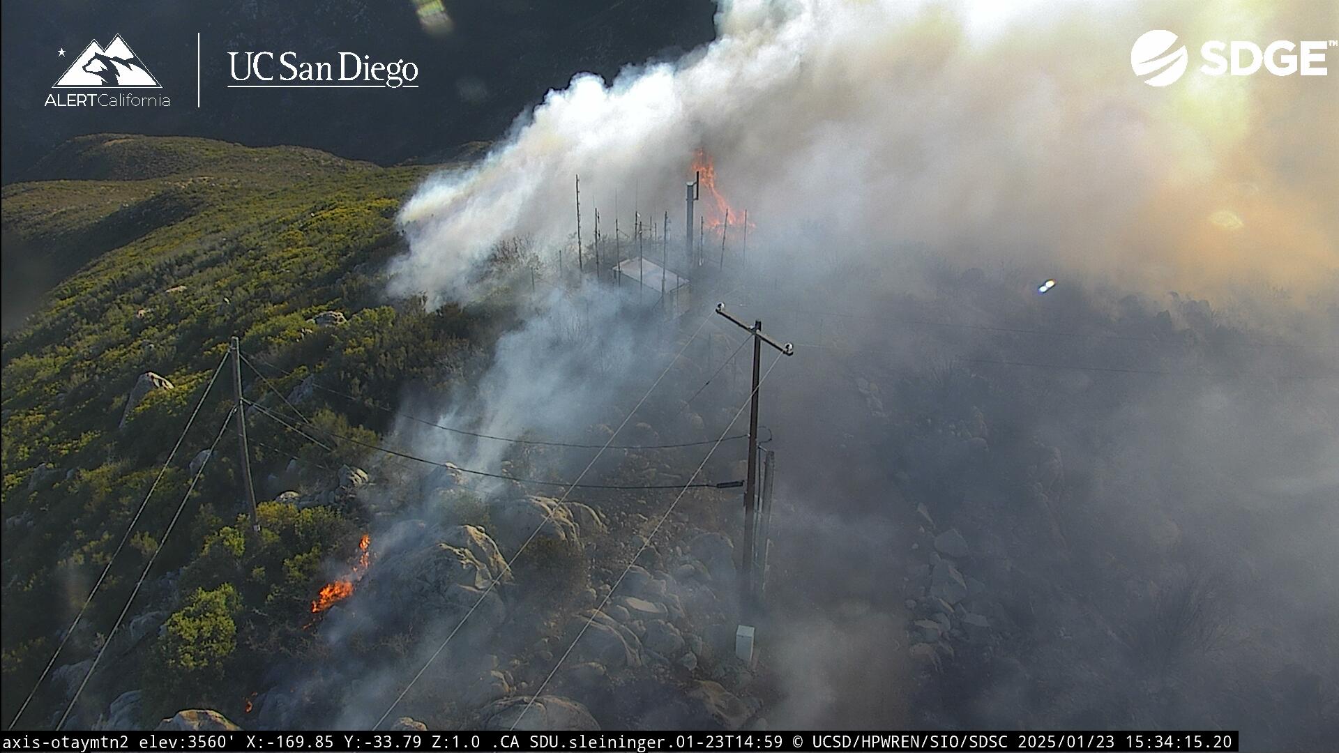

Per FIRIS 140 acres
3 Likes
AA stating everything is staying north of the truck trail, except for one spot that was picked up.
3 Likes
It in the BLM preserve between the peak and Mesa
1 Like
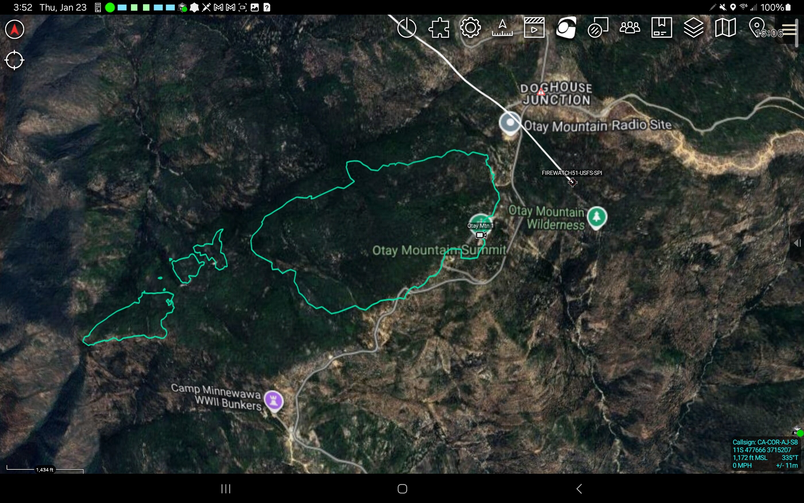


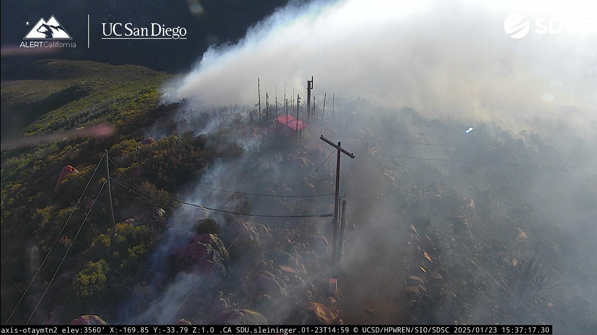
226 acres now
2 Likes
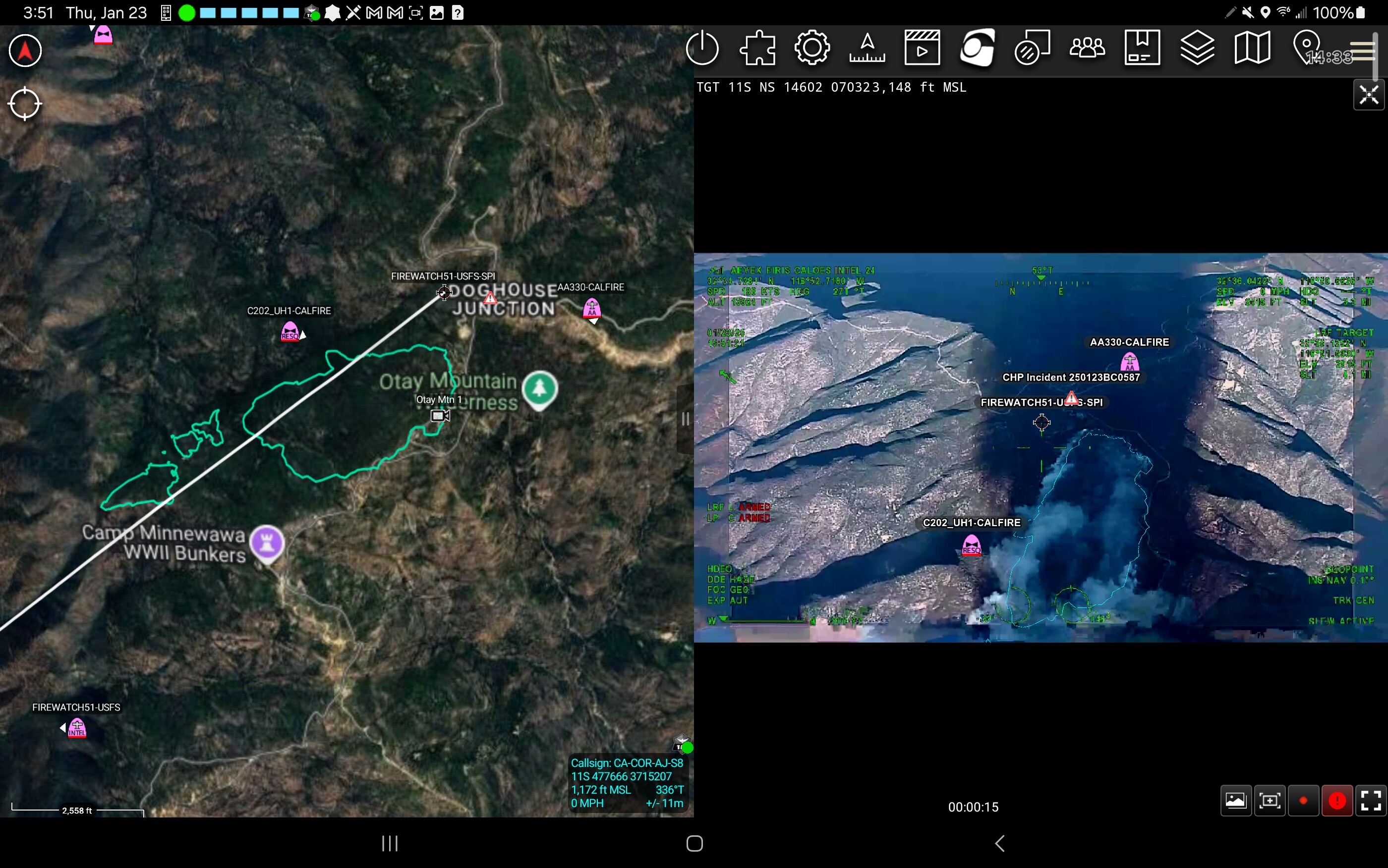
Thanks for the ATAK screen shots @ajohansson
4 Likes
500 plus acres now. Crews have a long night ahead of them. Steep hills and trails and not much for light
9 Likes
Prayers for their safety tonight.
4 Likes
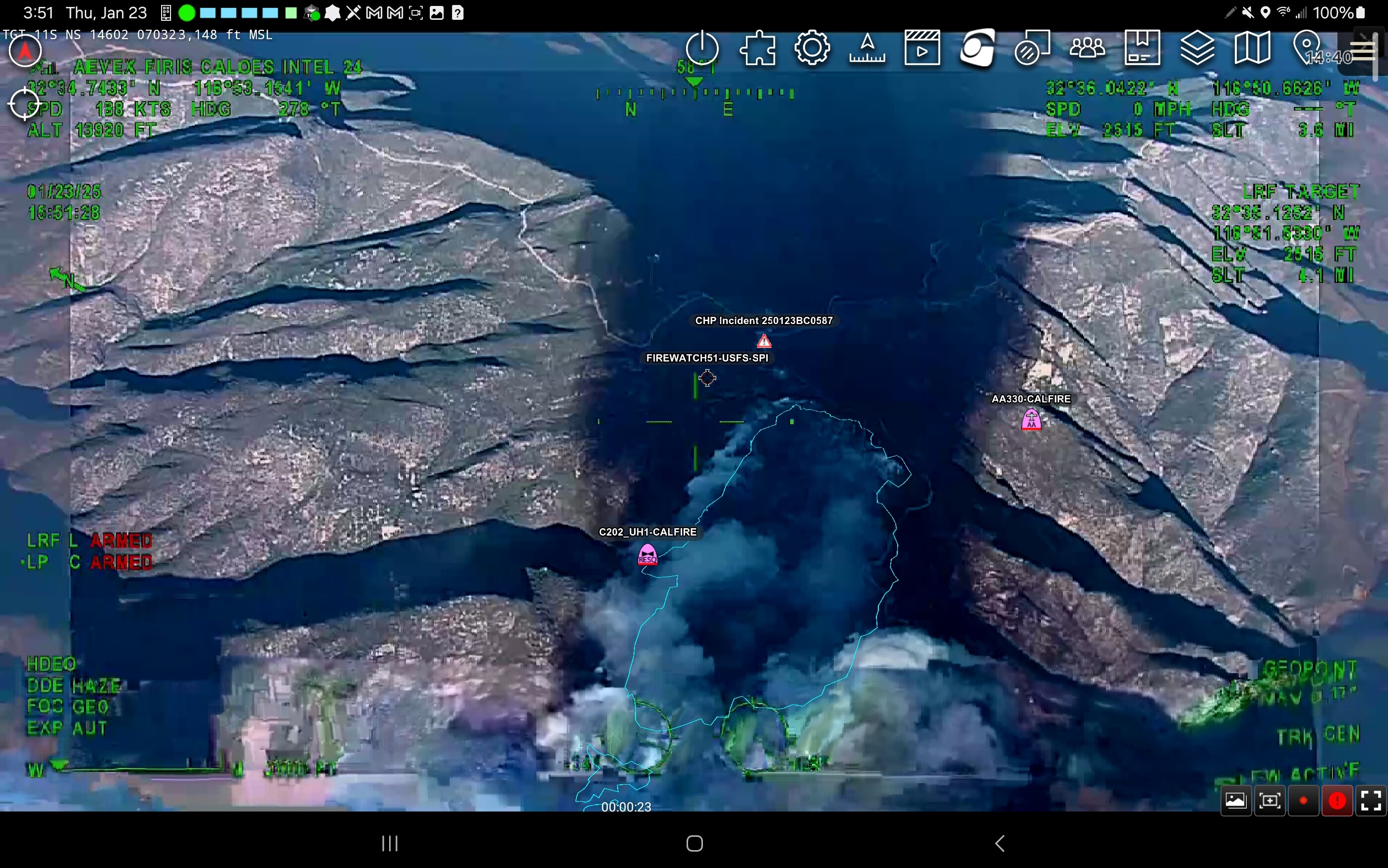
IC reporting current size 800 acres with extreme fire behavior. Evacuation order issued for SDC-2543. Evacuation warning for SDC-2464. CHV is monitoring the southeast area of the Chula Vista. That area is currently under an advisement warning.
Conditions on Otay Mountain winds are E 31mph with gusts of 45mph. RH is 4%. Temp is 52
2 Likes
800 acres with long range spotting. Night flying copters and additional dozens requested
3 Likes
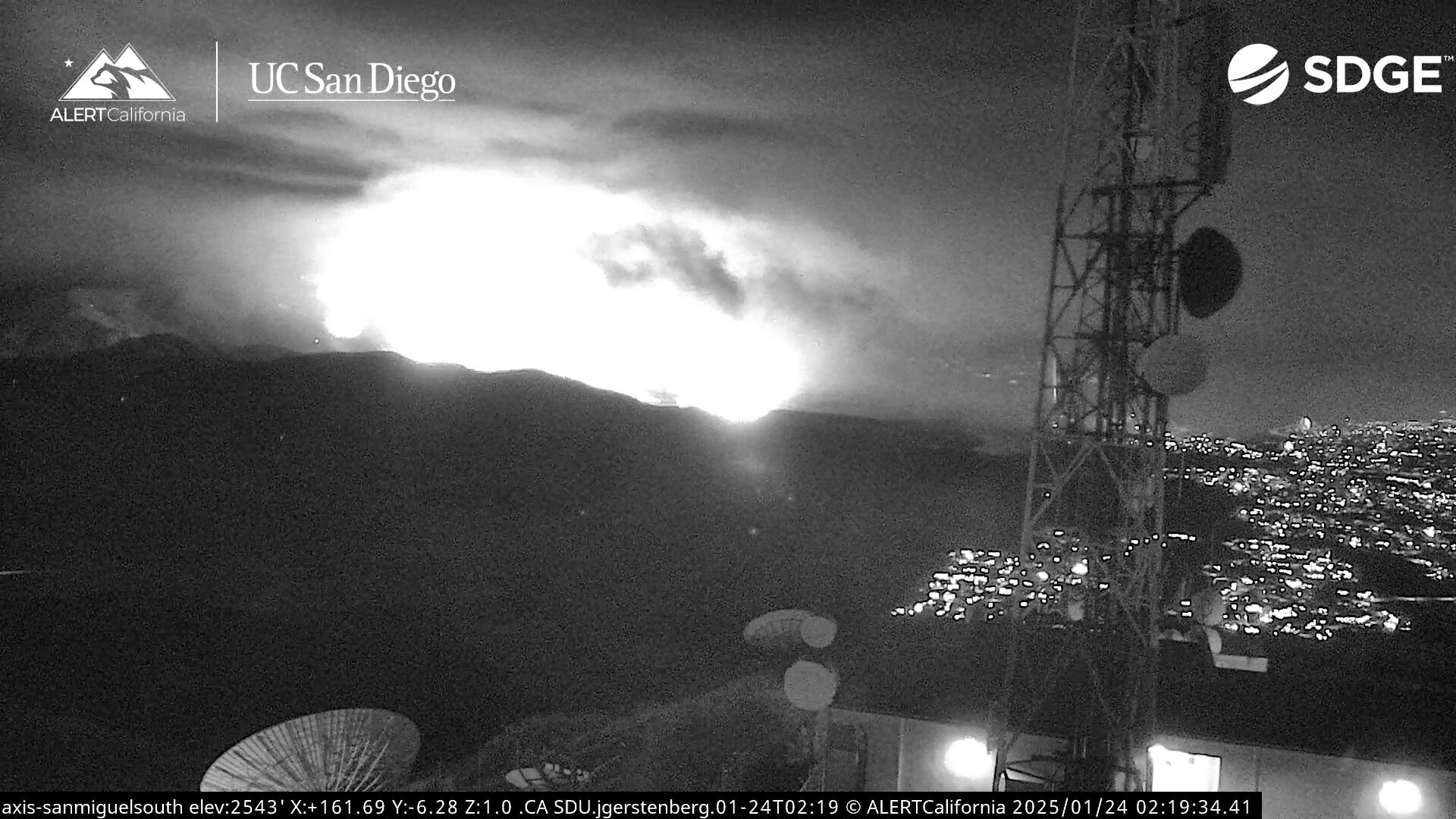
Viewing from the cams at Mount San Miguel, the fireline has already made it down to the Otay Lakebed on the northeast side along Otay Lakes Road. That would indicate based on rudimentary mapping that this fire is actually closer to 5,000 acres than 800. Big question marks on whether or not the road will hold the fire south of Mount San Miguel. Lot of land out there hasn’t had fire since 2007.

3 Likes
IC just upgraded SDC-2464 to Evacuation Order and zones SDC-2463 and SDC-2389 to evacuation warning.
2 Likes
Evacuation warnings issued to SDC-2541, SDC-2542 & SDC-2461.
1 Like
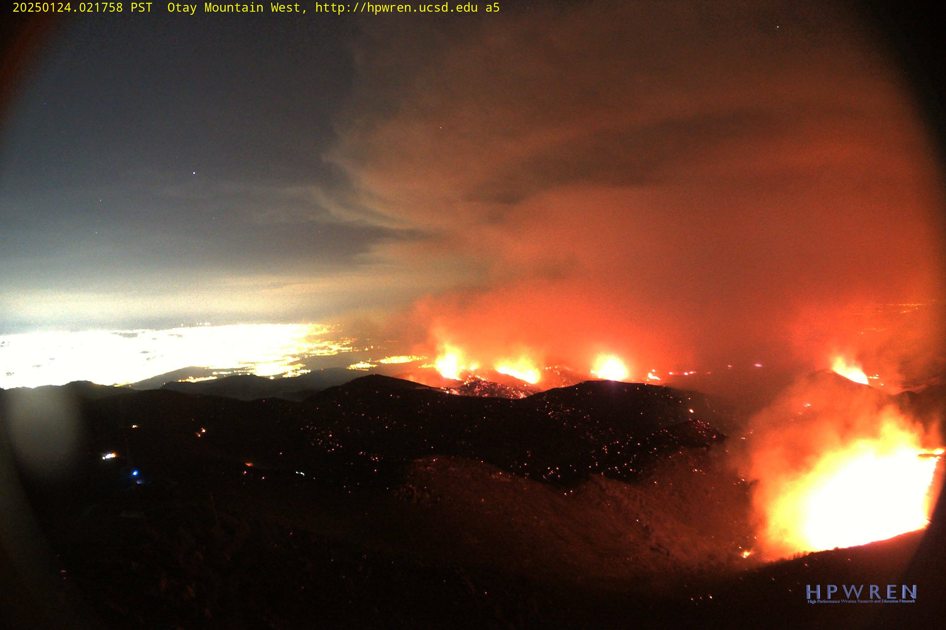
The fire is now 4,250 acres and 10% contained, per Cal Fire San Diego on X. Radio traffic indicates the fire is holding at Otay Lakes Road.
2 Likes
Night flying copters did a good job to help slow this fire advance.
2 Likes