State ID: Cal Fire SD
3 letter designator: SDU
Fire name:
Location:
Reported acres: 15 acres
Rate of spread: Moderate, Wind driven
Report on Conditions: First engine on scene reports 10-15 acres at moderate rate of spread. Requesting for immediate evacuations for De Anza Springs Resort.
Structure threat: Yes
Resources: 2CH, B3315, B332, E56, E244, E3365, E3399, FFC2, FFC3, SMGBR23, TD3342, TD3344, TW62, W43, E 43, E46, M31 - AA330 AT71, AT72
Hazards:
Weather:
Radio channels: CDF TAC 8, XSD TAC 11, XSD command 3 Tone 2.
Scanner link:
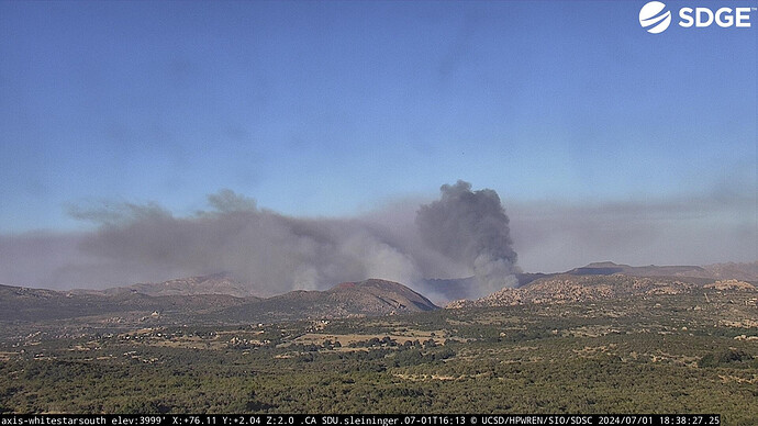
Webcam link: ALERTCalifornia
Agency Website:
Engine 244 is assigned to Division Zulu, Per IC.
Div Z reported 1 spot burning in the center median while arriving on scene
M31 REPORTS 1 PT, POSSIBLE SECOND PT TO DIV A ( ENGINE 46 )
Evacuation order for De Anza Springs Resort.
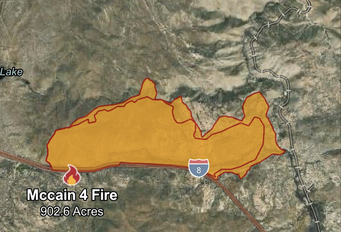
Div Z states fire is “outpacing him at a fast walk” down the freeway, trying to keep it on the north side of the freeway.
what we don’t want is that to move to the east down Corrizo Gouge and take out the historic Spreckles wooden trestle. Its one of the remaining largest wooden trestles in the Unitied States all that tamerist will burn nasty in the mouth of the gouge along the train tracks.
Live Chopper:
looking at the column, it already getting hte afternoon wind enfluence down Corrizo gourge.
I retired from McCain Camp near there. Trying to listen to the traffic to determine which side of the freeway it’s on. That new helicopter is just about there.
AA states majority of this fire is on the north side of I-8. Also very limited ground access and minimal dozer access in flats. Handcrews with an aerial show.
Evening winds can blow down canyon until sunrise.
yeah, that’s defo not Dozer country. All hand show. Will be a slow roll due to the Boulders. lt looks like the head is about 1/4 mile west of the old tecate RR tracks now. The De Anza Springs Resort is just 1/2 mile east of the tracks.
714 acres per FIRIS.
yep, it north of De Anza resort at the moment. heading for the firat tunnel on the Tecate RR going into Carrizo Gourge.
wish the news helicopter would fly the Goat canyon veiwpoint on the west flank to see where the head is on that side. I want to see how close to the wooden trestle it is.
Goat Canyon Trestle is about 5 miles straight line distance downcanyon from I-8, if that helps. You can actually see it on Google Earth.
yeah I see 2 helitankers working the west flank now. I think they’ll put this thing to bed before sundown as far as foward movement.
Fire is well established in the Carrizo Gorge and pushing to the north and northeast. Not sure if the historic tressels are threatened but I’d imagine so by sun up.

