
State ID: CA
3 letter designator: SHF
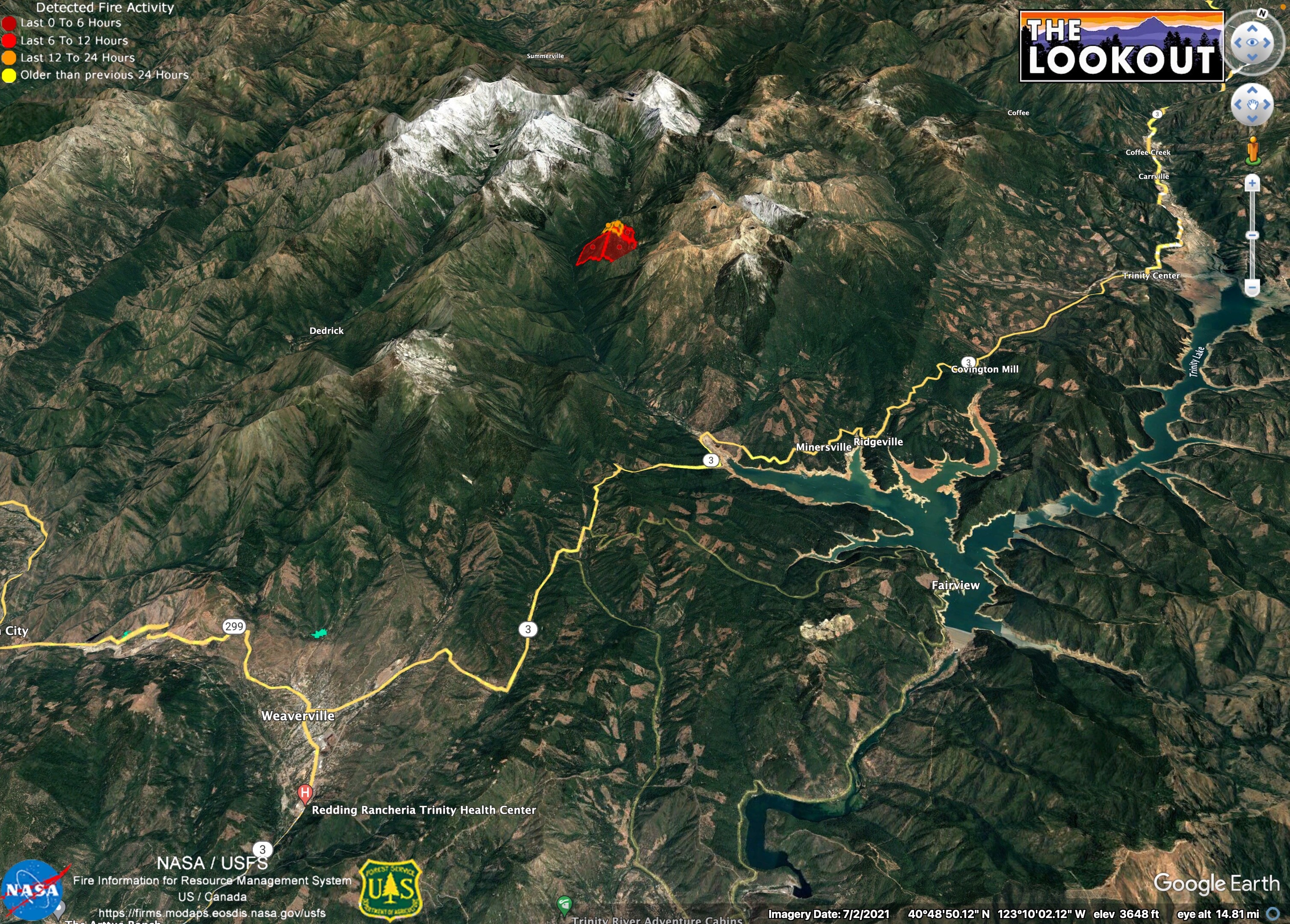
Fire name:Upper
Location: 40.931550, -122.938967. North west of Trinity lake, in the steep country.
Reported acres:unk
Rate of spread: unk
Report on Conditions: I have little information, but the fire has really picked up in size and activity in the last few hours. Multiple aircraft working the incident.
Structure threat:
Resources:
Hazards:
Weather:
Radio channels:
Scanner link:
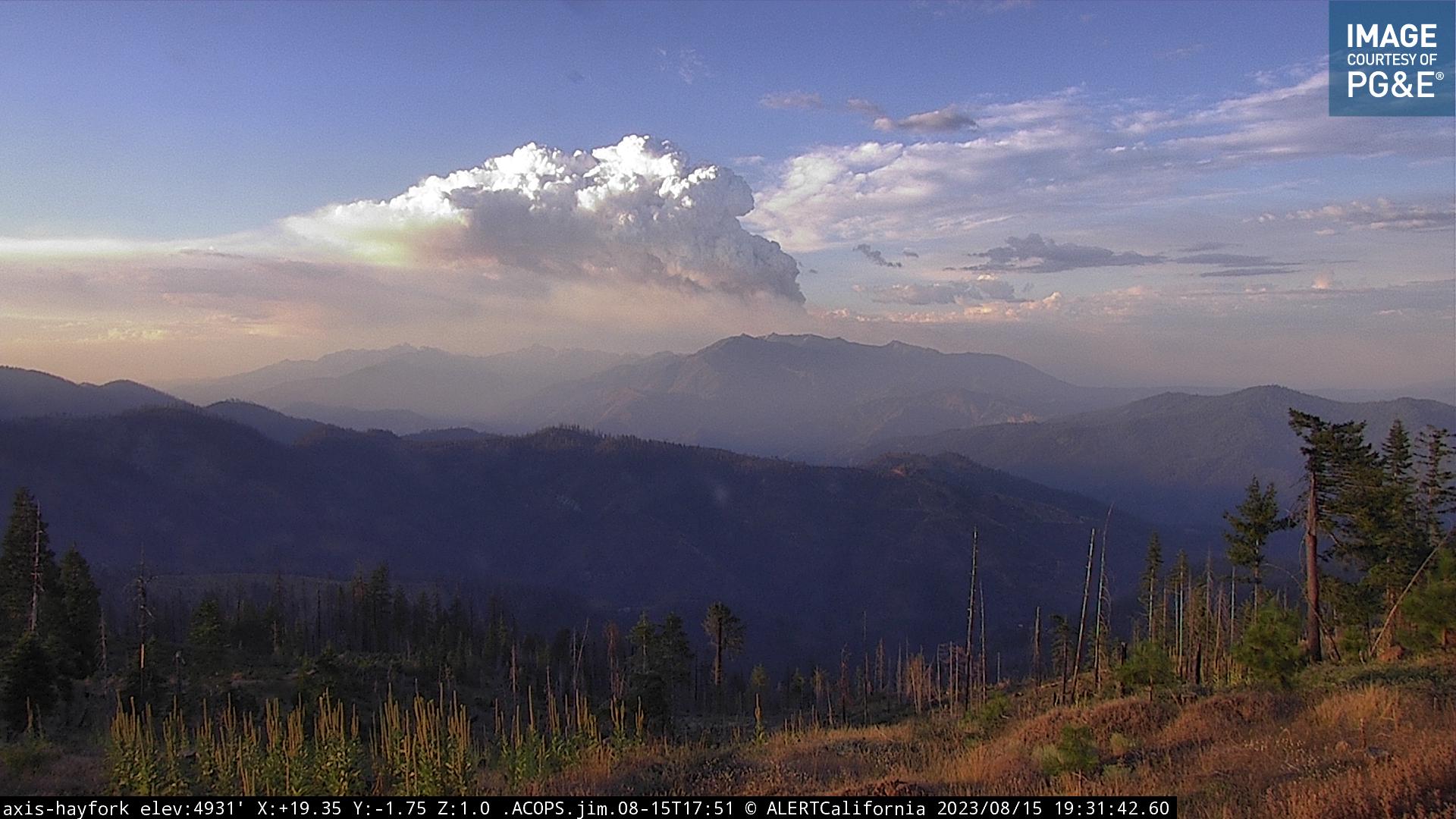
Webcam link: ALERTCalifornia, ALERTCalifornia - Oregon Mtn 1
Agency Website:
3 Likes
Could you guys possibly be looking at the one on the Klamath? Not sure where the reference point is to that?
3 Likes
Watch Duty has this as the “Deep Fire” ? Confirm?
2 Likes
it is possible the column we are looking at is the Klamath fire. They were working aircraft heavily at these coordinates earlier. SHF has it as the Upper, but it could be a different fire.
2 Likes
Points for the Upper and Deep Fires are very close together. Not sure which they’re ordering under.
3 Likes
https://cameras.alertcalifornia.org/?pos=40.7202_-122.9796_10&id=Axis-OregonMt
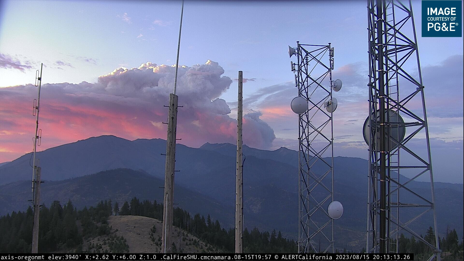
Hard to tell if this is the Upper or the Head
5 Likes
Per ONCC
150 acres timber, 0% contained. Fire is located in the Trinity Alps Wilderness. Fire has a moderate rate of spread with short range spotting
6 Likes
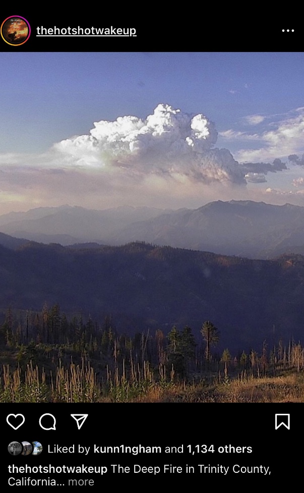
This fire is now the Deep per North ops, 500 acres
6 Likes