For reference
6 Likes
Here is our intel summary for the Green Fire as well as Horse, Helena, Summit, and fires in the Salmon River Country.
3 Likes
Rumour has i Team 10 may be going to the Green…
3 Likes
Inbriefing 7/6 @ 1100
4 Likes
Either some firing or found some alignment. This will be a challenging fire..
3 Likes
Fenders Ferry road is barely a road.. really hard on vehicles to get in there.
5 Likes
Since it sounds like you have some local knowledge any idea how the 2012 Bagley scar/footprint is looking like?
2 Likes
I don’t, but it would seem a 10 return interval is about right for any benefits to be erased. Plenty of wet and dry years to add growth and dead to live ratio to even up. I did not go to Bagley, but was on 2009 lightning and Hirz.
4 Likes
Thank you!
3 Likes
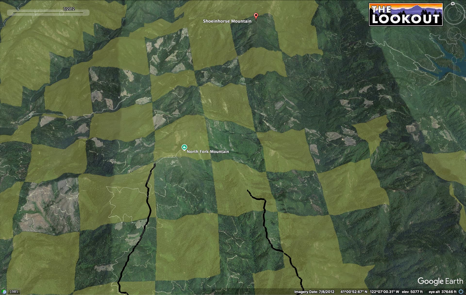
You can kind of get a peek into the 2012 Bagley Fire area on the panoramic view on the Shoeinhorse Mtn webcam:
The 2012 Bagley Fire area is mainly checkerboard between SPI and USFS. SPI salvaged and replanted most of their lands, and as such, you’ve got a lot of young stands, many of which have been pre-commercial thinned, with varying amounts of slash in them. Many of the USFS lands in the burn had a more mixed severity, with many of the larger trees surviving, especially on the north slopes. It’s a really interesting place to snoop around in Google Earth Pro, toggling thru the historic imagery.
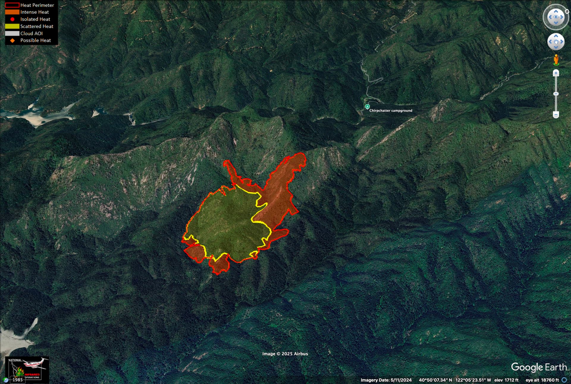
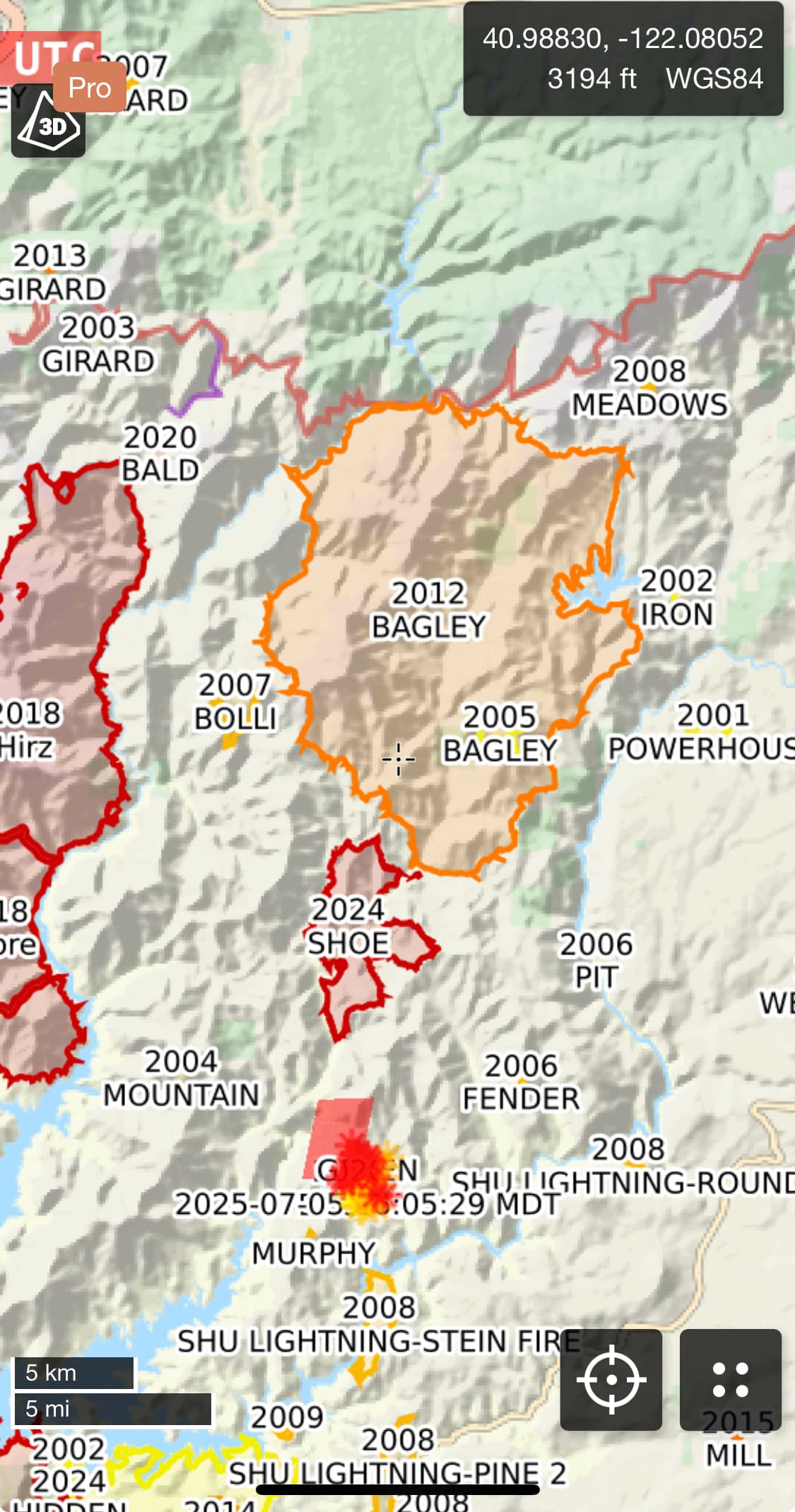
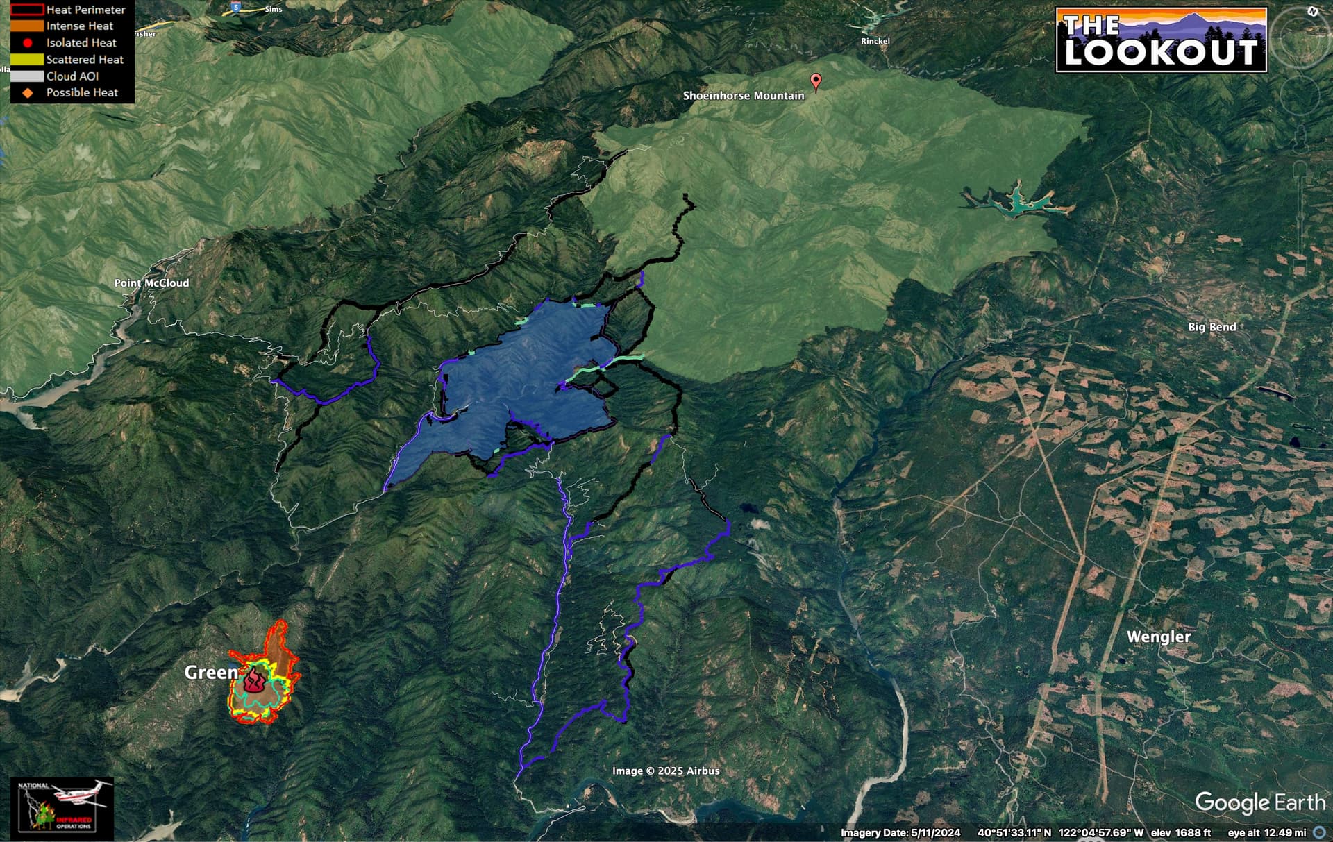
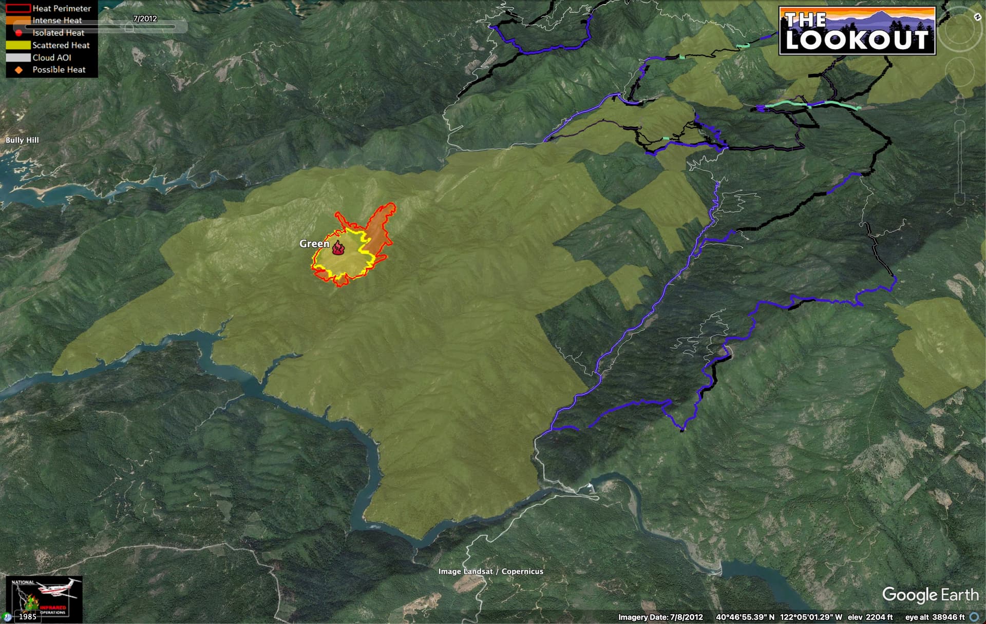
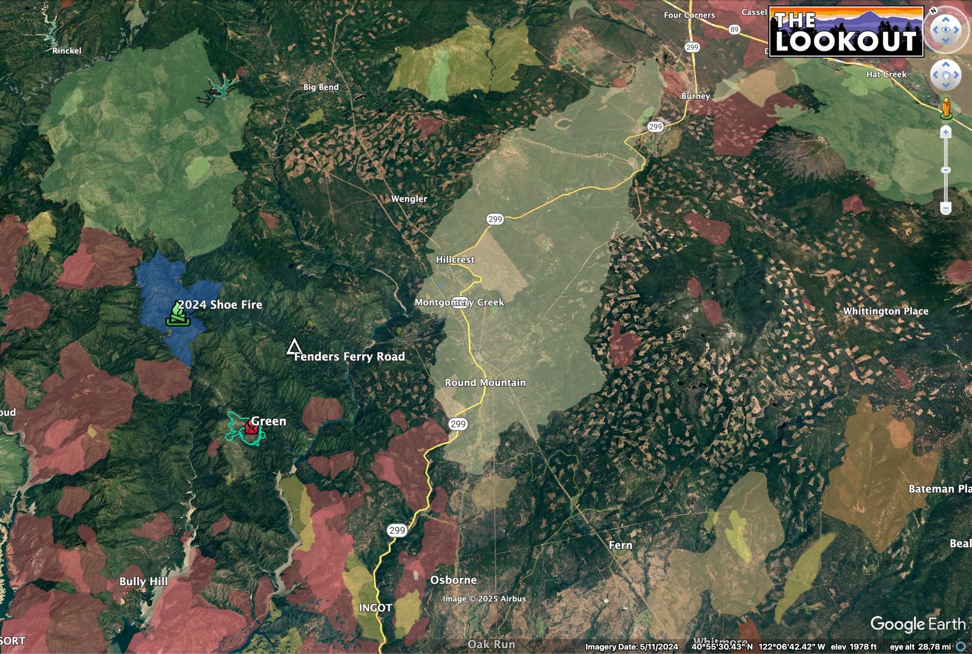
Here is a map showing the Green Fire, 2024 Shoe Fire (blue), and Bagley Fires (green). Black lines are 2024 Shoe dozer lines, blue are prepped roads. Fenders Ferry is main road thought the middle of the map. There was a lot of pot growing in this area in the teens, and there are more people living back in there that one might imagine.
Stark contrast between private and public lands in the 2012 Bagley Burn.

Interestingly, much of the USFS land here is classified as ‘Roadless’ (yellow), even though it is checkerboarded with heavily roaded private lands…
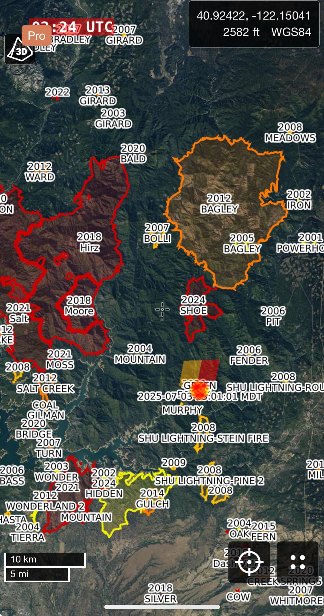
Green Fire is in the middle of a large roadless area. Closer inspection in Google Earth shows you why. Crazy limestone geology, not a lot of big timber. The whole area is also full of rare plants and unique limestone habitats, is classified as a Research Natural Area.
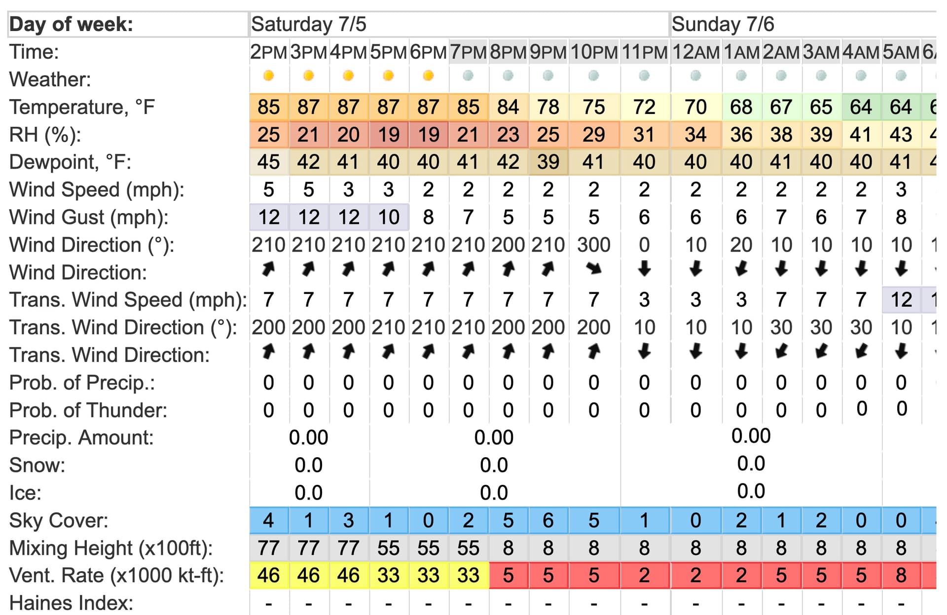
The fire is just starting to transition to the upcanyon flow. Next 5 hours should be interesting.
8 Likes
Very informative thank you
3 Likes
Word from the line is that ground crews disengaged from the west side of the fire this morning (not sure where else they are still engaged, Flightradar shows troop shuttles ongoing from Sugar Pine Camp). The initial idea for a box is Fenders Ferry Road, and the 2024 Shoe Fire. Here is a deeper dive.
5 Likes
Heard the crew shuttle was via barge…
6 Likes
#Got potential is an understatement. On the eve of another South Cnyn anniversary these “little” lightning fires that have been skunking/creeping around for days now - the only positive thing i can think of at the moment - at least the days are getting shorter & shadows getting longer in the drainages.. Even though there is for sure a SLUG of un-nicer weather still to come. Wish praying for rain actually worked..
1 Like
Yes, this thing is surrounded with a huge area with no recent fire history, and there is a lot of extremely productive areas for vegetation all around the rim of Pit River to the east.
Here is 100 years of large fire history.
8 Likes
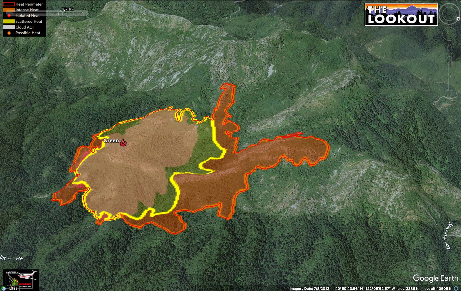
Fire is now a little over 1100 acres with team 10 taking command.
6 Likes
2 Likes
IAP
2 Likes