Unscientific observation from a curious non-producer here.. Sat view sure looking like its grabbing another gear now - evacs also issued a couple hrs ago..
3 Likes
Yeah, after days of backing it finally got into alignment at the head of Flat Creek, and is taking out the basin on the east side of Brock Butte. Red lines are 14:45 FIRIS from 7/8/2025.
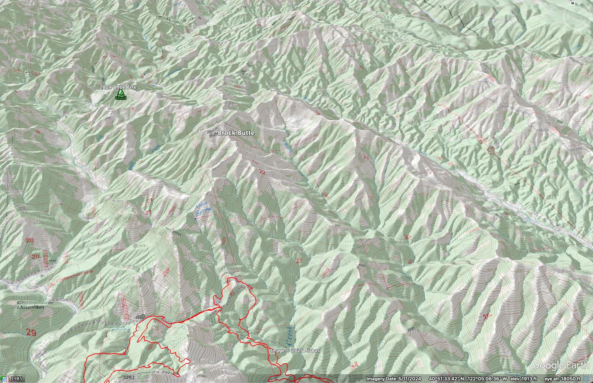
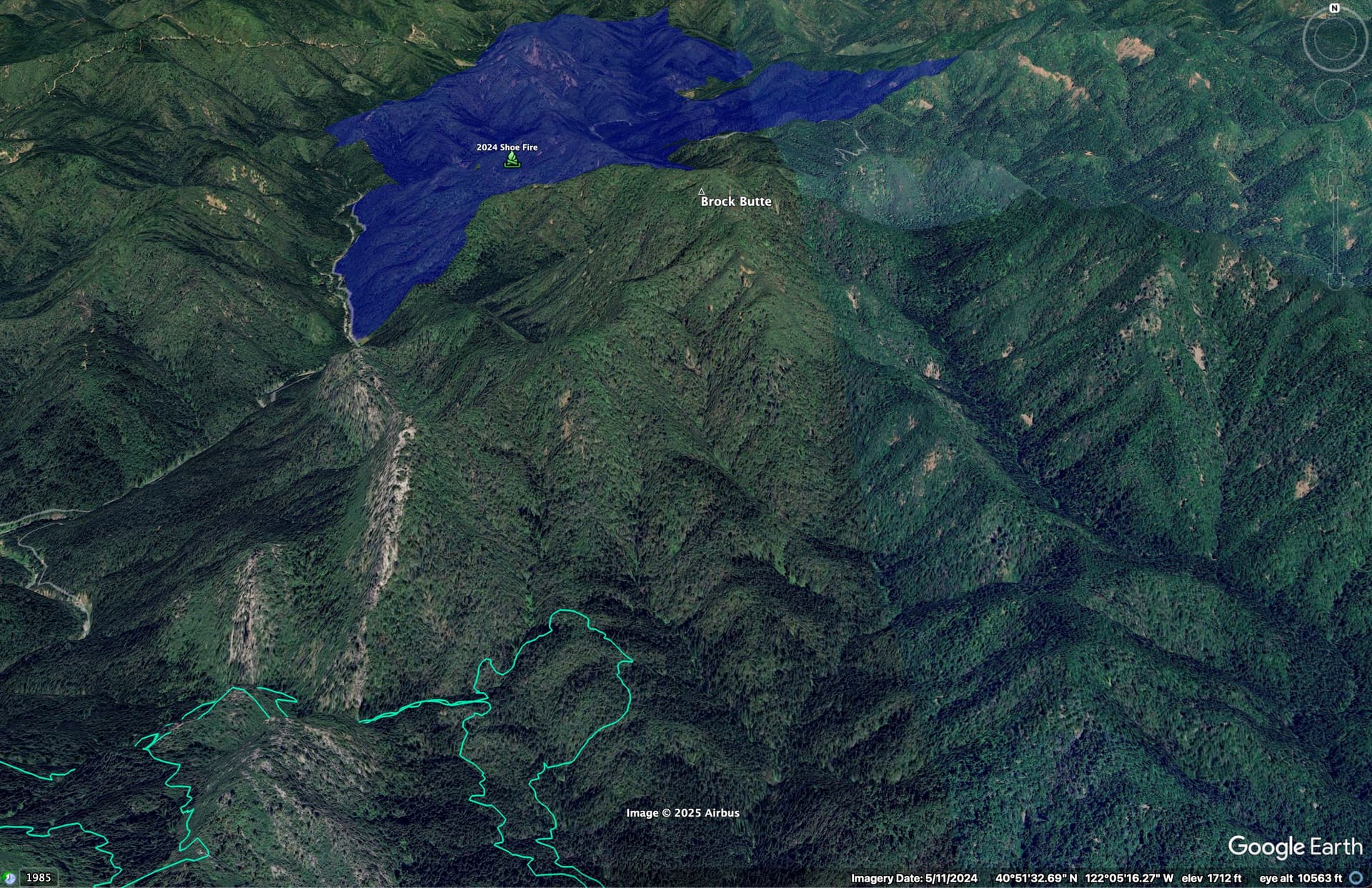
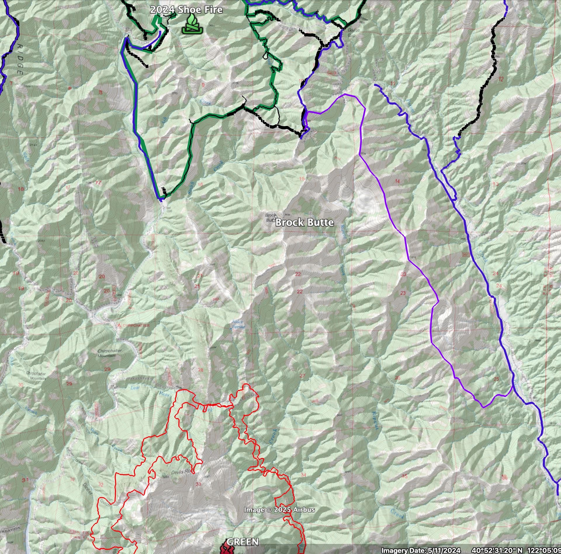
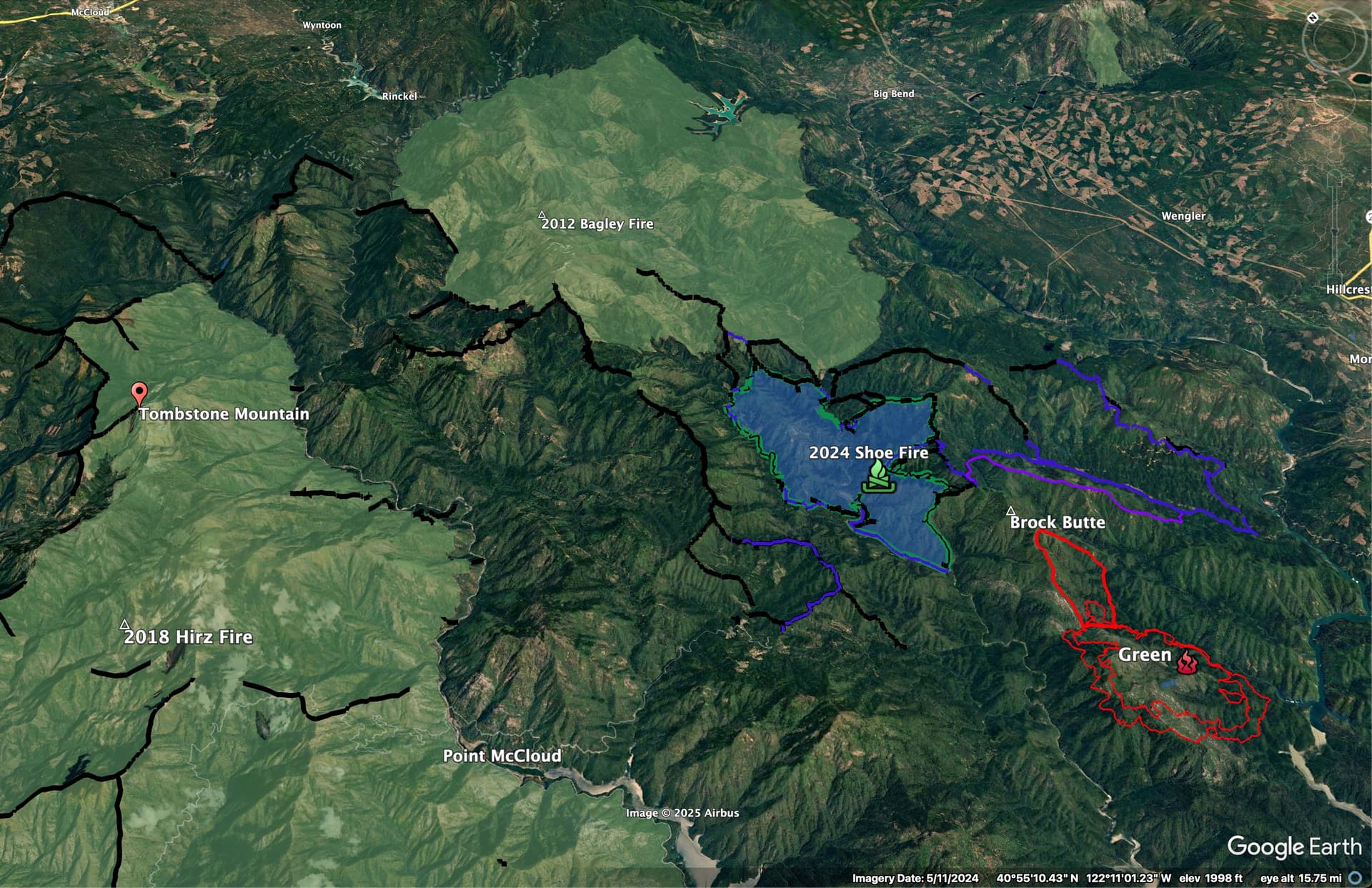
Crews are working on the next ridge system to the east, west of Fenders Ferry Road, on dozer and hand line. The plan was to connect to firelines from 2024 Shoe, but the timeline looks a little pushed, at the moment! Shoe Fire in green, planned line in purple, blue lines are prepped road, black lines are Shoe Dozer lines.
10 Likes
My gut says they will end up using some of the line from the Hirz, especially near Tombstone Mtn.. this is really tough country wit really long drive times from McCloud and Shasta Lake City..
7 Likes
1 Like
Here’s the Shoe and Hirz dozer lines, with Hirz and Bagley Fires.
If anyone is on the fire and wants the KML of the dozer lines to load into their Avenza Map, shoot me an email via the-lookout.org.
Here is an Ops map from Hirz:
And a Shoe Fire Ops map
![]()
4 Likes
3,271 acreage
3 Likes
I think what can become challenging with fires like the Green is the competition for resources. Right now the fire is not pushing them too hard and they have time to maneuver. For some reason the Hirz never really got up and ran other than a few isolated areas. With the temps on the rise over the next week, possibly the first real heat wave of summer.. we could see ERC’s rise and correspondingly IA rise. This will create a competition for resources and without the tools they need( solid type 1 crews and aircraft) the remoteness of the fire and extreme terrain will end up being factors in the end state of the fire.
9 Likes
3 Likes
It’s an interesting fuel type - there are a lot more oaks out there than just about anywhere else I’ve seen in NorCal, and combined with Douglas fir as the dominant conifer, the fuelbed is pretty slow to carry surface fire. You get the occasional flareup in areas with more long-needle under pines, but it’s kind of the exception. In the heavier mixed conifer, it’s the same story, but with even less surface winds due to the density of the stands. It all makes for a fire environment that is dominated by slope-driven/aligned runs, with a lot of slow movement in-between.
In some ways resource limitations are the best-case scenario for the Forest. I think the resource people on the Shasta-T are probably thrilled with an opportunity to let the south end of the fire back to Shasta Lake, where they have done some large rx burns in past decade, and have had plans for more, but the current mantra from the Washington Office is that they need to call everything ‘full suppression’ - so if they are resource-limited, they can claim this + firefighter safety was the reason they let the fire burn those 13,000 acres to between the fire and the lake.
8 Likes
Does anyone know what the critical resource requests are?
1 Like
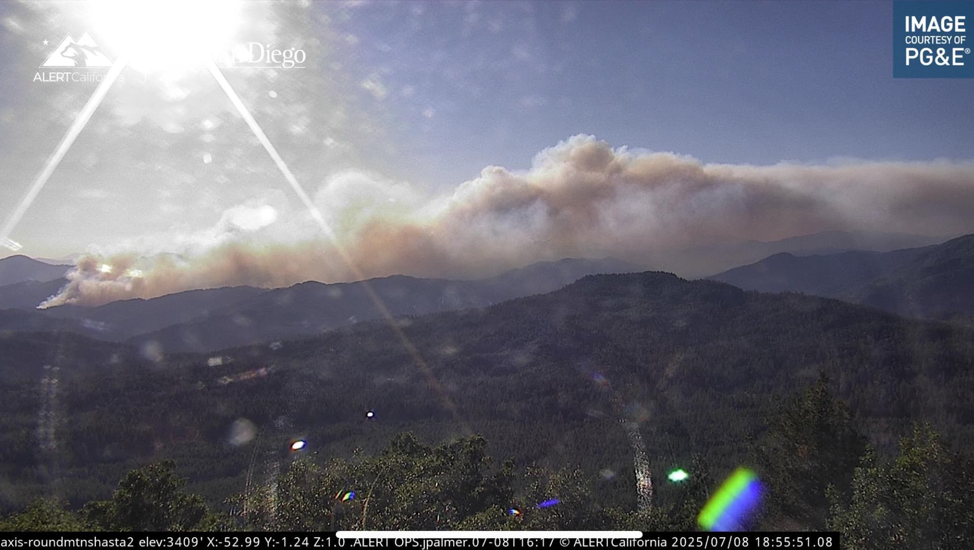
Just ordered a bunch of calfire equipment. But it’s got a pyrocumulus capping out right now. I live locally and the winds are flowing and 109 degrees. Maybe for structure defense within the next operational period? .
8 Likes
Local Government Charlie ST requested from SHU, report time 0700 tomorrow
3 Likes
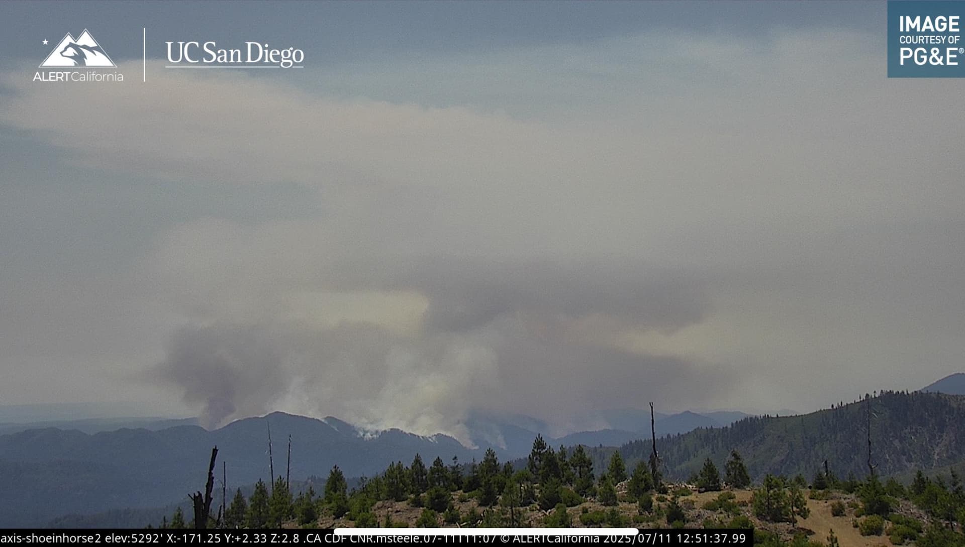
If fires can talk (some say they can) this one sure seems to be talking a bit different today given the number of plume(s) that have built & collapsed since sunrise.. #lces #onefootintheblack
4 Likes
Not from the area but have been on fires up there, what’s the chance that this chunks down to the Pit River and jumps it to the south side, or have they done plenty of RX burns in that area, was watching a helicopter cruise back and forth on the side side for a while on Watch Duty.
2 Likes
Sonoma LG Charlie punched out.
2 Likes
From the 11:45am FIRIS flight, and cams it looks like the pyro-cumulus action has been on the south flank of the fire, burning out the bowl on the north side of Brock Mountain.
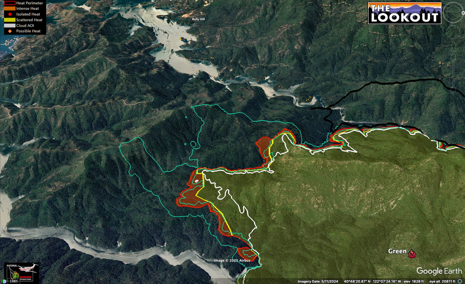
Time contour is about 14 hours between outer 2 red lines.
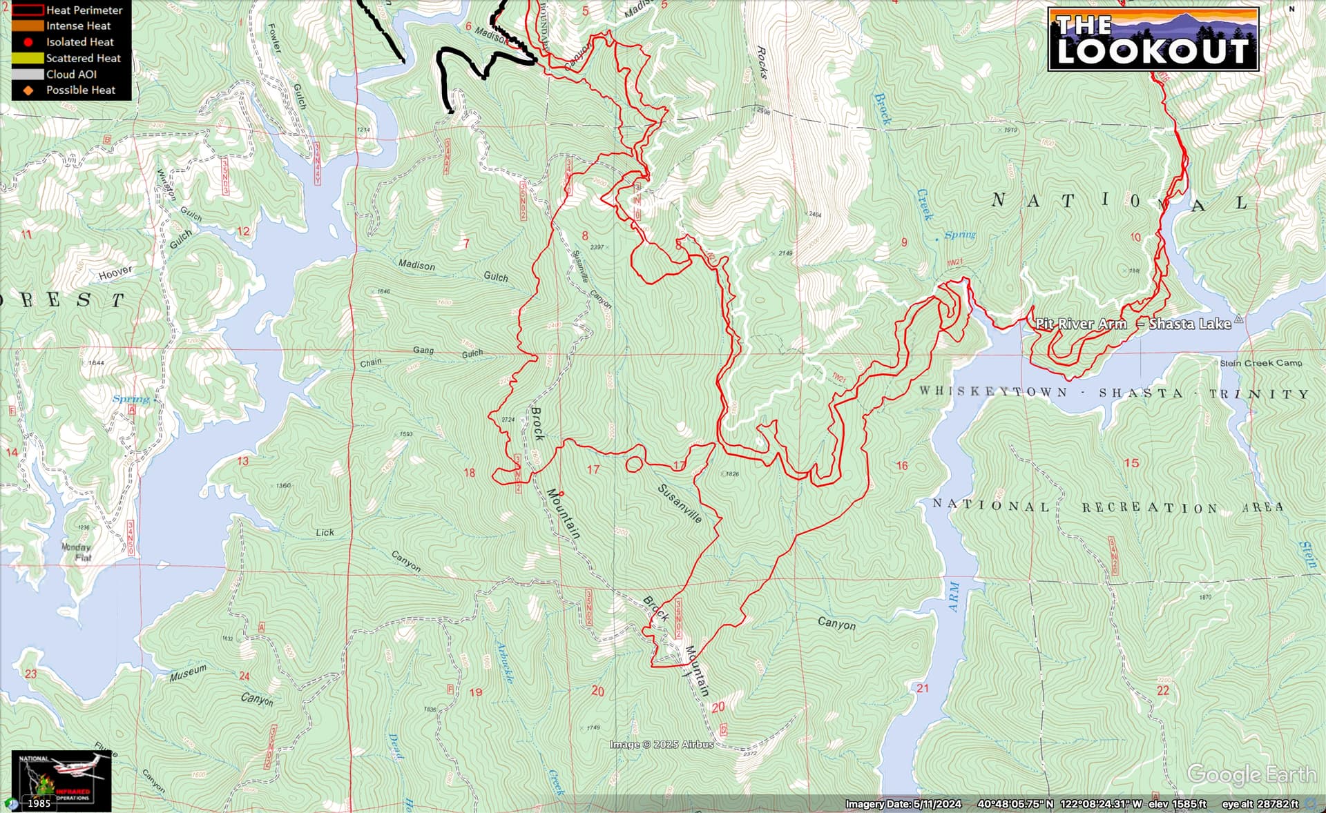
The good news as of the 11:45 flight was that the fire hadn’t advanced much into Ripgut Creek, where crews are prepping the main ridge south of Fenders Ferry Road.

7 Likes
XSA is punching out T3 OES ST, planned need. 4803C
STEN-CSM
STEN-T XSJ
OES 8432-SAC
OES 8433-SAC
OES 8434-SCR
OES 8435-EYO
OES 4306-XSJ
8 Likes
This fire is doing more good than harm it’s pretty much on a peninsula let it burn. It’s a lightning fire a hundred years ago it would have cleaned the forest up
9 Likes