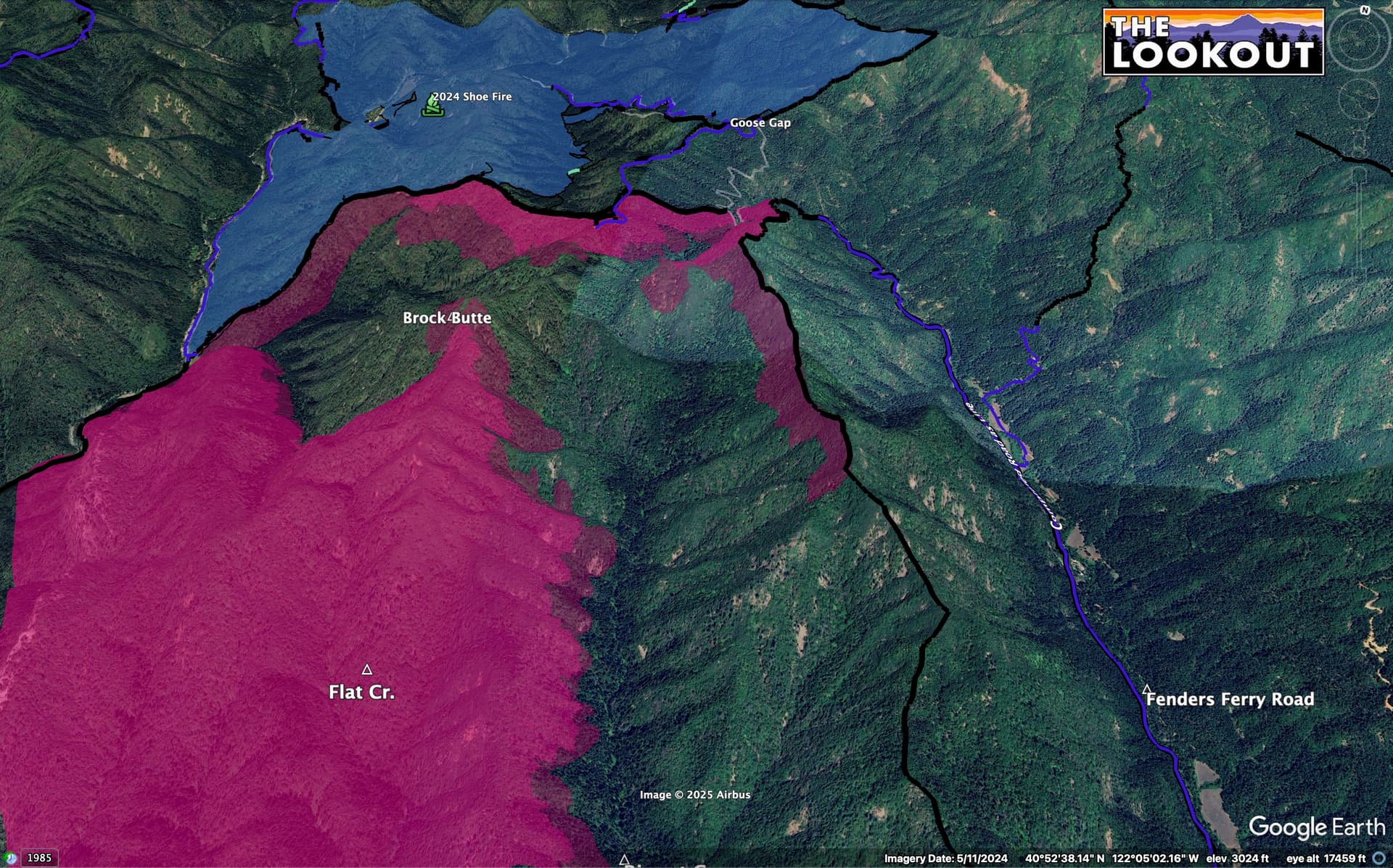
That seems to be the strategy over past week. I think even if the hope was to stop it, the fire’s got other ideas, now. Keeping it north of Brock Mtn seemed like it was going to be a tough task, looking at how it was likely to (and did) come out of the bowl, below.
5 Likes
Strike team of Type 3s from Region 4 (San Joaquin County) just punched out.
4 Likes
Seems to it has smoked itself out although there is no good cam angles on it right now the satellite confirms it has settled down. It’s still going to hotter than Hadis but Mother Nature is doing her job
5 Likes
Mixed Foxtrot Strike team from San Mateo Co. and San Francisco punched out.
5 Likes
Interesting. Back in ’92 during the Fountain Fire, our goal was to keep the left flank out of Fenders Ferry. Now they’re trying to keep the right flank out of Fenders Ferry.
9 Likes
Welcome to club old! ![]()
6 Likes
A little over 10,300 acres
4 Likes
I wasn’t in the fire service at the time but I remember being a kid and watching tankers come in and out of Redding for that. I too am part of club old just due to the fact that I know that fire ![]()
6 Likes

Imo, Its a good club & the light is always on for new members!
6 Likes
Here is our intel summary for this morning. https://www.youtube.com/live/M66tiwE0wB8?si=4bq2DlTotadn_AqS
3 Likes
3 Likes
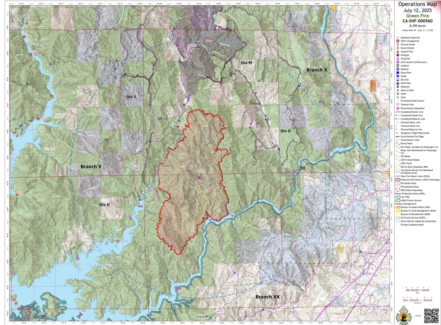
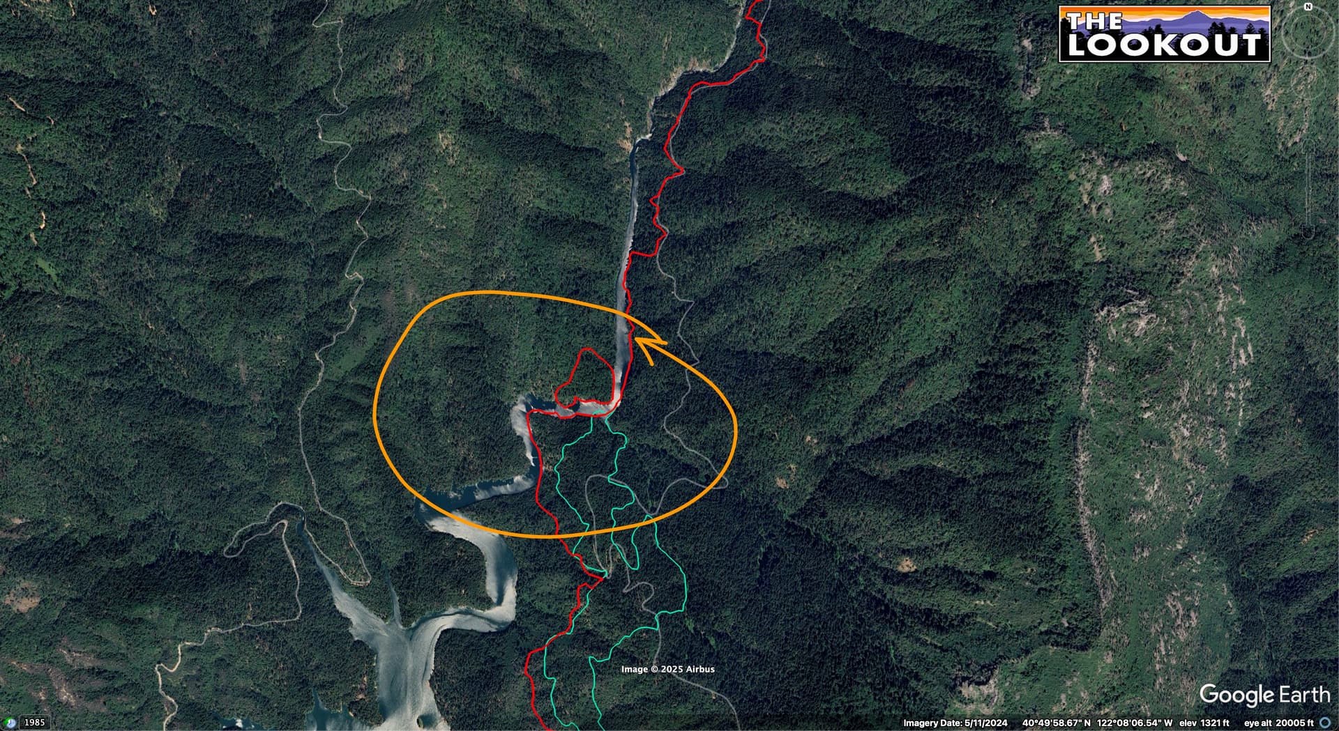
Today’s 12:30 FIRIS flight of the Green Fire shows firing ops underway on the ridge between Ripgut Creek and Fenders Ferry Road. Getting this line prepped over the past week has been a race against the fire’s spread, and the hot, fairly still weather, has helped keep the fire’s northward spread pretty slow.
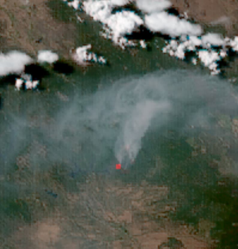
Looking at the visible and IR satellites (GOES18), and Round Mountain camera, the smoke has finally peeled out and activity is picking up a bit.
11 Likes
Hard not to get wide-eyed observing that arc of convective activity firing off around the fire and think just how close yet far enough away it is.. for now. #giddyup!
3 Likes
Significant spot on Div. D, across the Salt arm. Still within completed contingency lines
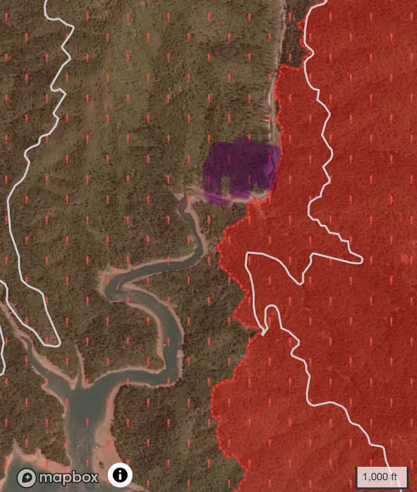
Working it with type 1 copters and Tankers from Redding are inbound.
5 Likes
May I ask how accurate is the size and shape of the spot across the Salt Arm and where did the info come from?
GOES agrees pretty well with the location.
3 Likes
It shows up in the latest NIFC perimeter, about 12 acres.
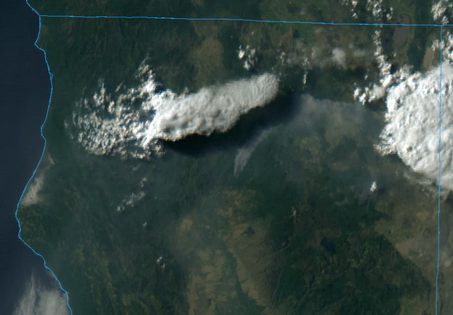
Looking at the GOES visible, looks like the fire might get heavily shaded and maybe a really hard push of outflow/west winds shortly?
What’s going on with that really well-defined boundary on the smoke to the north?
Looking at the new perimeter, it looks like they haven’t done any new firing today, and that the mapped firing happened last night.
5 Likes
You noticed that too - its a trip to see that super-well-defined-line to the north. Very very interesting.. Is it from the shade that isnt there any longer because the cells that created it have dissipated?
Edit: Including snapshot of well defined smoke line in question. Sorry to eat bandwidth but this is fonzie cool stuff worth learning about. #studentsoffire
5 Likes
What’s @norcal74 have to say about it?
5 Likes