Significant growth. Start time 1300 hrs
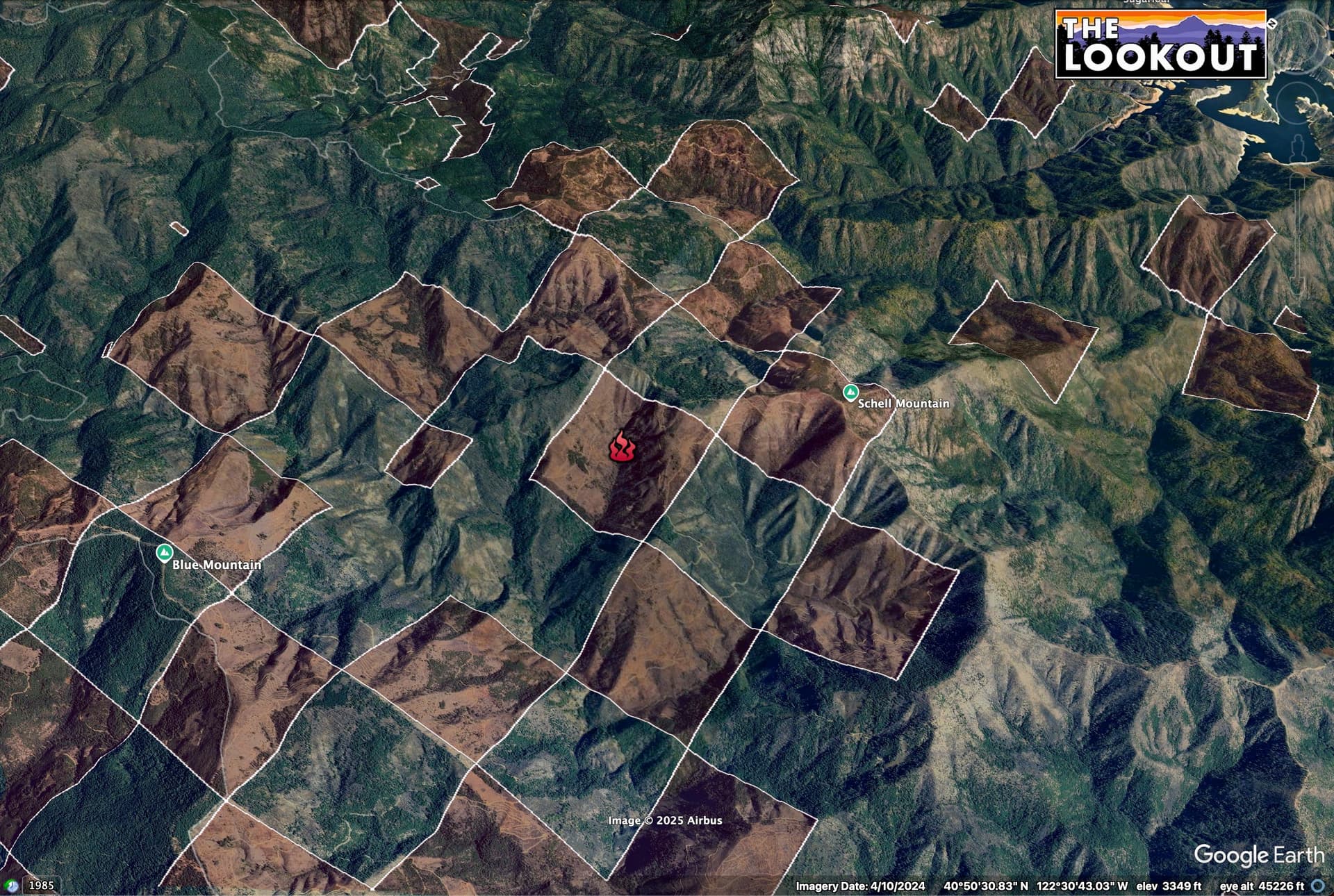
Near Schell Mountain
Between lake shasta and trinity lake( remote)
aircraft order going out now total of 4 AT( 2 t3, 2 T1)
Significant growth. Start time 1300 hrs
Near Schell Mountain
Between lake shasta and trinity lake( remote)
aircraft order going out now total of 4 AT( 2 t3, 2 T1)
50 acres, potential of 100
2 addl. Type 2AT per AA
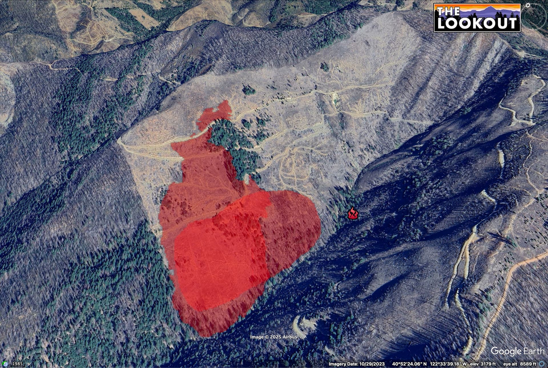
Based on the camera triangulation, looks like it should be well within the Carr fire scar? Should help slow it down, although I guess it has been 7 years…
40-50 acres, potential for 100. Total of 6 airtankers on order, 5 additional engines.
With the low still pulling away from the coast and drawing in moisture and the atmosphere primed for vertical development.. all of theses fires could become plume dominated. I would also not bet on the burn scar doing much to inhibit growth, in fact it could contribute to growth wit the dead and down.
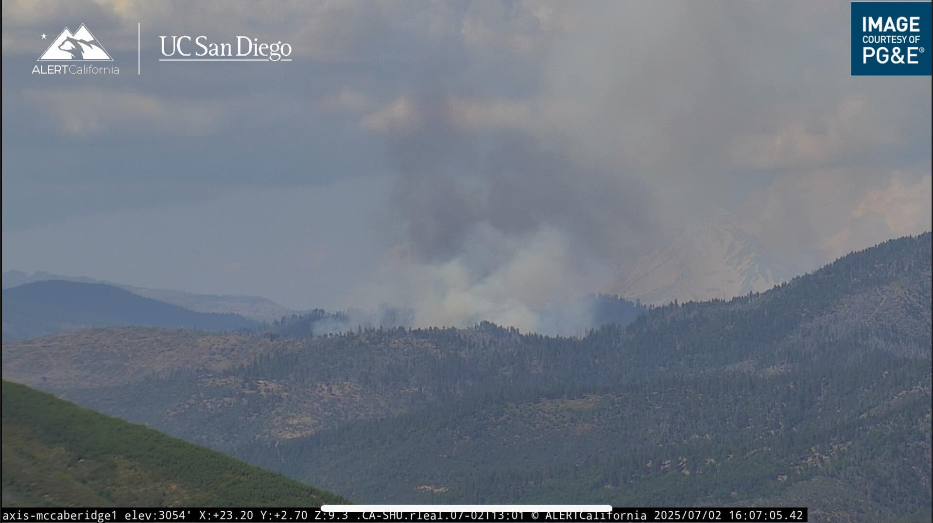
50 acres as of now looks to be well established on camera.
The fuels are ripe in the brush areas around Redding, for sure.
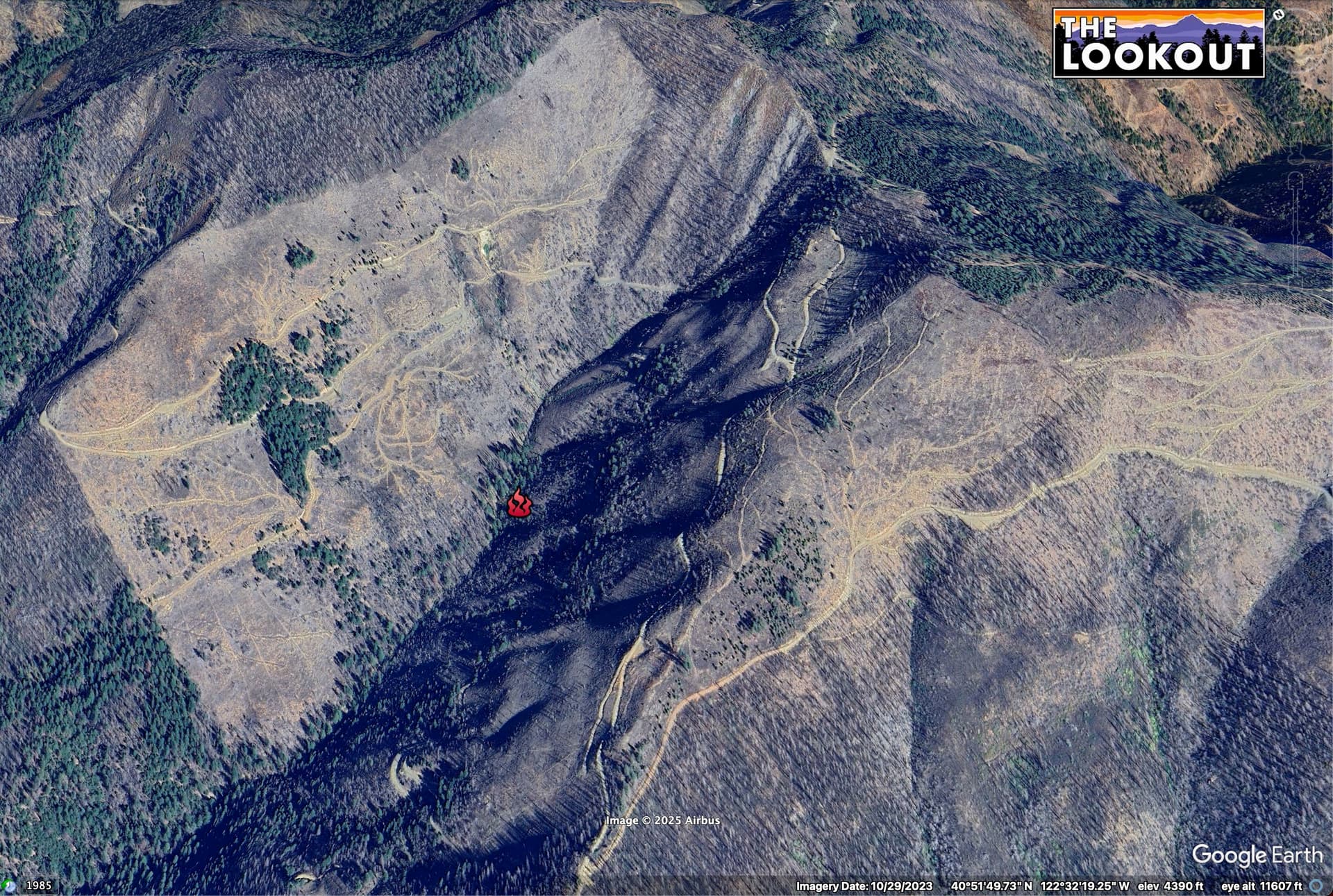
This fire, going off of the NIFC point, is burning in or around a salvaged piece of SPI land.
There will probably be a lot of logging slash in the cutblock, but the shaded slope to the south looks like it wasn’t salvaged, so there is some shade, potentially less dead and down/receptive fuels.
A lot of SPI’s Park Fire salvage areas have a sh!tload of slash in them.
This area is checkerboard ownership, so there will be schizophrenic fuel loading changes at the property boundaries - none of the public lands here were salvaged. Pvt lands in red.
FIRIS mapping puts it in the slash. I wonder if the unit had been replanted, yet?
Fires picked back up a bit aircraft continue to work it. Last I heard ground resources where still making access but estimated to make it in around this time
Yep…almost 3 hours in, and ground units are just starting to arrive.
85 acres, moderate rate of spread
400 acres still hasn’t crossed rattlesnake creek multiple slops over the line.
Releasing AA and fix wing for the night.
I worked in the Carr fire scar a few years ago and besides the plantations it’s all brush and dead and down now. You can tell property lines up there by the brush thickness…
The fire has crossed the drainage & there is now approximately 10 to 15 acres of fire on the south side of Rattlesnake Creek per Incident Command. Aircraft been requested when available (from Watch Duty)
SHF Horse extended freqs assigned
Air Tactics 170.3125
A/G 164.8625
Victor 125.275
210 Acres fire on both sides of the creek
No visible smoke today from the cams and WD prints “good progress by ground crews” , for past two days.