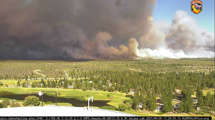
Tanker 912 in route from SMX.
The weed cam showed the crews parked on 97, close to where it crossed.
From the Camera’s looks like it crossed 97 near the 42N15 Road.
BC with the Vista group, saying that 97 isn’t passable at the moment.
It’s pushing hard, that column from that spot is near horizontal.
Putting in additional evacs for along A-12.
Vlat overhead getting ready to drop
Facebook live on 97 https://m.facebook.com/story.php?story_fbid=10222767245363137&id=1635196043&sfnsn=mo
T2 team 14 is assigned since late yesterday
Last night’s IR flight showing a 5 mile run north of Hwy 97. Interpreter’s log says imagery was incomplete so posted acreage probably won’t reflect overall fire size.
20210629_Lava_IR_Topo_11x17.pdf (963.5 KB)
13,300 acres and 20 percent contained.
That IR flight was WAY off
6/29 Day Ops Map - They had it filed in the QR code file.


