Yes, spotting way out ahead of the main fire. They’re talking about trying to box that spot in with retardant.
4 Likes
Spot weather forecast for the fire:
7 Likes
Type 2 team on order. Team 14
7 Likes
3 Likes
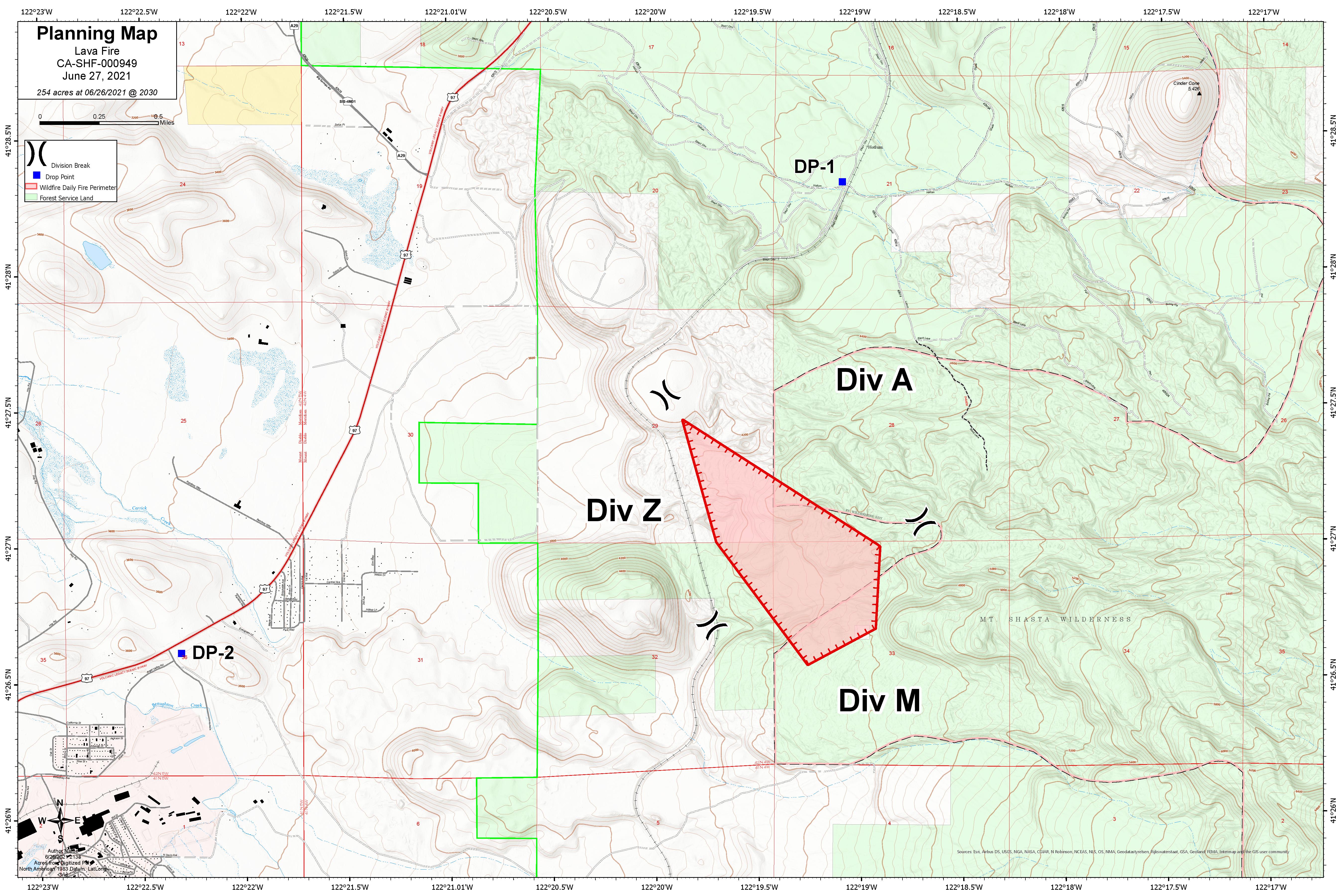
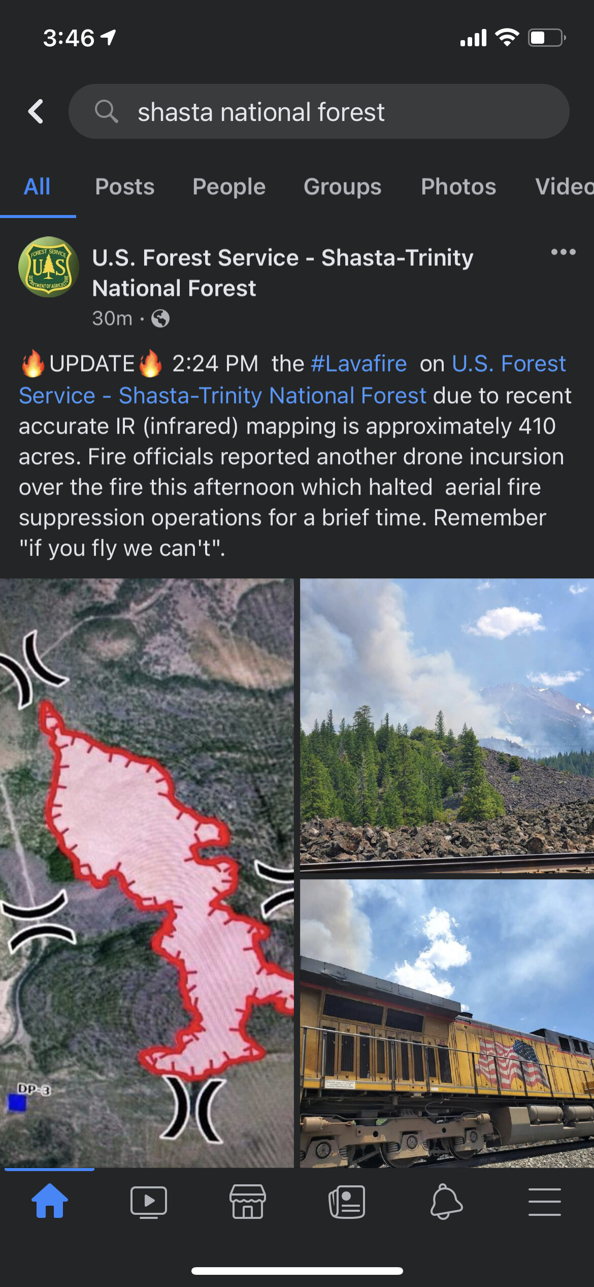
Map shows 254 acres as of 2030 last night. North Ops has it at 220 acres and 25% contained this morning. Probably both “ball park” numbers.
4 Likes
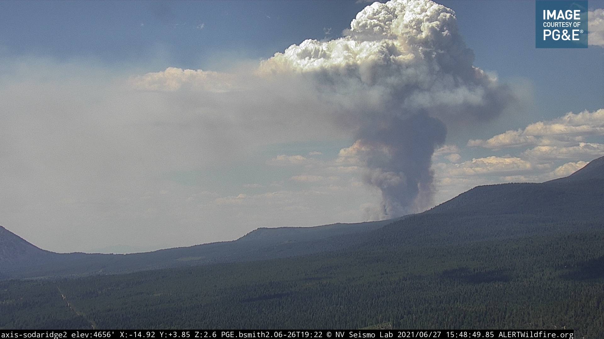
The 12 hour cam loop really shows the wind shift at sunrise.
4 Likes
Off it goes…
5 Likes
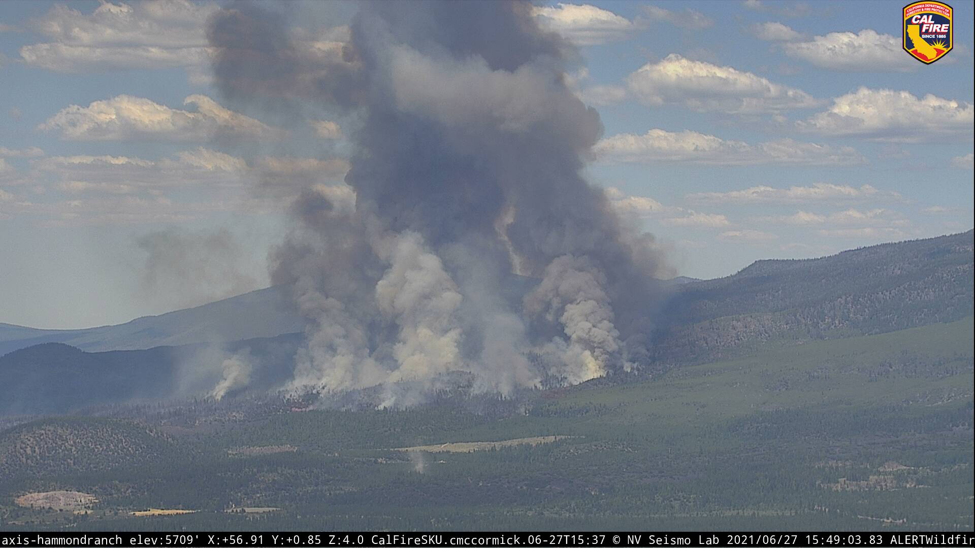
Two hot spots influencing each other and pulling each other together. Impressive behavior in the last 30 minutes… She gone…
6 Likes
http://www.alertwildfire.org/shastamodoc/index.html?camera=Axis-HammondRanch&v=fd40729
Another view… If you watch the time lapse you can really see the two spots influencing each other. Very impressive.
3 Likes
All AT released from the fire at this time
4 Likes
I heard that…I also heard some discussion about wilderness area…is that why they released the tankers?
3 Likes
I suspect they released the tankers because of turbulence.
Mt Shasta is well known for turbulence.
3 Likes
Sounds like it is due to the air turbulence as opposed to the Wilderness Area encroachment, from the AA traffic
4 Likes
They said they were releasing the fixed wing because they were not effective enough with the conditions they were experiencing. They did have authorization to drop in the wilderness.
8 Likes
That was about 30 minute or more prior to the airshow being put on hold, and the radio traffic indicated it ended up actually being much closer to Weed than the fire.
2 Likes
Tankers back to the fire.
6 Likes
2 posts were split to a new topic: CA-HUU-Marshall??
NWS Medford has issued a Red Flag
Warning…which is in effect from 1 PM to 9 PM PDT Monday.
- Impacts: Strong, gusty wind with low relative humidity and high
fire danger will likely contribute to a significant spread of new
and existing fires.
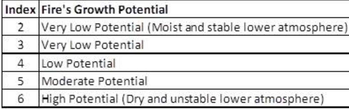
A Haines Index of 6 is forecast for the site of the Lava Fire.
-
Affected area:
In Northern CA…Fire Weather Zones 280 and 281, specifically,
the Scott and Shasta Valleys. -
Wind: South 10 to 20 mph with gusts up to 35 mph.
-
Humidity: As low as 8 percent.
-
Haines Index: 6
4 Likes