AA is advising fire is going to make a hard push North.
Division A is pushing folks back down the line.
2 Likes
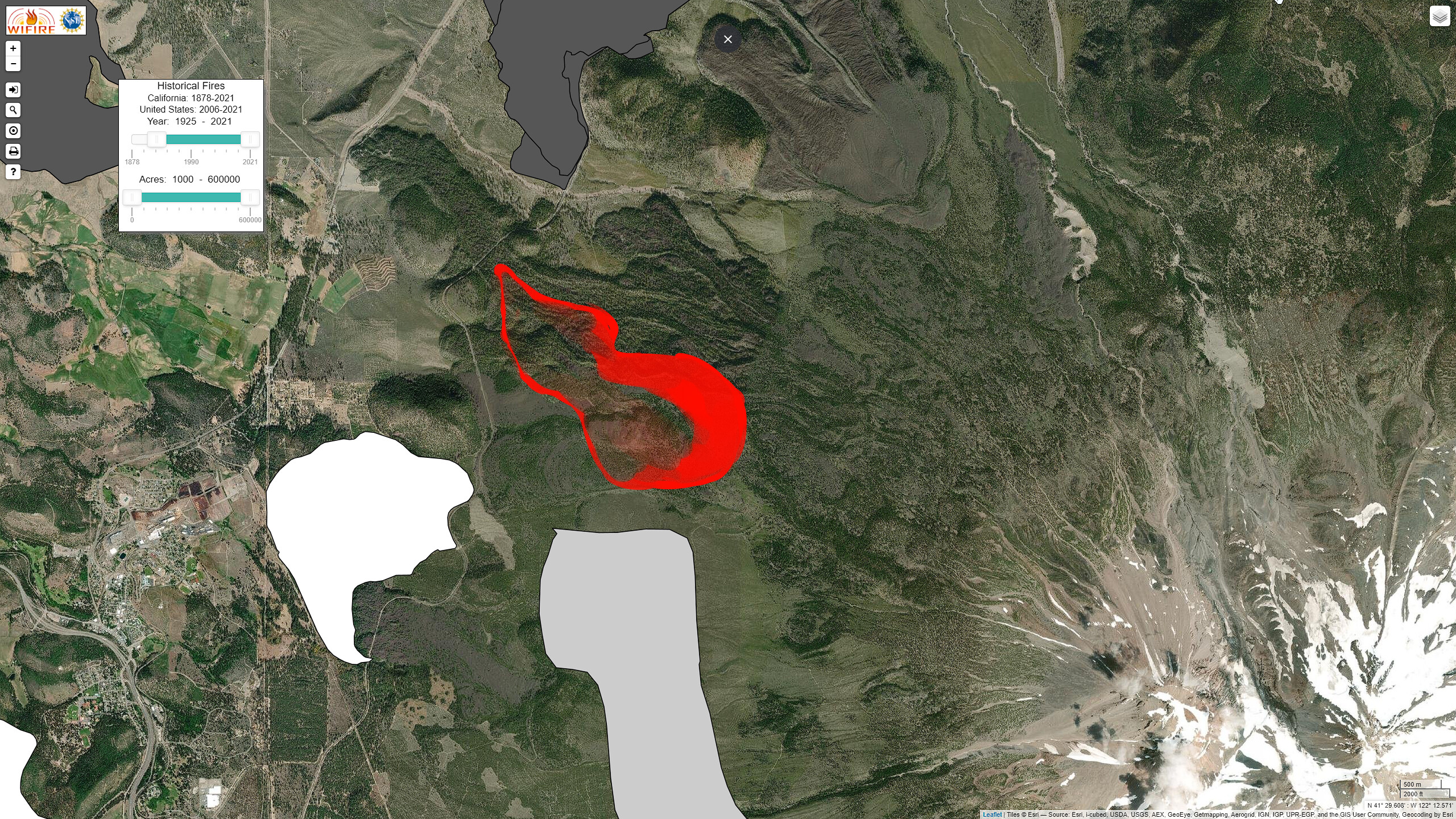
I can say with a fair amount of certainty this will be a rather long extended-attack incident. This area has not seen significant fire activity since at least the 1920’s, we have short range spotting and crowning runs-- and now a Red Flag Warning for tomorrow? Yeah, this may very likely be the first major fire of the season.
4 Likes
T912 has made its way up from the cool southern California beaches and is approaching the FTA.
5 Likes
Fire has switched directions and is now burning well.
3 Likes
Weed cam:
http://www.alertwildfire.org/shastamodoc/index.html?camera=Axis-Weed&v=fd40729
Soda Ridge 2:
http://www.alertwildfire.org/shastamodoc/index.html?camera=Axis-SodaRidge2&v=fd40729
1 Like
Read it is 710 acres and 25% contained
2 Likes
ventusky shows 12 mph gust in area
1 Like
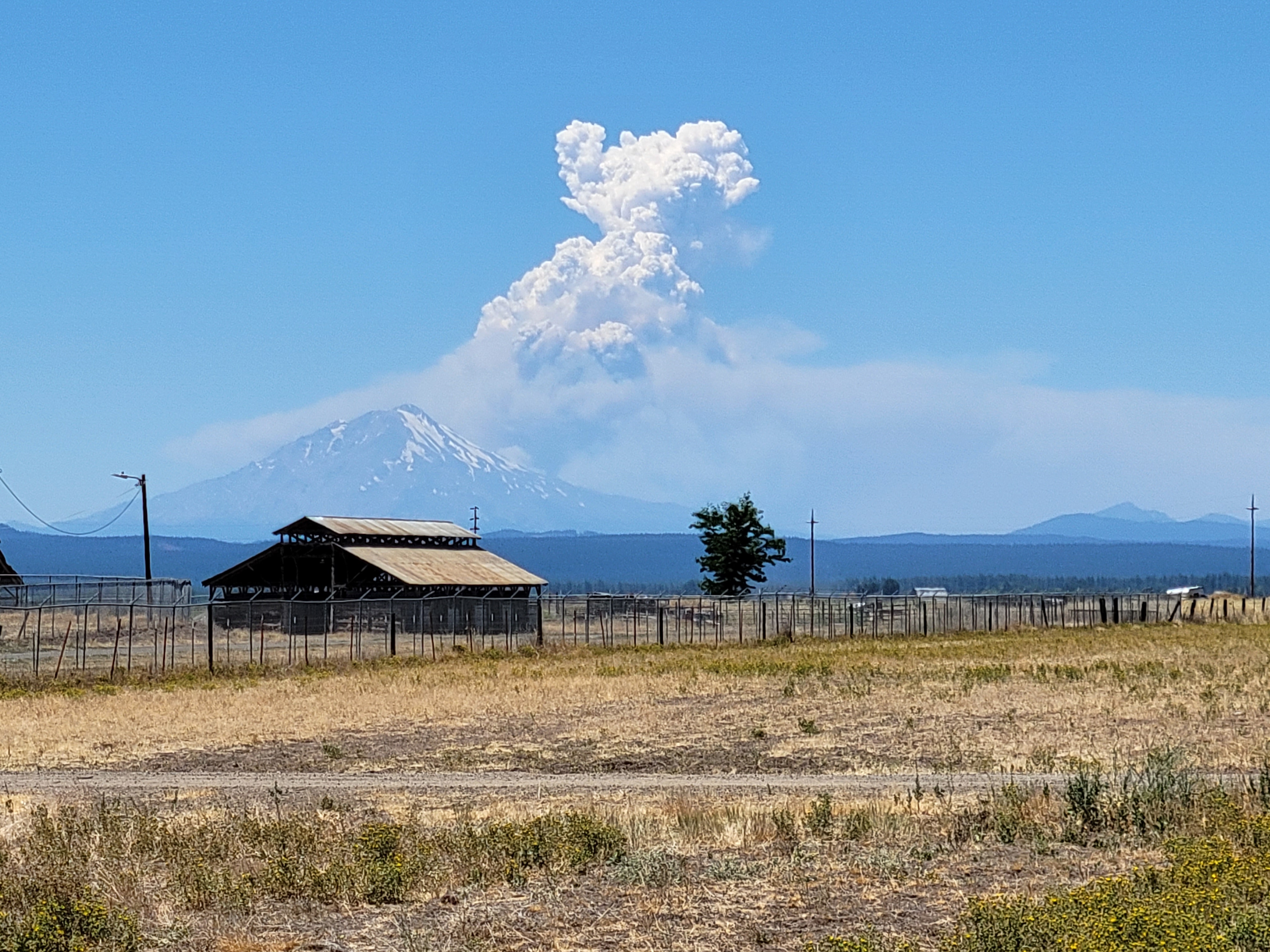
Impressive wind shift over the last 15 minutes on the Shastina cam. You can see the column shift as the mountain becomes shaded.
1 Like
looks like the wind may be shifting into a different direction again. From the Shastina Web Cam it looks like it is getting a westerly push on it now.
Looks like some spots burning on the north side, but it does look like the wind shifted… again…
2 Likes
Last night’s IR has it at 1446 acres. From the cameras, it looks like it continued to burn actively and chew through ground all night.

7 Likes
Red Flag Warning over the fire area from 8 am to 9 pm today, Haines of 6. Forecast winds from the south 10-20 with gusts to 35.
5 Likes
WX stations for the area and 0845 conditions
- UPRR MP349 - right on fire perimeter, or inside the perimeter now. 77F SSW3G9
- APRS D6273 - personal WX station on northern end of Lake Shastina, 80F SSW1G3
- RAWS Bolam - just northeast of incident, near Military Pass Rd at the tracks, good indicator of winds wrapping around from the east/downslope. 85F ENE7G16
- PacificCorp North Weed - on Hoy Road, today’s left flank if this thing moves. 78F 43RH Calm
- RAWS Weed Airport - more exposed station west of incident. 86F 32RH E3G6
6 Likes
Bolam raws @ 1000 hours. 16%rh 92 degrees and 22mph gusts. Not good. Have a feeling it’s going to get pretty western out there today.
7 Likes
Evacuation orders going into place.
North side of Hoy Road, North along Highway 97 to County Road A-12, Communities of Lake Shastina and Juniper Valley off Big Springs Road From Highway 97 to McDonald lane on both east and west sides of Big Springs Road.
2 Likes
One of the Strike teams is pulling units back to a TRA to reassess. Looks like it making a hard run right now.
1 Like
Talking about a 50 acre spot, not sure where at.
They are attempting to hold the fire at highway 97.
3 Likes
10 Likes
Significant spotting issues of the fire on the northern side, pulling some crews off the line to safer areas temporarily. Hwy 97 now closed by CHP from Hwy 265.
2 Likes
