http://www.alertwildfire.org/shastamodoc/index.html?camera=Axis-RainbowLake&v=fd40730
Evacuation Warning from TCSO, posted on local media.
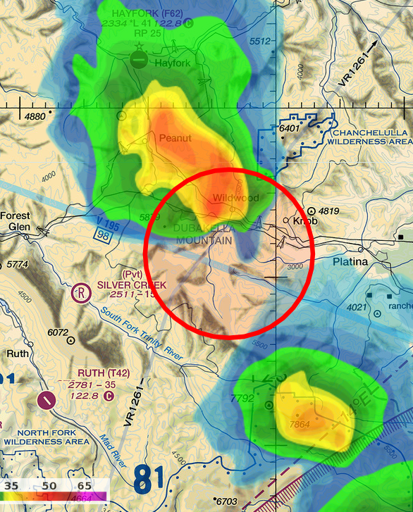
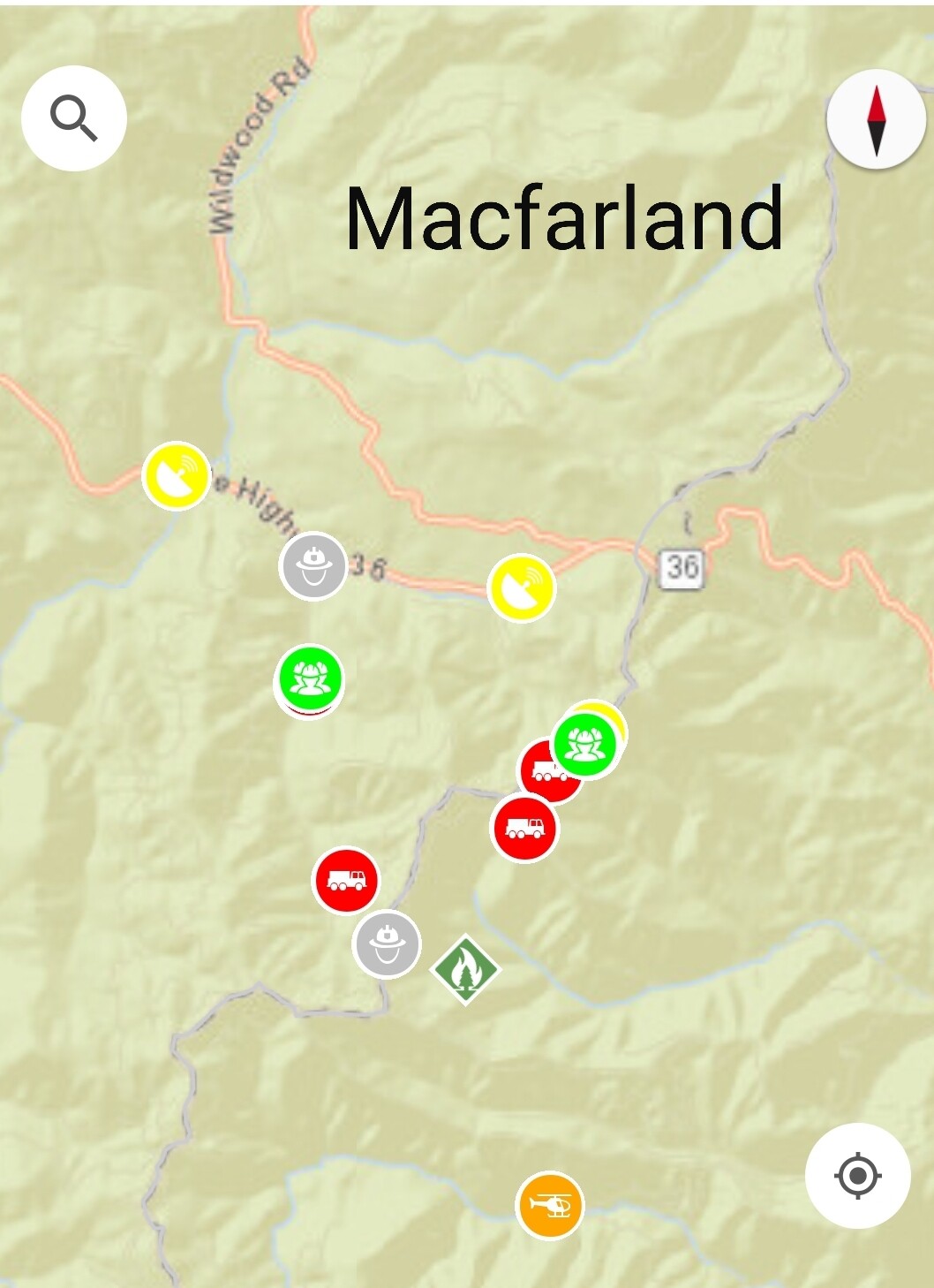
Areas impacted: SR 36, Wildwood, and the south end of DeerLick Springs Road near SR 36.
The Trinity County Sheriff’s Office is issuing an Evacuation Warning to the residents of Wildwood, and the south end of Deer Lick Springs Road, ob both sides of SR 36 due to a wildfire on McFarlin Ridge.
Area residents and visitors in the above listed areas if elderly, have medical issues, small children, or livestock and pets, need to be prepared to leave the area in case of increased fire activity.
This is an Evacuation Warning at this time.
1 Like
Deleted post, thanks for correction, NorcalScan.
2 Likes
Too far south Pyro. It’s at the very top of middle fork cottonwood creek. VIIRS has it spot on.
If it was that far south it’d be in Beegum drainage and that wouldn’t be good with historical fires, terrain alignment, and Platina.
2 Likes
300 acres now with a spot over McFarland Ridge where the retardant line has been
4 Likes
The cross with McCabe ridge and hayfork puts it right were NorCal said.
1 Like
AA: fire most active on the north & southern ends, northern end will be the priority due to values @ risk on that side. Multiple spot fires outside the road system & one across the 41 Rd.
2 Likes
600-650 acres per AA around 14:40.
4 Likes
Looks like a fair amount of rain activity
http://www.alertwildfire.org/shastamodoc/index.html?camera=Axis-Hayfork2&v=fd40730
Two large cells just to the north and south of the fire. HEavy rain and hail coming out and about to hit the incident, hold all fixed wing at base. Rotor looking for big leaves to park under…
6 Likes
Lightning mapping is showing some ground strikes east and south of the area. We are getting a good buildup in South Western Siskiyou CO right now.
4 Likes
Not a whole lot of moisture I’m afraid. Just a lot of rumbling. Unfortunately I see clear skies looking over towards that way. From Hayfork.
2 Likes
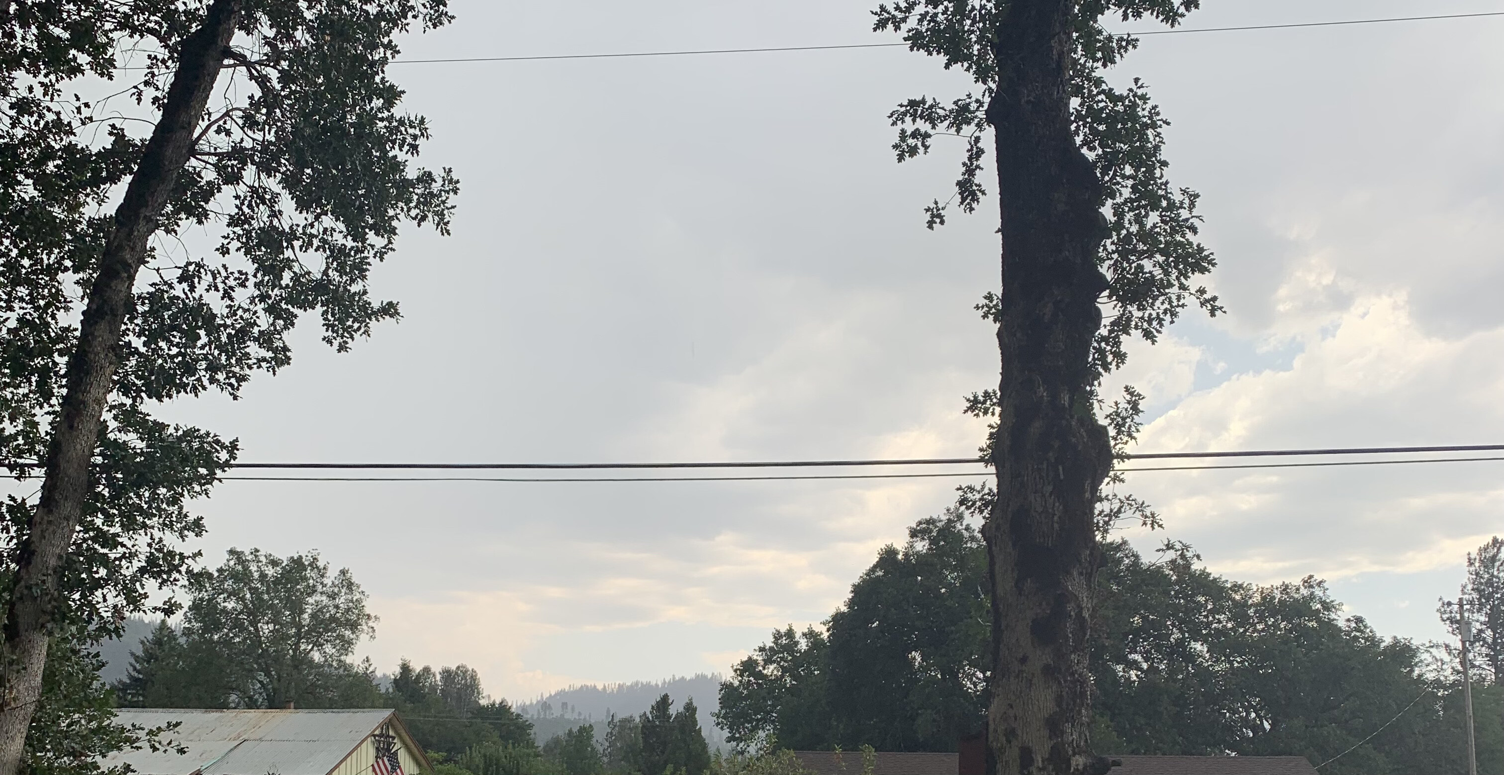
Hayfork cams showing some decent downpours. Hopefully it’s hitting the ground
1 Like
900 acres per IC, starting all the assigned tankers back to the incident.
6 Likes
IC was placing a significant order for overhead and had some orders earlier he kept checking in on and not getting results. Sounds like CalFire is about to get a decent order as well and if this isn’t unified yet, it feels like there’s some good unified-esque communication happening between SHF/SHU on this one. SHU started Trinity County LCA as well with a lot of new starts north of this, so resources are thinning out pretty quick.
4 Likes
I’ve put the scancal live scanner on McFarland priority
Pri1 - McFar A/G
Pri2 - Shasta Forest
(pri 3-6 is TGU, SHU, Natl FF and AirGuard)
normal scan has McFar Air Tactics, ground tacs, Southfork District net, and IA freqs for the rest of the lightning mess.
You’ll need an mp3 streamer for this old-school stream. Paste the URL of the stream into “Network Stream” of your favored MP3 streaming app like iTunes/WinAmp on desktop or VLC app on mobile.
1900: T102, MAFFS 2, MAFFS3, all three VLATS all released for the evening. S2’s being diverted to new SHU starts, one in Del Loma it sounds like. (edit, T911, 914 both already loaded KMCC before the release so had to launch and make one more drop)
9 Likes
Per tonight’s 209 a Type 2 IMT has been ordered.
2 Likes
1930: The wild guess from AA was 1300 acres. Placed order for 3 VLAT, 4 LAT and an ASM for tomorrow.
My last update for probably the evening.
5 Likes