Team 11 Fogle on order
4 Likes
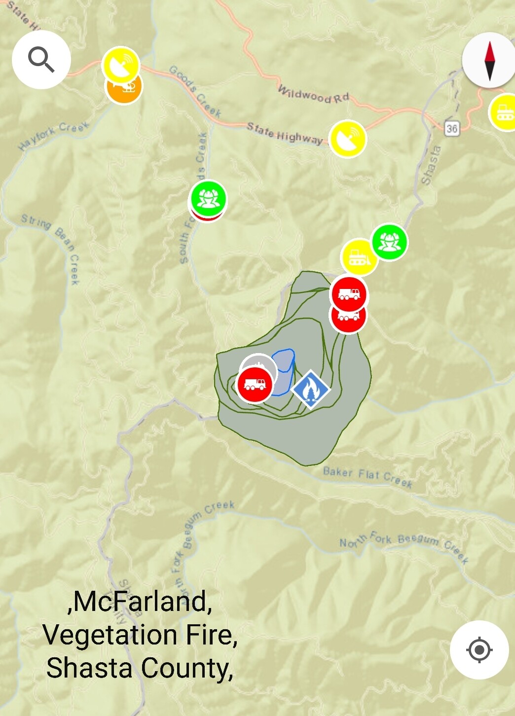
IC reporting 1500 acres - Div A (north) most active.
Resource Order for 10 Dozers, 5 Dozer Bosses, and 4 (?) Felling Bosses
4 Likes
1600 acres this morning. Multiple spots on the south side towards Beegum drainage (but not in it yet) in Sec 30 and 29.
2 Likes
Hearing that 3CH made an “unscheduled landing”
No damage to the ship and pilots are fine.
A testament to the skill and steel nerves of the pilots flying these fires.
4 Likes
North Ops is showing Californian Team 11 (Fogle) will be taking this one however California Team 14 has been on 2 hour for over a week. Any idea why the change?
That is because as of yesterday morning Team 11 came back up on the board for 2hr call (placing them back on normal team rotation). Team 14 is now back on 2hr call.
4 Likes
10-4 I copy
2 Likes
XYO 4278C assigned
DVS G33
YDF B225
PAY B222
WOF B7
WDL B3
1 Like
Here is a link to the IAP for today. You can see most of what is there.
2 Likes
Calling for Evacs in Wildwood and closure of Hwy 36 between Hwy 3 & Wildwood Rd
6 Likes
The fire is pushing toward Hwy 36. AA can’t get Tankers under the column. It looks pretty active with a decent column right now. Hwy 3 is closed at 36 and units are moving into wildwood canyon for structure defense.
3 Likes
Wildwood evacuation just about complete. About to cut power to the area. Fire making crown runs and making crews hot foot it out of some areas.
9 Likes
10 Likes
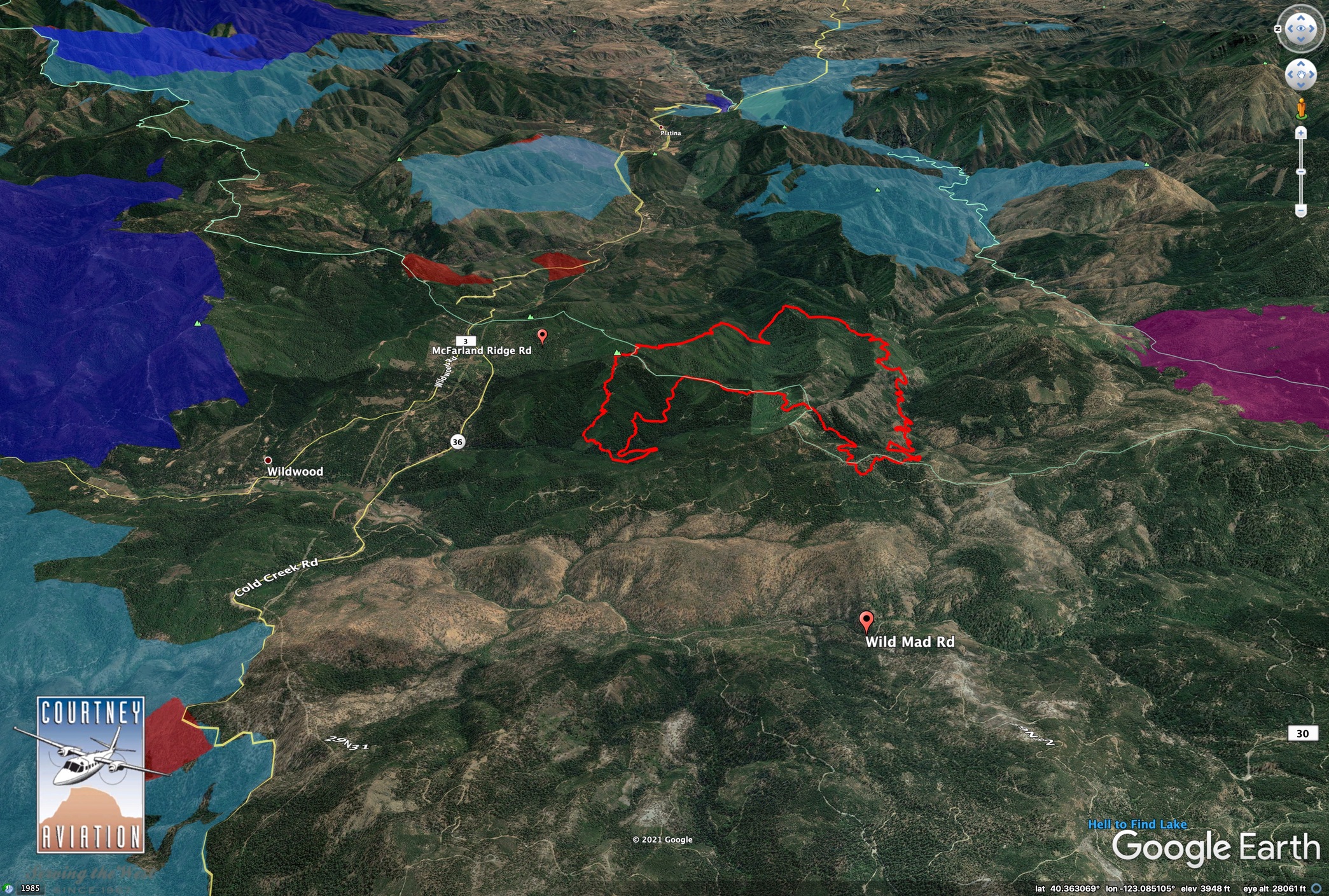
1800: Fire has pushed west and several spot fires have gotten established for a total of 130-200 acres on the west side of Wild Mad Road (the “30 road”)
Earlier today confirmed the south has gotten into the bottom of Sec 25, the very top of the North Fork Beegum Creek. That entire gorge west to east is a watch out for terrain aligned winds as the coastal influence breaths with the valley.
Also see @pyrogeography post in the lightning thread with the mapping. This thing has a lot of room to do what it wants on its terms.
5 Likes
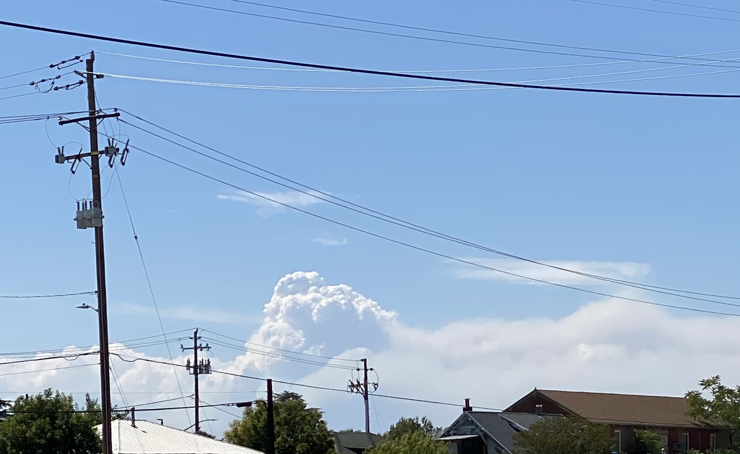
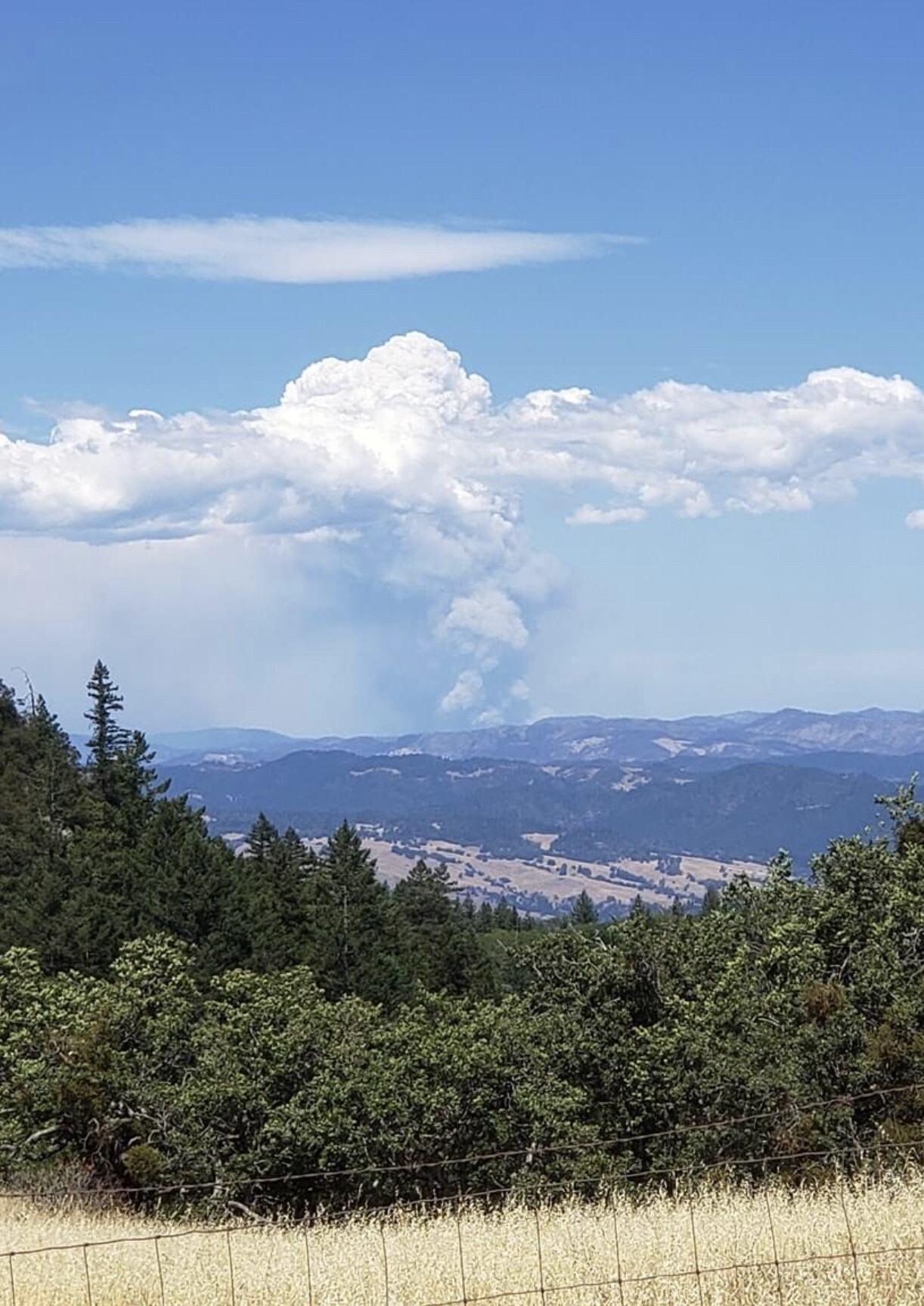
Last night’s IR with the Wild Mad Road for reference.
2020 August Complex in purple, 2015 fires in dark blue, 2008 fires are light blue.
6 Likes
With the IR map for reference, i would say this new intel means the fire has probably doubled(ish) in size since last nights flight?
1 Like
Thanks Chris for the picture. Worked with him the last two years on various fires. JB Fire Support.
2 Likes