The fire is now spotting 1 mile ahead. IC will take any closest resource for structure protection. Not many type 3’s available in the area.
10 Likes
Another seasoned USFS FF (Div. quals) I know said the same thing. Like the Delta.
1 Like
2050hrs: 2,500 acres still progressing to the north, resources doing structure defense in the Gregory Creek area, slow progress on line construction on the southern side of the fire.
3 Likes
Caltrans cams:
https://cwwp2.dot.ca.gov/vm/loc/d2/sacramentohill.htm
https://cwwp2.dot.ca.gov/vm/loc/d2/sugarloaf.htm
https://cwwp2.dot.ca.gov/vm/loc/d2/antlersbridge.htm
https://cwwp2.dot.ca.gov/vm/loc/d2/vollmers.htm
https://cwwp2.dot.ca.gov/vm/loc/d2/saltcreek.htm
5 Likes
5 Likes
A spot is across the Sacramento arm in the area of the Antlers boat ramp with extreme ember cast and expect further spots across
3 Likes
Antlers bridge cal trans cam went dead… 
3 Likes
They were building up large orders of immediate need resources, with the closest being out of Shasta County to head into Lakehead should this occur. They are now starting the Shasta County resources…
WX PGE Cascade in Lakehead shows favorable winds so far… SSW7G16
but upper level WX above Lakehead on Sugarloaf explains the ember cast…dang it.
WX Sugarloaf RAWS SSE6G13
WX Sugarloaf PGE ESE7G13
3 Likes
2 posts were merged into an existing topic: CA-SHF-Salt ???
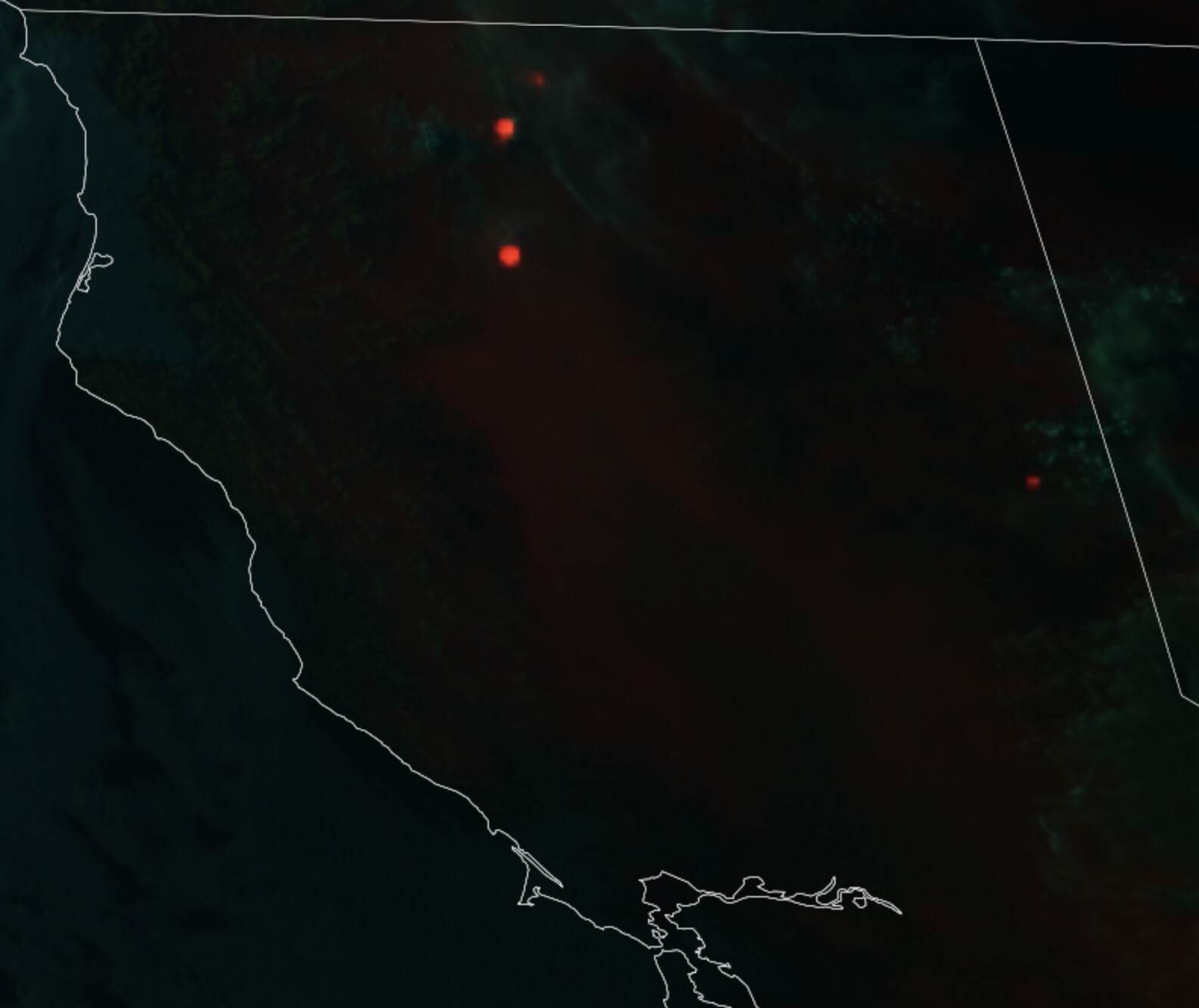
Getting the heat signatures now dropped onto caltopo. Will need to zoom and scroll to find all 3.
https://caltopo.com/map.html#ll=41.21115,-122.15149&z=10&b=t&o=f16a%2Cr2&n=1,0.25&a=fire%2Cmodis_mpg
Wind shift with a Spot on the west side of i5, crews still making access to the spot
4 Likes
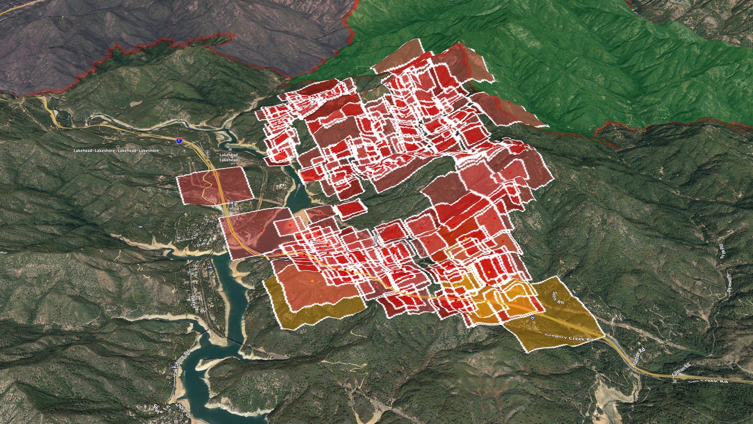
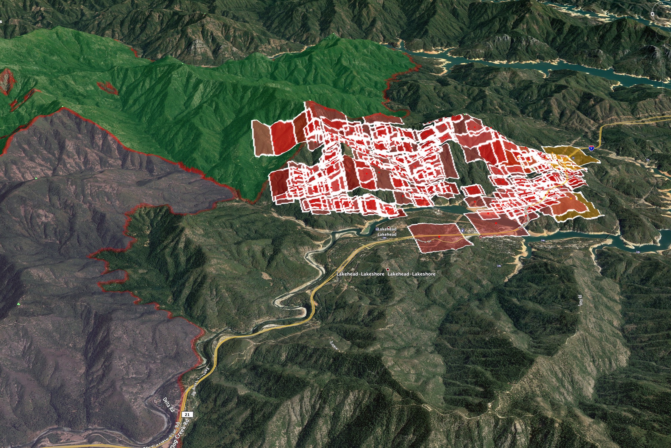
Last night’s MODIS and VIIRS combined, with 2018 Hirz (green) and 2018 Delta (blue) footprints. Both burns have plenty of dead fuel bed and stands, slash, new brush etc.
Looking north, slightly east
Looking ESE, over Sugarloaf Mtn (radio site at bottom center of pic)
5 Likes
4 Likes
Northbound and southbound 5 now closed due to salt.
7 Likes
Per CHP CAD both Northbound and Southbound I5 reopened.
6 Likes
Nice timelapse of the Salt from yesterday: https://fb.watch/6tE0gME8vg/
3 Likes
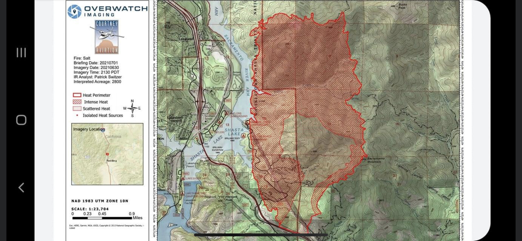
2,800 Acres, 0% Contained, Current Aircraft, AA, 1 Lead, T-102, T-132, T-104, Copter 191. This afternoon winds should be very similar to yesterday, it is expected that activity will pick up later in the day.
4 Likes
Sugarloaf cam is back.
2 Likes
Winds have kicked up considerably in the past hour out of the south, which has also cleared the Sugarloaf camera view.
WX stations also concur
WX PGE Cascade (Lakehead proper) 91F 28RH S9G14
WX PGE Sugarloaf (above Lakehead and higher than fire) went from casual east to heavier ESE.
WX PGE Whiskeytown (which is really Gray Rocks at the bottom of the Lake,) is a good indicator of the influence coming off the valley floor and into the McCloud and Sacramento Arms of the lake.
2 Likes