State ID: CA
3 letter designator: SHF
Fire name: Salt
Location: Coal Creek Road x Gilman Road; Lakehead, CA
Reported acres: 20
Rate of spread: rapid
Report on Conditions: 5 additional engines requested. Running uphill in timber. Requesting LEO for evacuations.
Structure threat: yes Shasta Sheriff Evac info
Resources: SHF- CR-CR5 D-5 E-343 E-351 E-353 E-361 E-372 E-9911FST PT-61 WT-16 WT-66
AA240, T94, T95, T132, T163, T912
Hazards: high tension powerlines
Weather: Sugarloaf RAWS
Sugarloaf PGE
Radio channels: TAC NIFTY TAC-2
Scanner link: Cal Fire - SHU Live Audio Feed
Siskiyou and Northern Shasta Counties Fire Live Audio Feed most radio traffic here
Webcam link: Sugarloaf Shasta 2
Shasta Lake 1
Round Mountain- Shasta
Agency Website: Inciweb
Per tankers on scene, couple spots up on the ridge, left flank will be priority, right flank has the wind in favor, multiple structure threat ahead of the fire.
VLAT 912 enroute.
Based on some good intel, crude sketch of fire location and tanker drop effort (as of 1440) to protect the solo egress route of the Gregory Creek subdivision, and tying in power line clearance to the freeway. Don’t count on updates to the map much past this…
Diverting 4 large air tankers off the Lava Fire to this incident, priority is structure protection at the head but the column is laying low and might not get tankers under it.
Diverting T910 from the Lava to the Salt
Anyone have a more active radio frequency?
Sugarloaf Cam still showing traffic on 5 north and south on the Sac Bridge at Lake Head

Fire is 75 acres, AA requesting 4 more Copters.
This fire has several small spots down its left flank.
Standard SHF IA freqs.
171.575 SHF Forest
A/G 43 167.600
Air Tactics 64 168.6875
Spotting about 1/4 mile ahead of the fire. Retardant tied into the freeway along the right flank. Left flank chewing through a bit between powerline and freeway. Fire path is generally right down the powerline corridor and slightly right (more northerly direction)
AA reports the fire has spotted across the Gregory Creek drainage. An attempt was being made with Copters to hold the fire along the large Kv power line right of way. Strong wind is bending the column and pushing the fire to the North. It looks like she is making a push up hill in alignment with the wind.
The fire is 250 plus acres, attempting to get Dozers to open up the old Hirz Fire control lines.
IC ordering 5 additional WT and 4 more dozers
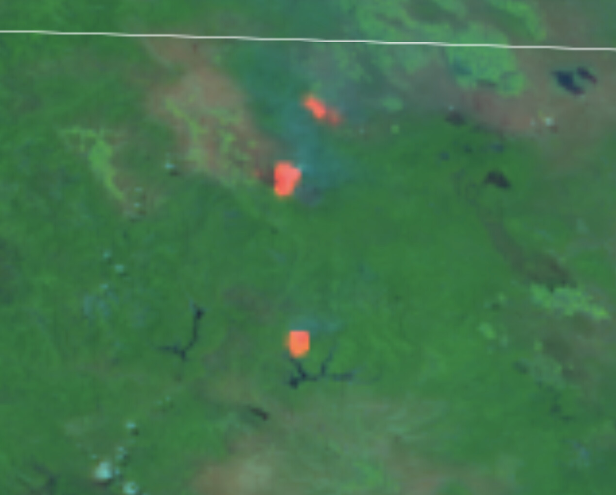
Updated the crude sketch map based on pretty strong intel. I don’t have the spot on it, but definitely have a good spot established in the sub division, and another good spot well out ahead. AA reporting another 1/2mile out. The right flank is outrunning the retardant lines.
AA bumped the T1 rotor order to six, and four T2 rotor.
Scoopers ordered as well
S261 and 263 sitting at Chico, came in on Monday…