
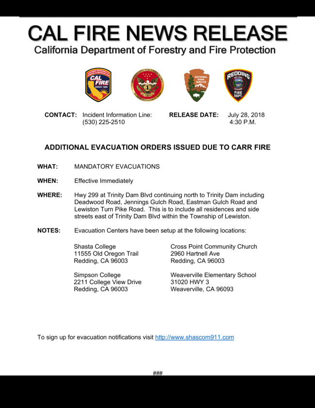
New evacuations in Lewiston, east of Trinity Dam Boulevard:
Folks please keep this forum to incident information. NorCalscan is doing a fantastic job with communicating. Questions and conversations are for the CARR??? forum.
9 Likes
For the Lewiston evacs, not to diminish them because we need to respect and act on every one of these orders, they pulled the trigger because fire made it to a certain point where they earlier agreed upon to pull it. However conditions on the ridge around County Line Rd, at the moment, sound pretty favorable with the winds out of the west.
With that, fire had made it up into the old Highland Fire from a few weeks ago. This is up Highland RIdge Road area. With the same northwesterly winds now, fire is pushing south back toward Trinity Mtn Road in Div H, looking for a strike team from Div M to come down and help with structure protection.
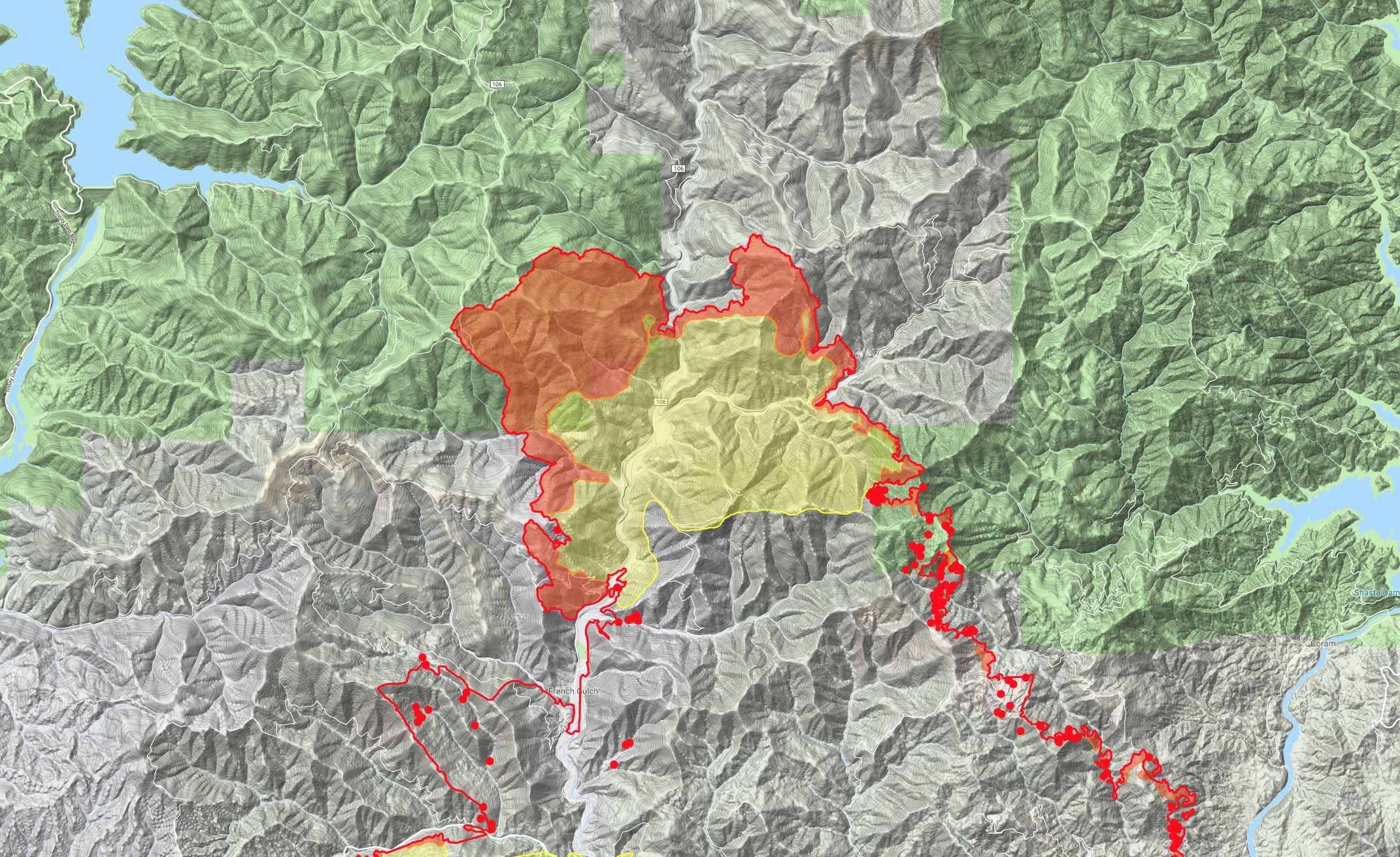
edit: to clarify location - French Gulch area and north French Gulch.
3 Likes
RICC did tone out a fire near Pine Cove (by Lewiston). Wildweb put it at 1/4 acre. 40 47.748, -122 46.146
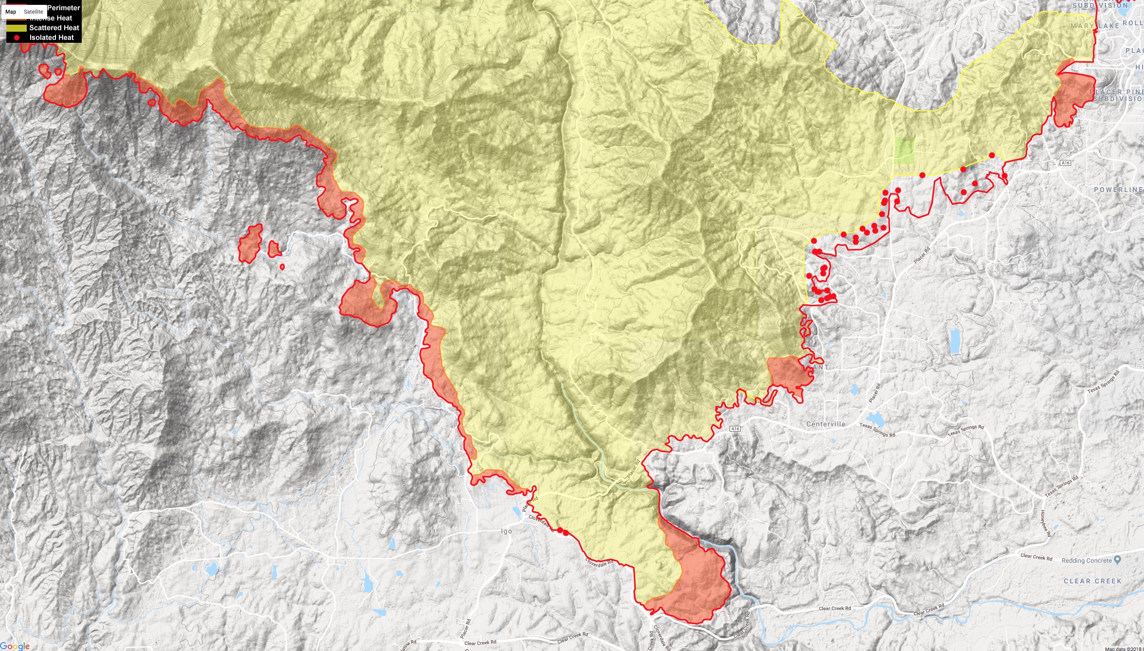
Getting intel from boots on the ground in Igo, earlier today the fire was hung up in the east side of Zogg Mine Road area. Trying to pick it up. Now sounds like it slopped over Zogg Mine Rd and trying to pick it up with some firing ops down toward South Fork Road.
addition from boots on ground in Igo area: Small piece backing into Clear Creek off of diggins road. Trying to get check line to Clear Creek before dark. The Placer corridor looking good.
6 Likes
2200 update: from boots on the ground in Igo (one of our own), "Cloverdale Rd blacklined mostly from Placer Rd east to the SHU-Creek fire black from late June. The piece backing into the clear creek drainage is lined, and a contingency (is being, or has been) built from the SHU-Creek black on up along Diggins Way. "
The SHU-Creek black is one of the many recent scars this will get hung up in and stop/slow it down if it tries to make its way into Happy Valley area. The snapshot below is of the last Ops map for that section of the Creek Fire from June 28th.
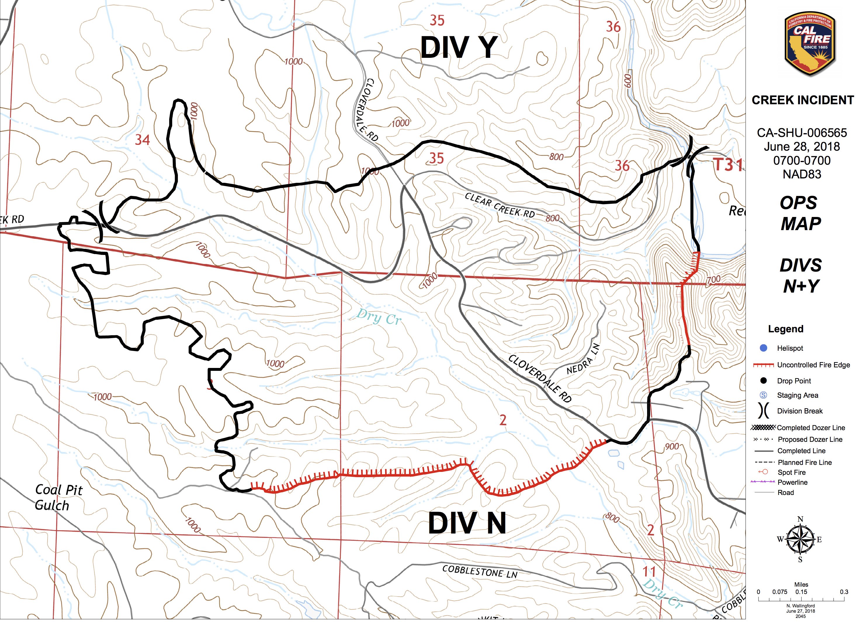
9 Likes
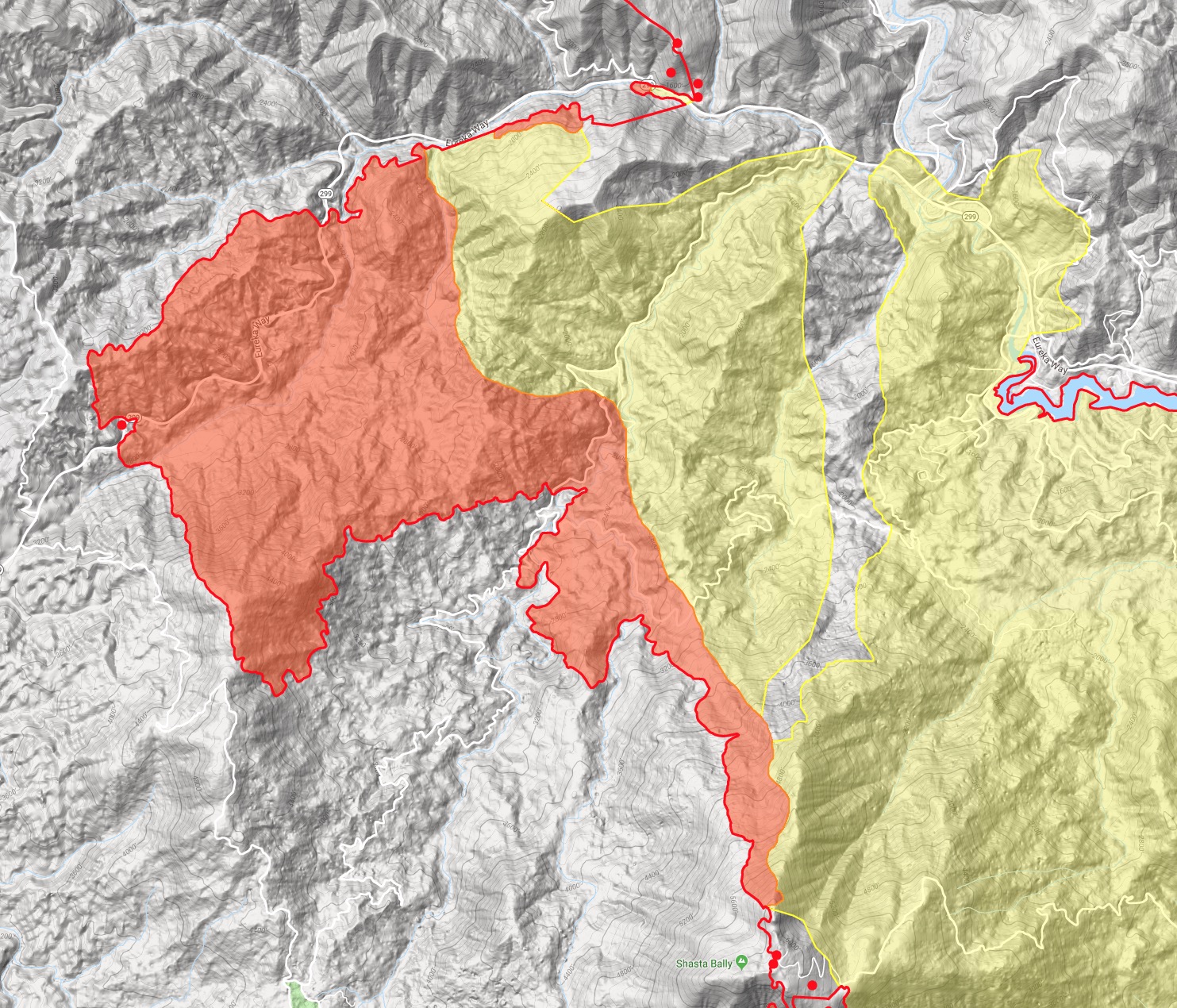
2245: not much large intel to share for this last post. Tiny bits here and there. They are doing a lot of iron work on County Line Road up there in Div C, not sure if north or south of 299, I believe north to Hoadley Peak. I believe I heard a FOBS being told to leave the County Line road south of 299 by way of back roads into Douglas City (up and over Bully Choop and then Indian Creek Rd) since the exit out to 299 was impacted. I think winds have been favorable for them to attempt the iron work on that ridge north of 299 at Buckhorn.
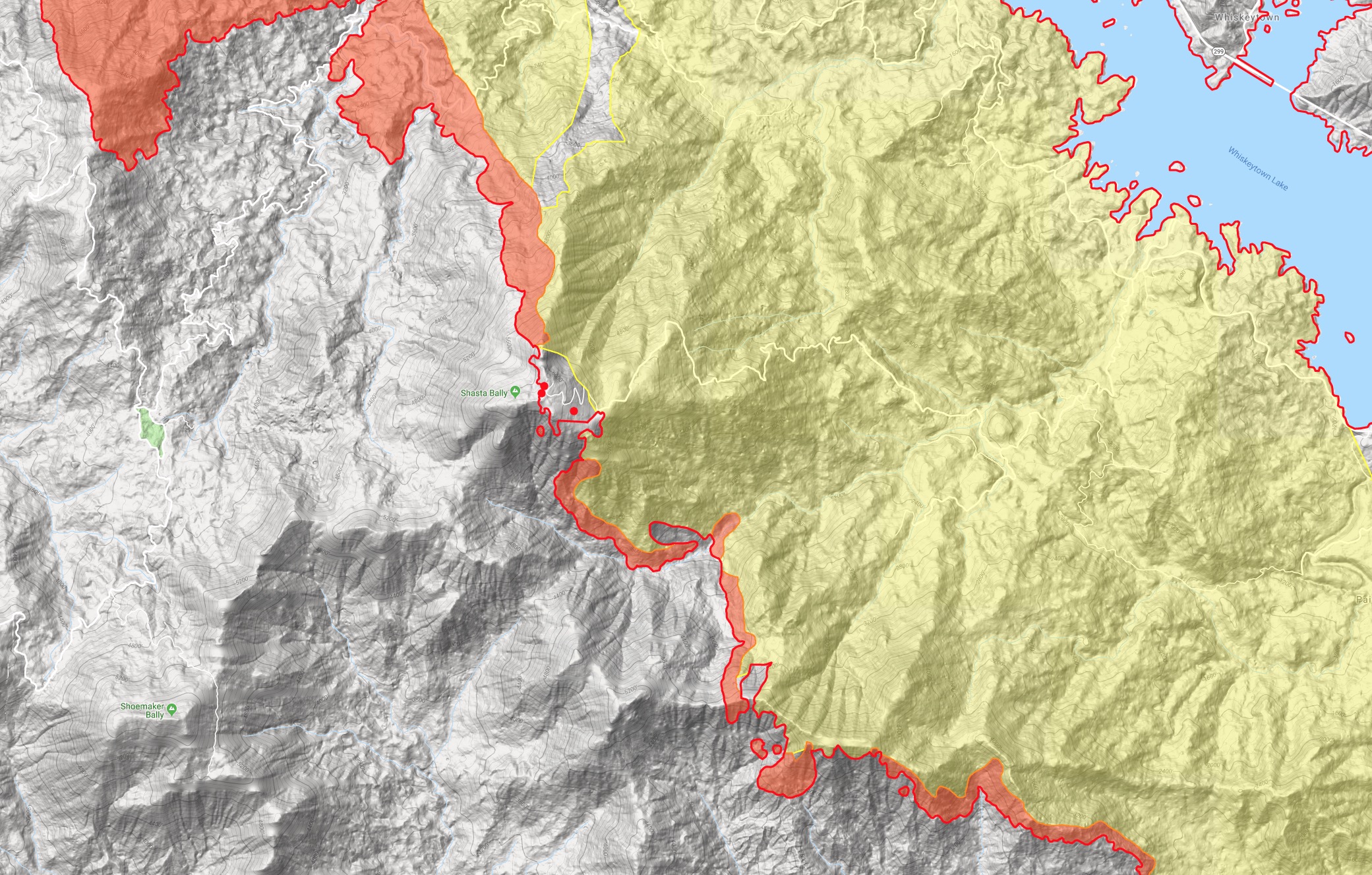
Have not heard much from Highland Ridge Rd situation outside French Gulch where they were doing structure protection in the community again from a finger of fire that wrapped back around in the winds. Even further north on Div H there is a pretty good run up to the County Line (well north of Hoadley Peak, on the trinity side it would be opposite Papoose and Little Papoose Creek area). Not sure what has made it to the top, slopped over or what, but I know it’s hot and active.
We saw the boots intel on Igo a few posts earlier. They got a couple T1 copters in this afternoon to pound out hot spots in the same place they were yesterday along and north of Placer in the Centerville area. Only fixed wing action they could get today was retardant around Hoadley Peak repeater site.
USFS IR platform just flew over a few minutes ago - went over LNF-Whaleback and now heading back home it looks like.
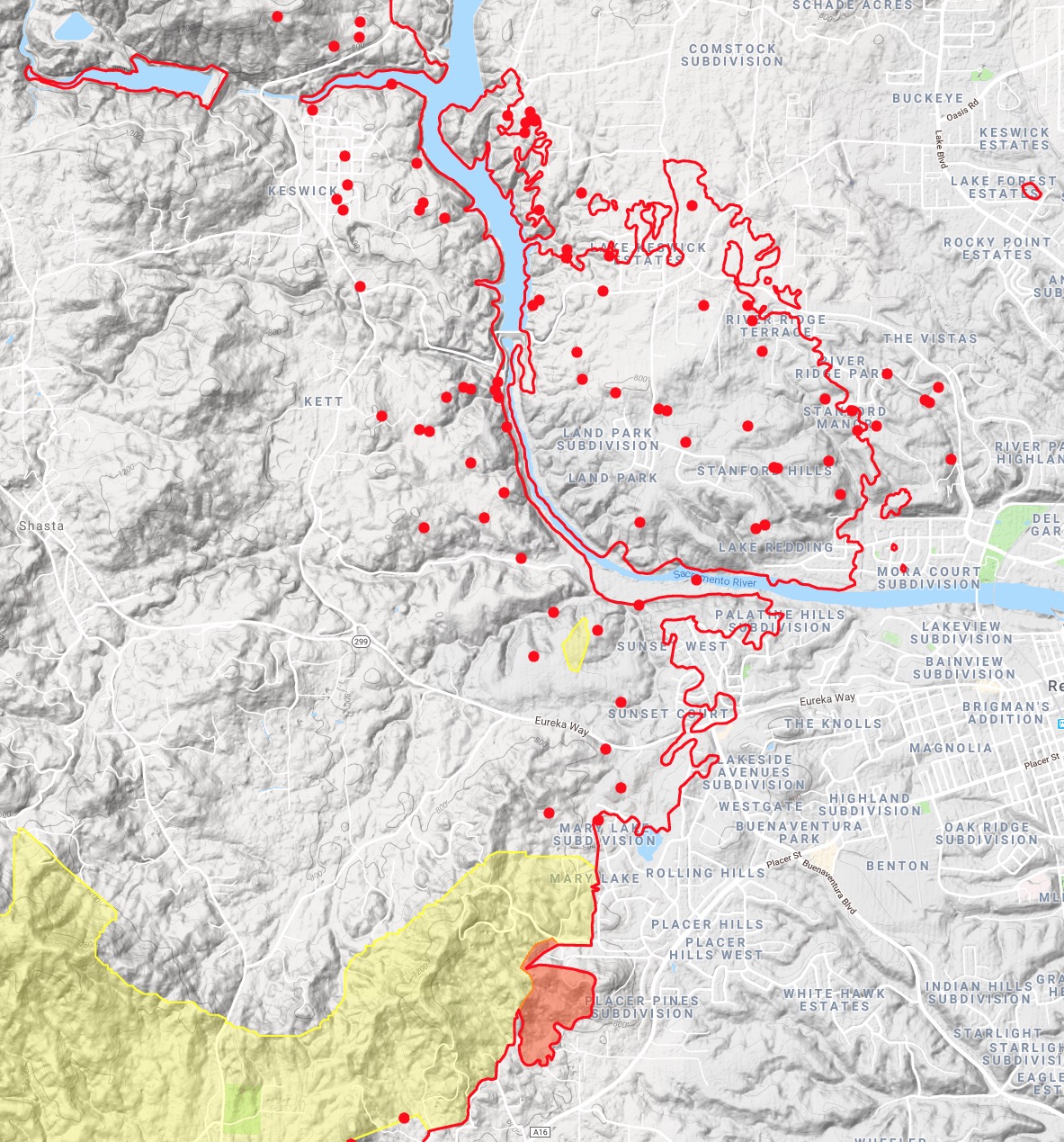
KRCR TV7 shows more and more live video of homes on the Redding side of the fire that have massive wind damage, uprooted trees etc. Reports of debris falling like rain all over town. It’ll be interesting to see what comes out from further studies of the WX that happened Thursday evening.
I’m talking too much, see ya in the morning.
18 Likes
Last night’s IR:
IRIN’s Log (good info here):
KMZ for Google Earth:
https://ftp.nifc.gov/public/incident_specific_data/calif_n/!CALFIRE/2018_Incidents/CA-SHU-007808_Carr/IR/20180729/20180729_Carr_IR.kmz
Today’s IAP:
Ops Map:
4 Likes
Additional evacuations in Trinity County last night, including all of Lewiston:
CHP posted some photos from last night a mile or two east of Buckhorn Summit:
https://t.co/pMXHzGibZI?amp=1
Wildfire Today posted a new article this morning:
Based on the IR interpretation,
At 2349 hrs:
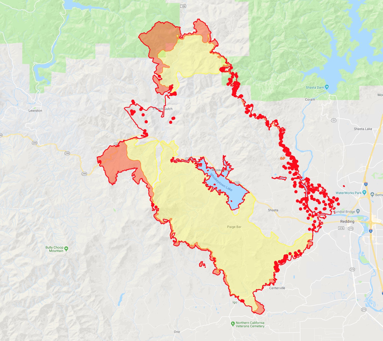
95,368 acres
Increase of size 14,462 acres
5 Likes
0900 Good morning. Definitely had a less eventful evening relative to earlier! Winds were much lighter on the valley side of the fire. Refreshing to wake up and not see double the growth again.
With the IR you can see where it challenged the County Line Road area in Div H/M, above Hoadley Peak in the Five Mile Gulch (opposite Papoose and Little Papoose on the Trinity Lake side), and in Div C below Buckhorn Summit around Buckhorn Bally. That would explain the resources south of 299 having to exit south and east into Douglas City last night. Not sure if they’ll try to catch the slopovers from the ridge, or build a bigger box into the Trinity side.
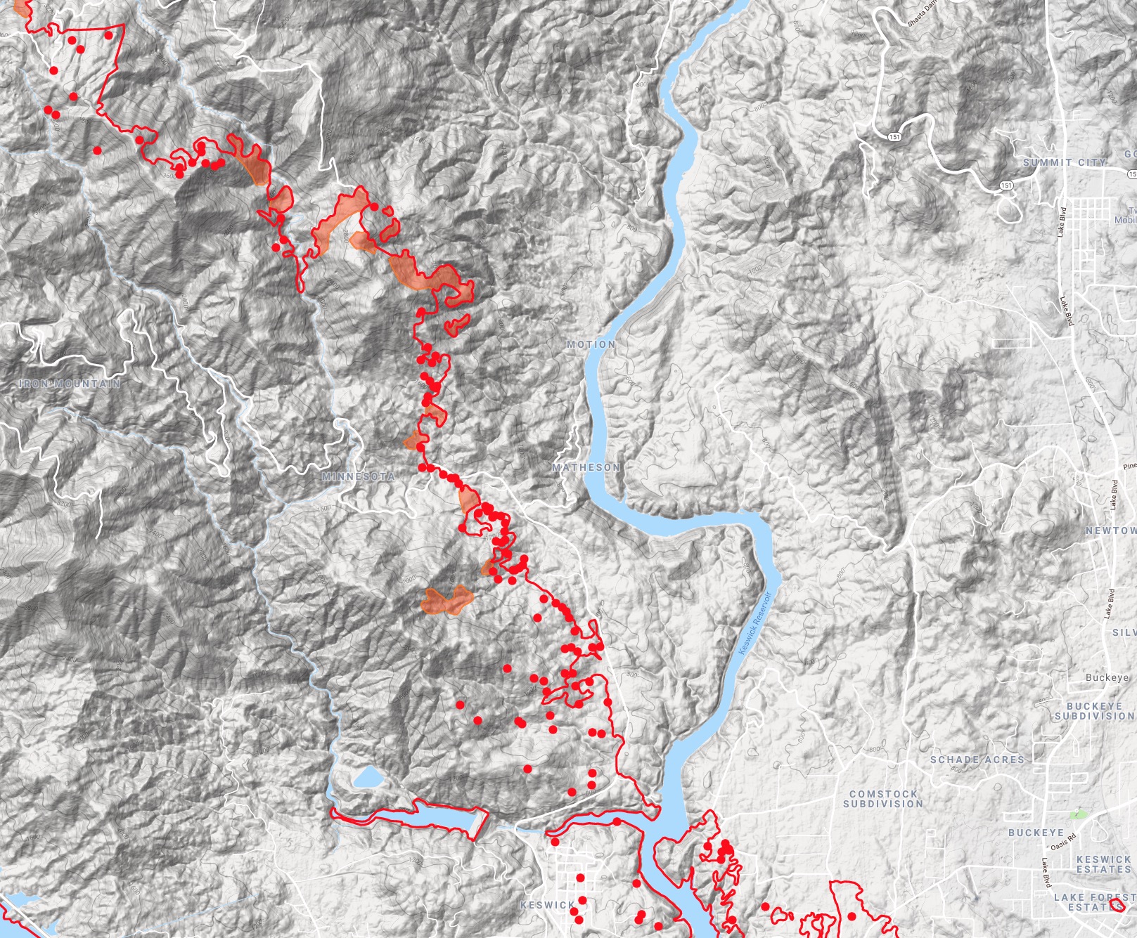
It’s also definitely marching up the Trinity Mtn Road/Clear Creek drainage, above Shirttail Peak towards their northern objective of Big Gulch. This end of the fire can become an interesting variable if they don’t catch it soon, causing problems well into next week.
Branch 1 looking real good across the south side. As our intel pointed out last night, the finger that made it down the clear creek east of Cloverdale ran into the black from last month’s Creek Fire, and they were able to get that lined with a contingency line up Diggins Rd. MODIS shows it cooling down around there. With the expected winds this evening this will still be an area of concern along Placer and Centerville area, but Happy Valley can definitely take a breather for a bit.
There is a lot of heat still hung up above Igo above Zogg Mine Road along a NW/SE line from South Fork Mtn to Petty Butte, and a couple spot fires that I’m not sure which side of the line it’s on. This will certainly be an area of concern for Igo and Ono, especially with the expected winds this evening. Keep an eye on that.
Air Attack 503 just launched at 0930 and Helco was up earlier but back on the ground. (UPDATE: Command primary will be Shasta Command 154.430. Live scanner updated appropriately. CMD2 and NIFC command are still in the scan as they transition over.) I’ll be off intel for the next 3-4 hours.
12 Likes
That previous post should not have been deleted. Directly tied to the fire and a valid point looking for more info. Seems a lot worse slides on here than that…
Sacramento Bee reporting a 6th fatality on this fire…
Has anyone else been able to open this link? I’m unable to
Reference to this mornings Map…
Which link specifically?
And we should be putting questions in the q and d thread.
1 Like
I was going to delete it but couldn’t… I’m trying to see this mornings OP map