CA-SHU-Carr (contained)

Hearing that it jumped 299 to the south side around Swasey but not confirmed. It is confirmed that members did structure protection at Cal Fire Station 58 at 299 and Iron Mountain Rd.

Sounds like it’s setting up like the Incident Managent 3 Class simulation.

1 Like

There is a 15acre spot fire on the south side of the lake, across from Grizzly Gulch, which is Oak Bottom Marina, and just east of Carr Powerhouse. This is highest priority now for aircraft. HelCo found an opening and is waiting at the Sac River for two heavies to guide them in through the smoke to this spot fire.

edit 1008: “made it to the spot, night resources have it about tied in” just got approval to run dozers in the park on this.

Lots of immediate need resources being dispatched/reassigned from NOPs forests

Well it looks like the lake is burning, but I think this illustrates what @pyrogeography mentioned above about the satellite imagery picking up the heat of the column. At least I hope thats whats going on.

2 Likes

Yikes! that does not look good, and yes VIRS catches the column, as I recently learned, when you see the more widely spaced “stacked” hot spots. Nonetheless that puts the column heading in the direction of Redding, along with the bulk of the spread in the old burns around Whiskeytown Lake.


Photo just taken looking at J’s Market in Old Shasta. Chaos has ensued as the Carr Fire spread to the southeast overnight, going around Whiskeytown Lake, and taking a direct aim at Redding. Fire is reported as far into town as the Cal Fire Station at Hwy 299 x Iron Mtn. Rd and beyond toward Keswick Dam. Profuse spotting and multiple heads have been observed.

4 Likes

From Caltrans District 2 Facebook Page: 07/26/18 at 1:10 pm - The fire crossed SR 299 north to south.

4 Likes

28,763 acres, 10% containmenthttp://www.fire.ca.gov/current_incidents/incidentdetails/Index/2164

Carr Fire update as of 4:23 pm
28,763 acres - 10% contained
Total Fire Personnel: 1,356
Total Fire Engines: 110
Total Fire Crews: 42
Total Helicopters: 10
Total Dozers: 22
Total Water Tenders: 14

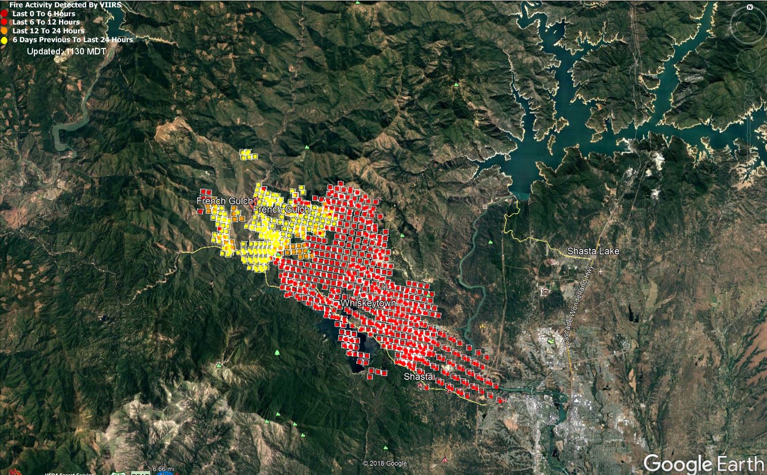
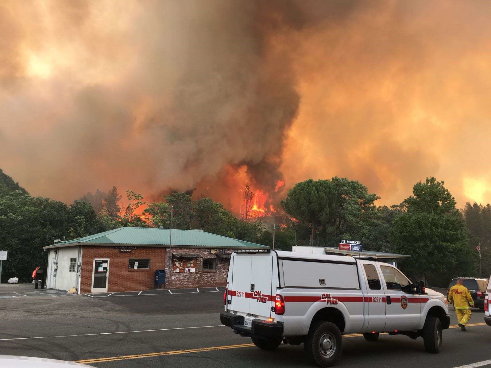
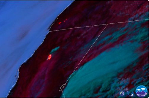
CA-SHU Carr Fire: 28,763 acres, brush and timber, 10% contained. Fire behavior remains extreme with long range spotting and crowning. Structures remain threatened. Evacuations are in effect for the communities of French Gulch, Old Shasta, Keswick, Victoria Highlands, Whiskeytown and Whiskey Creek. Hwy 299 remains closed in both directions. There is also a threat to Keswick hydroelectric, Carr powerhouse, powerlines, historical sites and private timber. There is also a threat to the Western Area Power Administration, which powers numerous Northern Coastal Communities. Cal Fire IMT1 and Whiskeytown National Park are in unified command.

5 Likes

The beast is awakening again with the winds and heat. Two major issues, one is the north end at Div M and Div O. Their first hope was direct there in Cline Gulch, then abandoned that and hoped to go indirect on the ridge system with Shirttail Peak. They’ve just abandoned that and pulling out as the fire spotted across and well established over Cline Gulch with strong northwest winds.

The other major issue is at 5pm multiple spot fires over 299 at Rock Creek Road got established and is now “boiling” per air attack. AA is pulling fixed wing out of that area due to the fire running through too many structures and no targets anywhere to make any headway. The fire will burn hard through the entire Brunswick Drive neighborhood. Trigger points have been hit to establish another wave of mandatory evacs south and east of Shasta.

AA just placed a no divert on 3 tankers.

25 Likes

Excellent update norcalscan. Thx

1 Like

Structure Group has been in Fire Front Following mode for the Shasta and Keswick area. Very large fire whirl and column leaning over. Not enough resources for much in that area.

Fire has reached Brunswick at Winthrop, and talk of Lower Springs at Swasey, and north at Iron Mtn into Keswick community. Fire has crossed the Quarry at Iron Mtn Road north of Keswick. new spots with 30mph winds on it to the river.

8 Likes

The heat signature is crazy right now, Good luck up there!

48%20PM

1 Like

S.O. Reporting, Fire is approaching Keswick

Still very dangerous fire conditions, still in fire front follow mode. 3 major heads on the east side marching east. Of those 3, southern is Lower Springs and Swasey area, very large fire front there. Middle is Iron Mtn Road just north of 299 where the Mill is. It has reached and spotted across the river right at that bend in the river. Spot was 1-1.5 acres under the WAPA power lines at last update. This is city of redding now and causing all sorts of new triggers - looking to evacuate 2miles out ahead of this thing into the city. WAPA lines should be deenergized about 745-750ish. Furthest north head I believe is a spot fire spotted across the quarry north of Keswick running west in 35mph winds.

edit: I’m not going to focus much here, focusing on local FB intel helping out there. I’ll get over here when I can. Very large scramble and panic on the west side of Redding. WAPA just shut down the lines, which put Shasta Lake City in the dark, along with other major areas. Who knows how far south that will be felt. It’s all the output from Shasta Dam. My power blipped in RB when the switch was thrown.

11 Likes

Northwest Redding is being impacted by the fire.

Mary Lake Subdivision under mandatory evacuation

Update as of 7:30 p.m. on Thursday, July 26:

According to the Shasta County Sheriff’s Office, the fire is encroaching on the community of Mary Lake and all of Mary Lake is being evacuated.
Officials said the fire has also reached the area of Keswick, which has already been evacuated.

The evacuation center currently at Shasta High School is now being moved to Shasta College.

2 Likes

SHASCOM states they are forming a rescue group to go into the Keswick area