State ID: CA
3 letter designator: SHU
Fire name: PETER
Location: Olinda Rd x Peter Pan Gulch
Reported acres: 50+
Rate of spread: MROS
Report on Conditions:
Structure threat: YES
Resources: SIgnificant augment
Hazards:
Weather:
Radio channels: Shasta command T2, Tac 11, Tac 12
Scanner link:Cal Fire - SHU Live Audio Feed
Webcam link: Axis-WestPeak2 | Shasta & Modoc | Regions | ALERT Wildfire
tile view
Agency Website:
2 Likes
If the SHU live feed doesn’t have Shasta Command on it, the Northern Sac Valley Fire feed does, along with Air Attack, A/G and rotor vic (TGU Local will be priority over it though)
5 Likes
IC requesting
3 charilie s/t
2 gulf S/t
3 Likes
PGE WX Howard Street 100F 13RH SE 6G12 (in town of Anderson, right flank influence but residential/urban)
PGE WX South Fork South, 98F 15RH SSW 7G15 (3mi south of incident, located on the 230kv near Gas Point Rd and Rancho Estates Rd)
Significant spotting into the area of 3rd Street (which becomes Aquado Way)
5 Likes
200 acres, continued issues with spotting and structure threats.
4 Likes
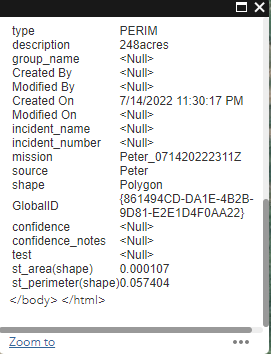
FIRIS mapping it at 248 acres at 4:30pm
4 Likes
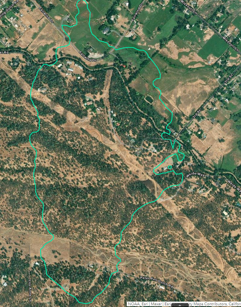
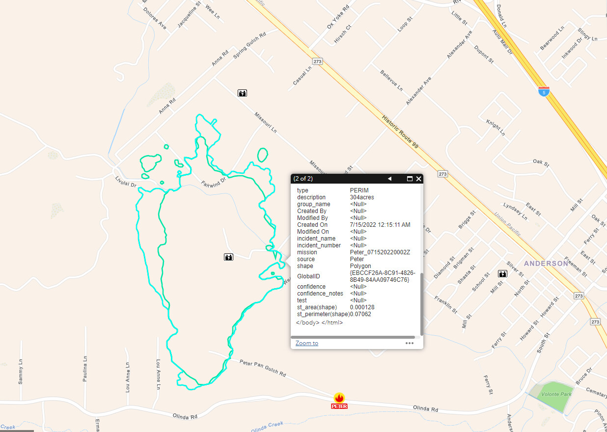
FIRIS mapped to 304 at 5:15pm
5 Likes