State ID:CA
3 letter designator:SKU
Fire name:Mill
Location:Weed Mill
Reported acres: 200
Rate of spread: Dangerous
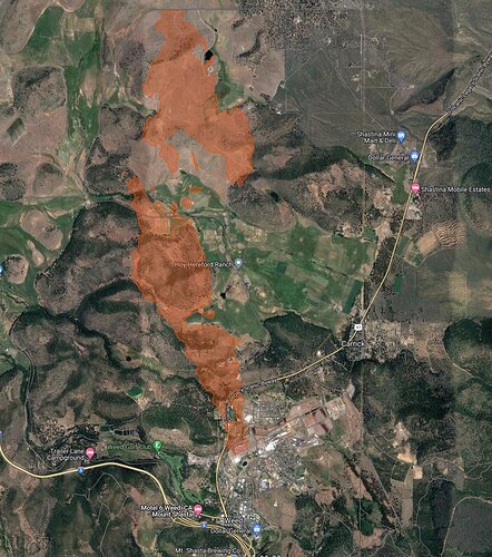
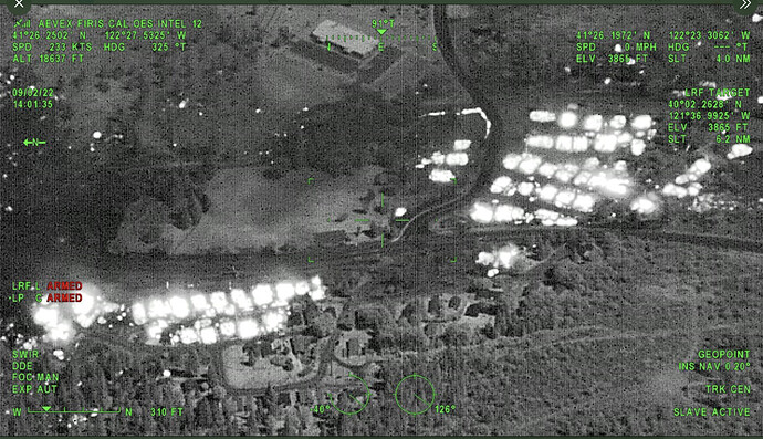
Report on Conditions: FIRIS mapped fire 555 acres, Mandatory EVAC Shastina
Structure threat: Mandatory Evacuations in place
Resources:
Hazards:
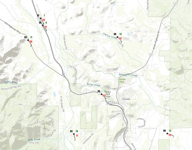
Weather:Temp: 97 RH:14 Wind: SSW 20-30
Radio channels:
Scanner link: Siskiyou County Sheriff and Fire - West
Webcam link: ALERT Wildfire
ALERT Wildfire
Agency Website:
Current NWS RH is ~10%, winds 22mph from the south (gusts to 33&44 until ~1900) Ground temp ~98F. I was there today and it is crunchy and very dry on the ground.
Just mapped at 1228 acres
It is moving fast. The valley winds were out of the south all day, with highest gusts near Weed.
Pacific Power appears to have de-energized the area lines. Power is out through south Siskiyou CO. Cell phones are down too.
Updating all EVAC Warnings to MANDATORY
5 additional engine ST any type immediate need
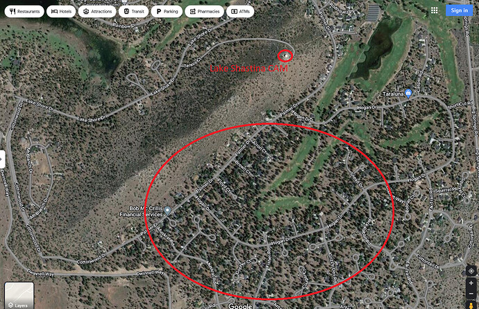
“has crossed Jackson (road?) & in to the community of Lake Shastina”
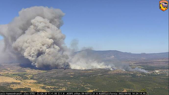
Looking at the valley from Hammond Peak, and watching the flight patterns, its heading in the direction of Shastina. If you are in that area, LEAVE.
Watching the rate of spread and spotting on the Lake Shastina camera is incredible.
Being on the ground, in front of one of these is no fun. Contacts in and north of Shastina tell me that they are still there and have power. Anvilhead’s map is a clearer view of where things are at (at least at the time of the mapping…)
Tankers 132, 139 is entering the area.
T912 off of SMX, T911 off SBC
Fire is at Muskrat Rd and Buffalo Rd near Lake Shastina now.
Judging from the view on the Lake Shastina cam the fire is in the community already impacting homes on the south side.
That is a new look I haven’t seen before from the FIRIS plane.

