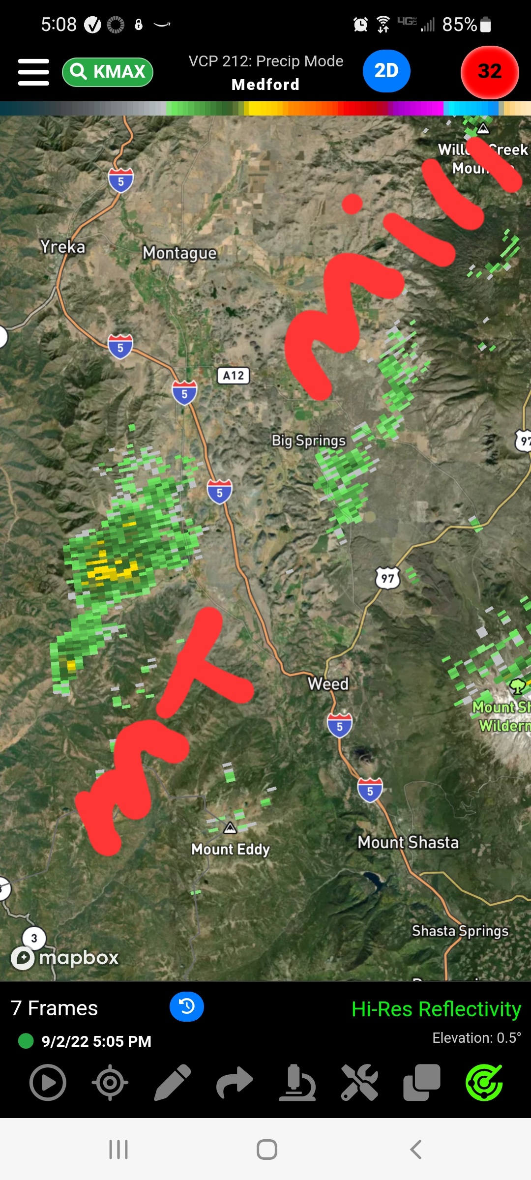
Both fires showing on radar
4 Likes
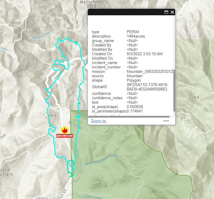
AA reported 300 acres a few minutes ago.
5 Likes
diverting 5 tankers from Mill to Mountain incident (per Mill Air Attack)
3 Likes
T91, T94, T95, T96, T160
5 Likes
2 Likes
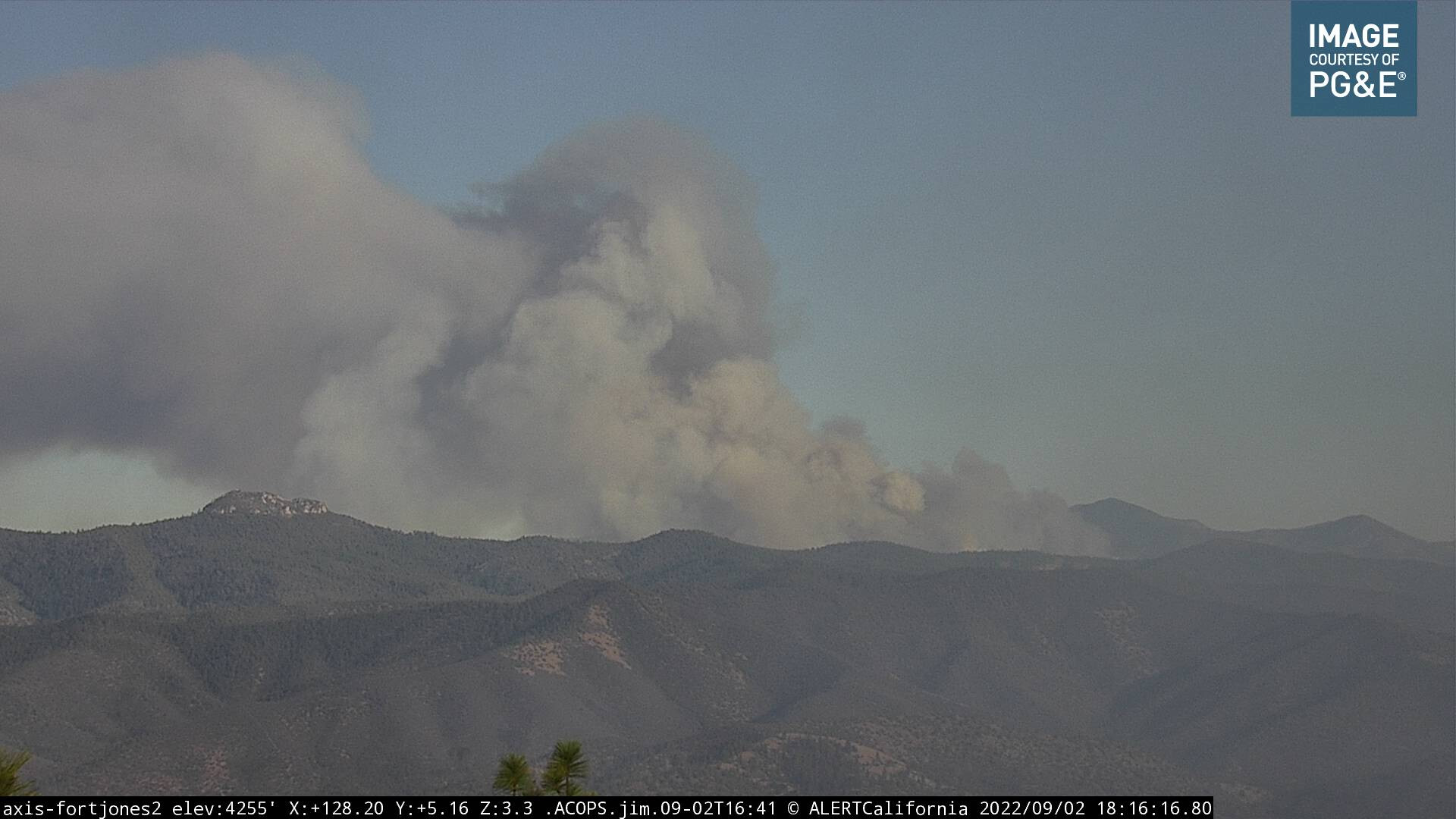
Is there some brand new fire breaking out between the Fort Jones camera and the Mountain Fire? There’s clearly some smoke or something beginning to obscure this camera shot.
2 Likes
Good catch, clear on the 15 min loop
2 Likes
That area has been impacted by smoke from the SRF Complex the last few afternoons.
3 Likes
You may be right, I’m seeing a lot of driftsmoke from that SRF Complex on most of the other cameras in that area. Must be that then.
2 Likes
GOES-18 - Sector view: Pacific Northwest - GeoColor - NOAA / NESDIS / STAR Smoke impacts from one fire to another
5 Likes
Throwing a few type1 tankers before pumpkin time
2 Likes
Last report was 700 acres. It was stated that potential of 2,000 acres overnight tonight.
3 Likes
Per the scanner, fire crossed Gazelle Callahan road near milepost 13, heavy fire and the road is impassible.
2 Likes
I heard AA state about 900 acres before leaving.
3 Likes
2 Likes
We just got punched out E66 out of TGU headed to incident with our W/T. I was working Constuction yesterday when this all started up In yreaka it was nasty to say the least
5 Likes
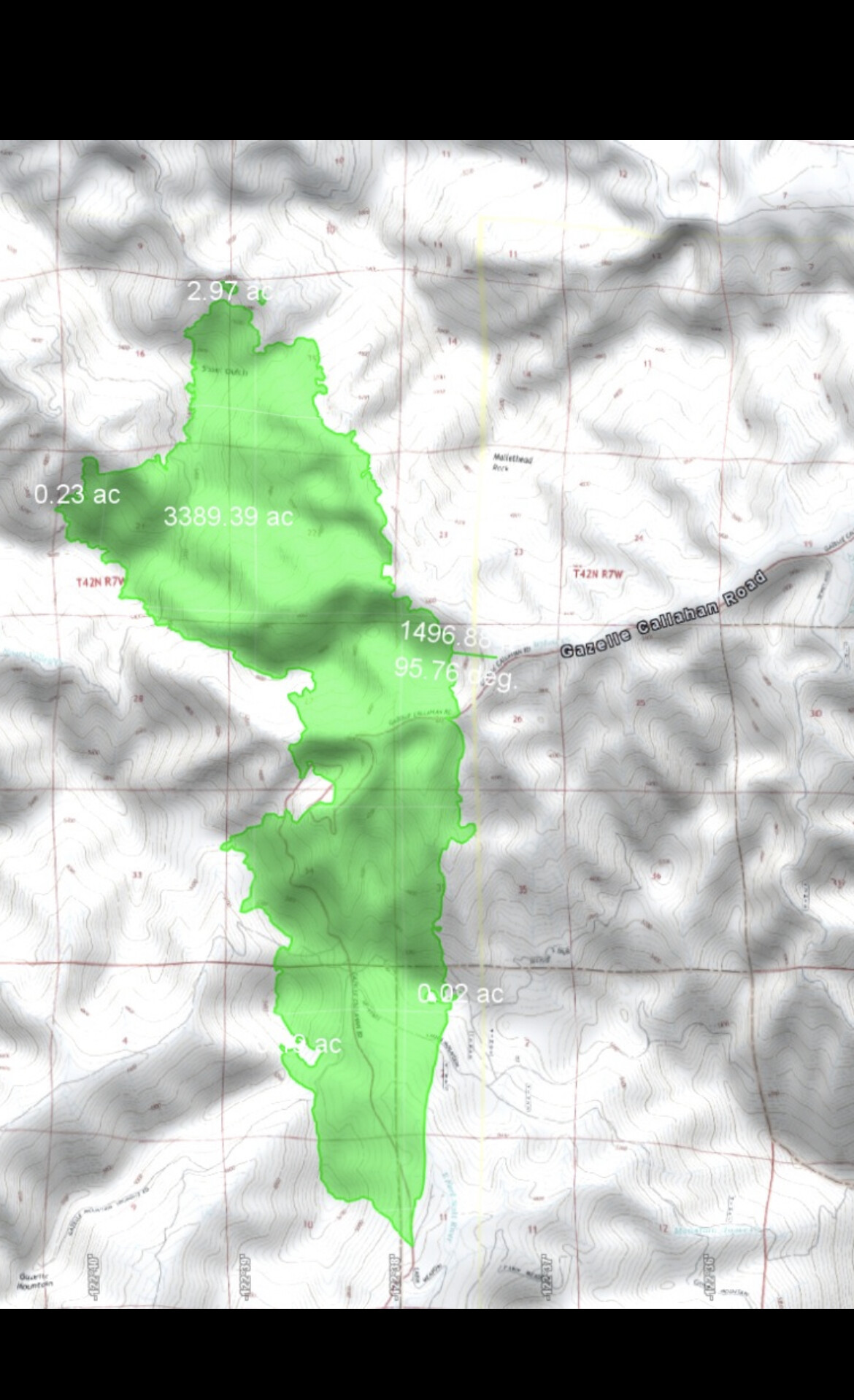
5am FIRIS shows 3,400 acres
8 Likes
5% Contained
5 Likes