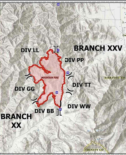
Looks like new evacuation orders from the Sheriff’s Office
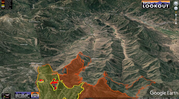
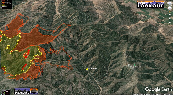
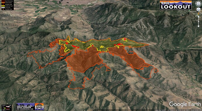
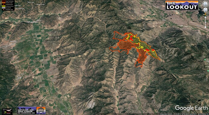
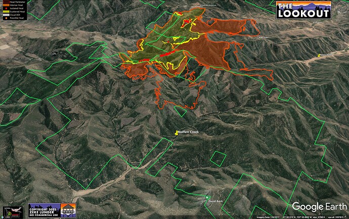
NIFC has a new perimeter made from IR overflight around 11:30am. Fire continued to spread west thru the day. Maps show last night’s IR (solid fills) and 11:30 perimeter (outline). It seems likely fire will cross Moffett Creek this afternoon/evening. Terrain is set up to channel fire west if we get another big downslope push at dusk. Source on the ground reported an extended push west last night at dusk until about 2300.
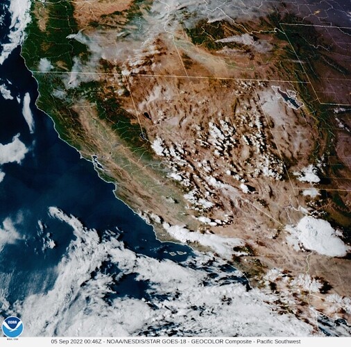
GOES-17 starting to pop up a header on this one.
Here is a link to the NIFC perimeters page - it’s a good place to get a publicly-available derivative product of the CAL FIRE intel flights, albeit with a several hour delay. WFIGS - Current Wildland Fire Perimeters - you can download a KML file and open it in Google Earth Pro, or in the Google Earth smartphone or tablet app, which is cool if you’re in the field, as you can display your location on the map as a blue dot.
Putting up a good column on the Fort Jones Cam. Looks like an active afternoon.
The fire is now well established on both sides of Noyes Valley Road and is spreading toward contingency line crews put in today.
She is moving alright…
8,896 acres and 10% contained.
Per watch duty app this was taken right from the scanner. Fires pushing hard towards s/sw towards contingency lines put in today do to activity firefighters are having to pull back from some areas
Anyone want to pull out a crystal ball and guess at the size of the box this one gets out to?
What is the land use where this is burning? It all seems to be private land but not many structures of any kind and not much evidence of timber harvesting, the trees are not very big.
There’s a tract of private timberland on the north end of the fire with a lot of fairly recent clearcuts. Used to be Fruit Growers Supply, has a new owner.
There’s a lot of scrub oak in the area on the harsher sites.
25k if we’re lucky. Rough country. Hope I’m on the high end
whole area between Gazelle, Ft. Jones, and Yreka has basically never burned before so I’m guessing 40k since 8k in first couple of days and its getting hotter.
According to Watch Duty, “ The fire has been mapped at approximately 10,558 acres by FIRIS as of 12:12am today”
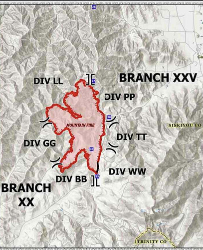
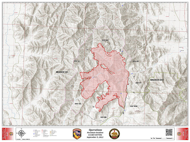
Monday 9/5 Ops Map:
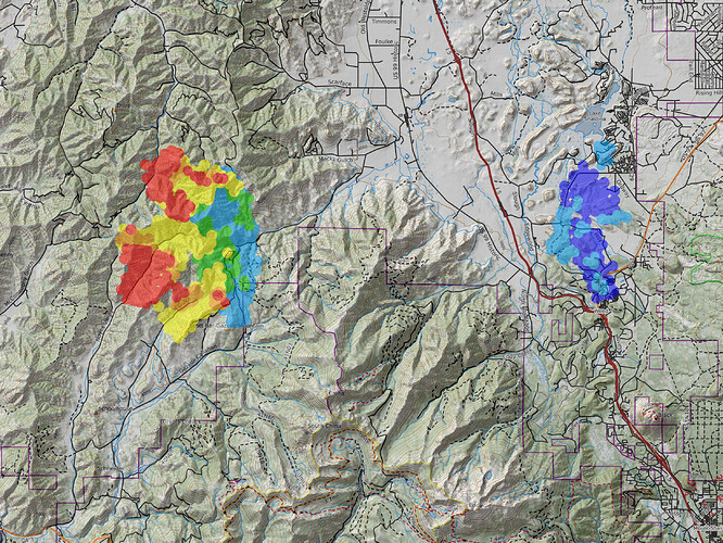
IR Heat Progression - bit crude but shows hot flanks NW & SW of the Mountain and cooling off of the Mill to the right.
9/5 AM Intel:
10,338 Acres, 10% Contained,
332 Civillians Evacuated
1740 Personnel Assigned to Incident
Fuel Hazards/Concerns: Major concerns are critical fuel moistures. ERC and BI are above the 97th% 100 and 100 hr. fuels are critical at 6%-10%. Live Fuel Moisture is approaching critical at 80-85%Today begins a period of warming and drying through Tuesday. The fire is active through the night with sustained runs in timber even after sundown.
Critical Resource Needs: 2 STG & 5 HEQB
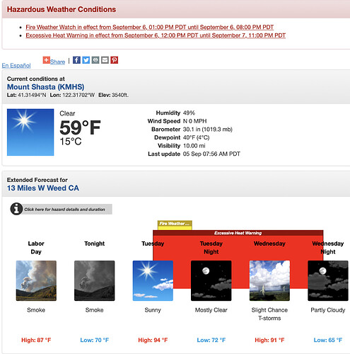
FIRE WEATHER WATCH IN EFFECT FROM TUESDAY AFTERNOON THROUGH TUESDAY EVENING FOR STRONG GUSTY WIND AND LOW RH FOR FIRE WEATHER
-
AFFECTED AREA…Fire weather zone 280, including the Mountain fire
-
WIND…Northwest winds 10 to 20 mph with gusts as high as
30mph. -
HUMIDITY…6 to 13 percent.

