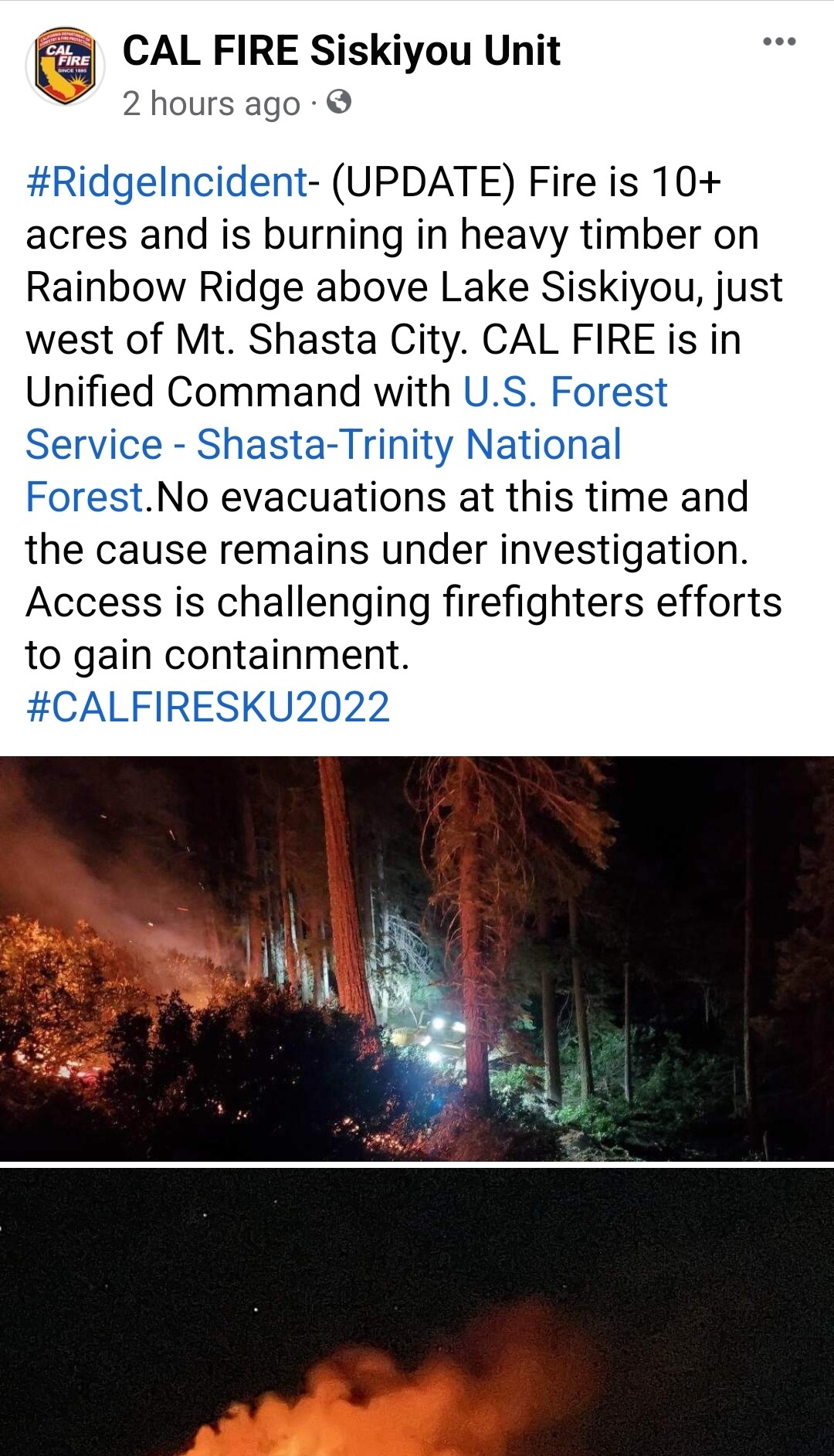
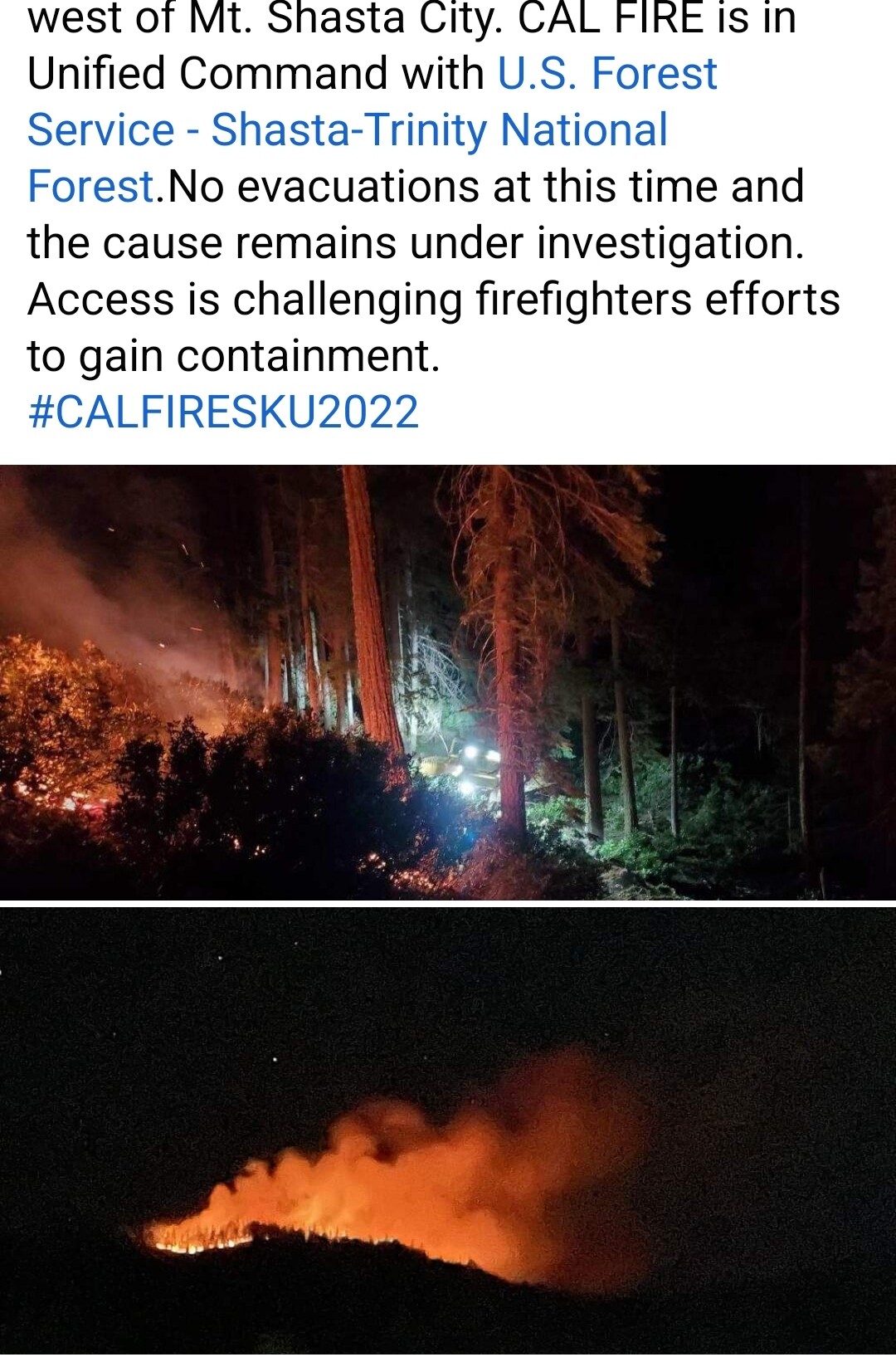
New fire south west of MT Shasta, Rainbow Ridge area, unknown if SHF or SKU
https://www.alertwildfire.org/region/shastamodoc/?camera=Axis-Weed2
New fire south west of MT Shasta, Rainbow Ridge area, unknown if SHF or SKU
https://www.alertwildfire.org/region/shastamodoc/?camera=Axis-Weed2
Sounds like 3 fires. Calling it the Ridge.
How big? State or fed?
Have not heard a size, Sku is currently running the fire.
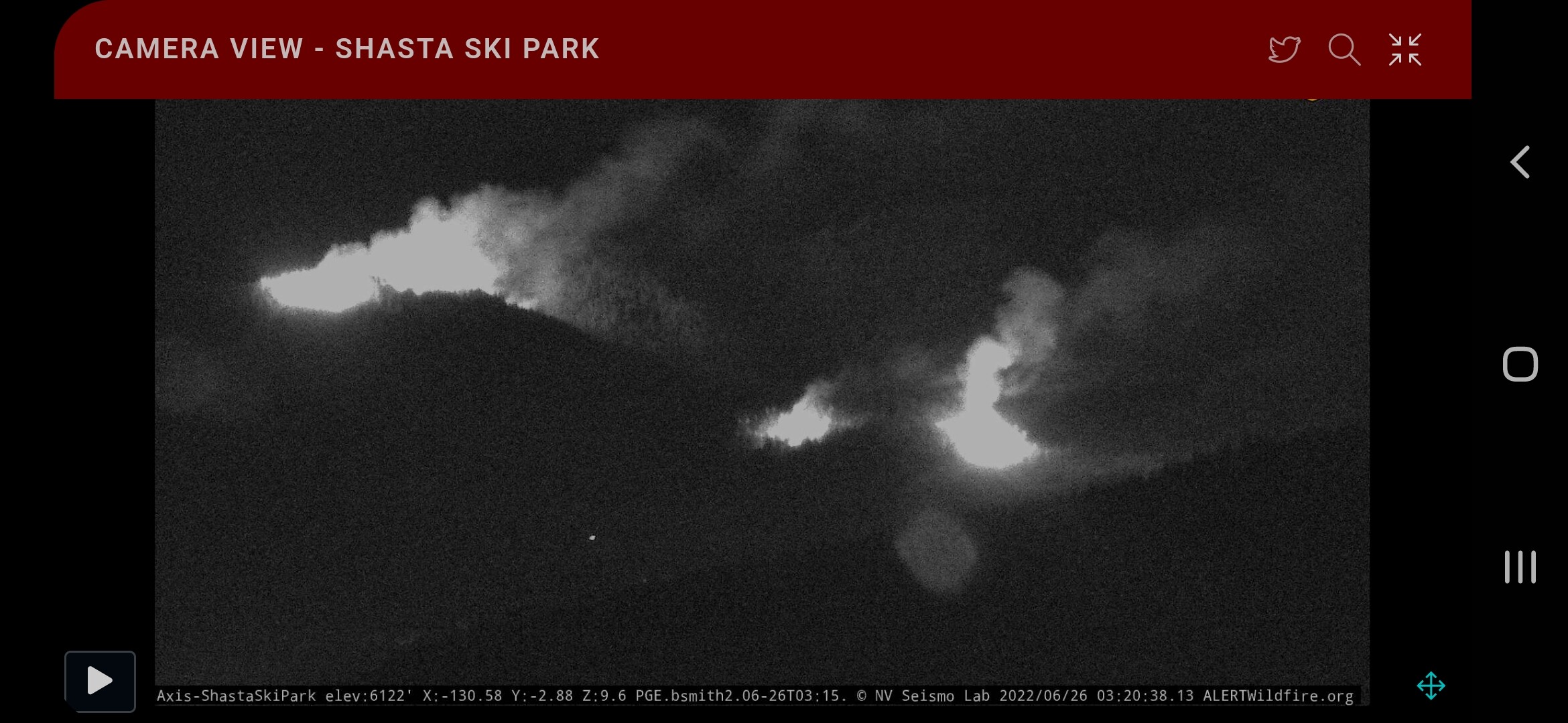
2312: still trying to make access, Attempting to hike into, no ROC
I know this area and live near the fire. I know where there are secret access points you could run trucks up there from.
Rainbow ridge is a series of spine ridges north of lake siskiyou in a very Closed timber stand with no access for full size vehicles. Actually the only way I know up and over the ridge is singletrack dirt bike or on foot accept where the old cabin used to be
Significant diurnals here as it is the saddle between Mt. eddy (9k) and Mt Shasta (14k) and it is the rough headwaters of the Sacramento river drainage. The column is bent over towards the “town” of Mt. Shasta proper with effects from Eddie.
No known fire history that I am aware of.
@ That_guy I know this area and live near the fire. I know where there are secret access points you could run trucks up there from.
Can you get me a number of anyone on that crew? I can get trucks up there. I see the fire and know how to get to it without hiking.
Made foot access 3 acres MROS, trying to bring resources in off of Wyehka Way. Sounds like the fire is on the DPA line, burning both sides of the line
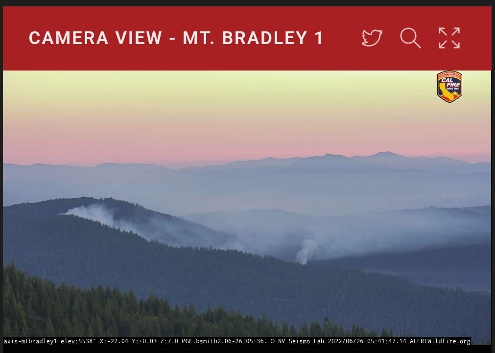
https://www.alertwildfire.org/region/shastamodoc/?camera=Axis-MtBradley1
10-15 acres, slow-moderate rate of spread, low-moderate potential per IC around 0200. Now a spot fire visible on cameras.
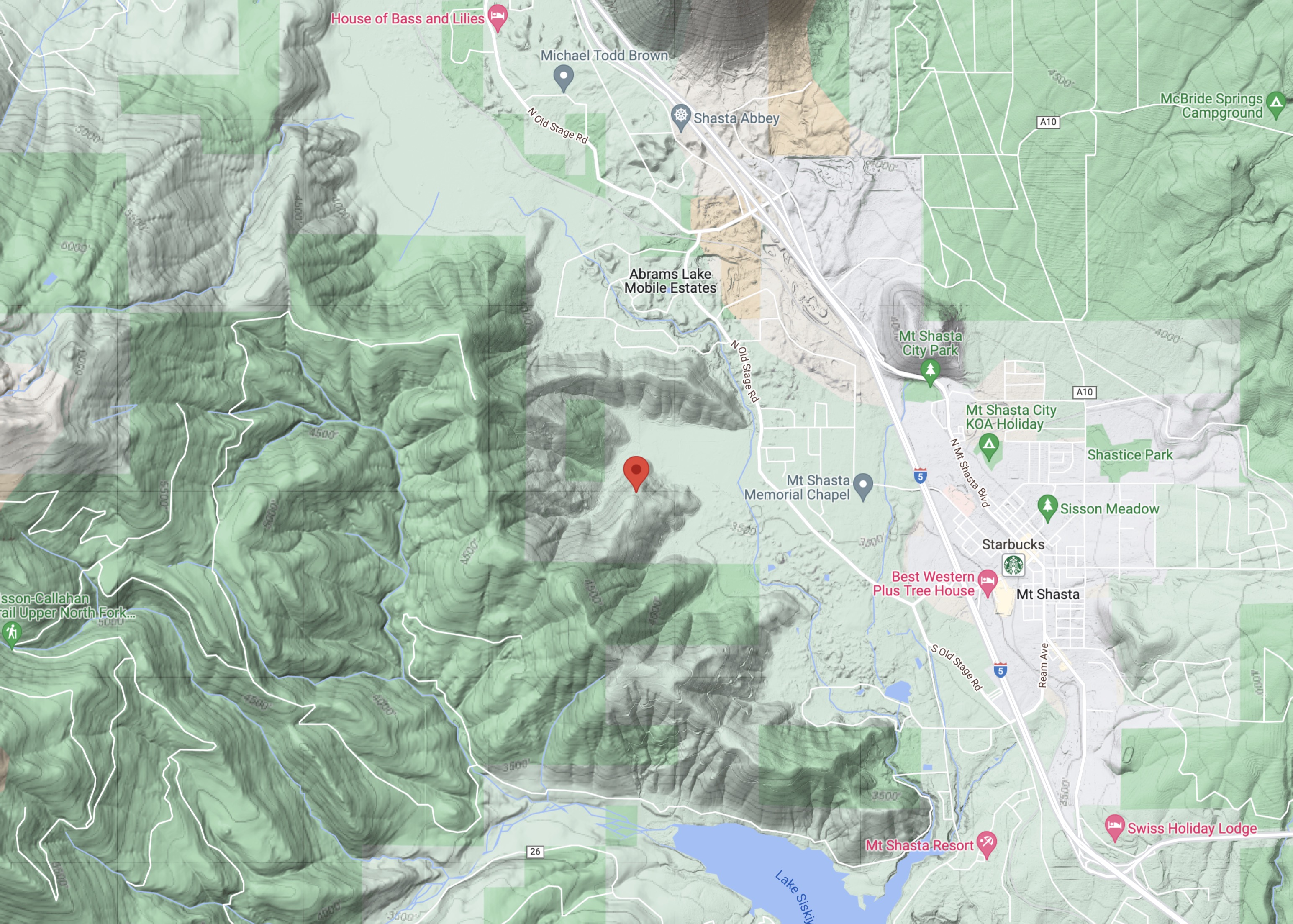
1/4 acre moderate ROS in timber on a steep slope for the spot fire per the prevention unit, located at 41 19.130 -122 21.557
https://www.alertwildfire.org/region/shastamodoc/?camera=Axis-MtBradley1
12 hour time lapse confirms the diurnal effect and is the cause of the two spot fires. Hopefully the cooler morning temps will allow them to get ahead of this fire. The region is under a heat advisory today which will extend the burn window. Considering that there are no other major incidents they should be able to get all the resources that they need.
#RidgeIncident- (UPDATE) Forward rate of spread has been stopped. Fire is 10+ acres and 20% contained. No evacuations and the cause remains under investigation. Access is challenging firefighters efforts to gain full containment.
#CALFIRESKU2022