Yes, sir. I started it, once I heard the new dispatch go out.
3 Likes
No new fires on cad.
3 Likes
Looks like the Rock fire is a having some control issues, tankers 107 and 132 just made drops again.
3 Likes
Rock fire has personnel on it. Creeping with some single tree torching. Had a spot hundred plus yards away from the original fire, now has a retardant on it. AA had wanted to get a drop or two on this incident before cut off.
4 Likes
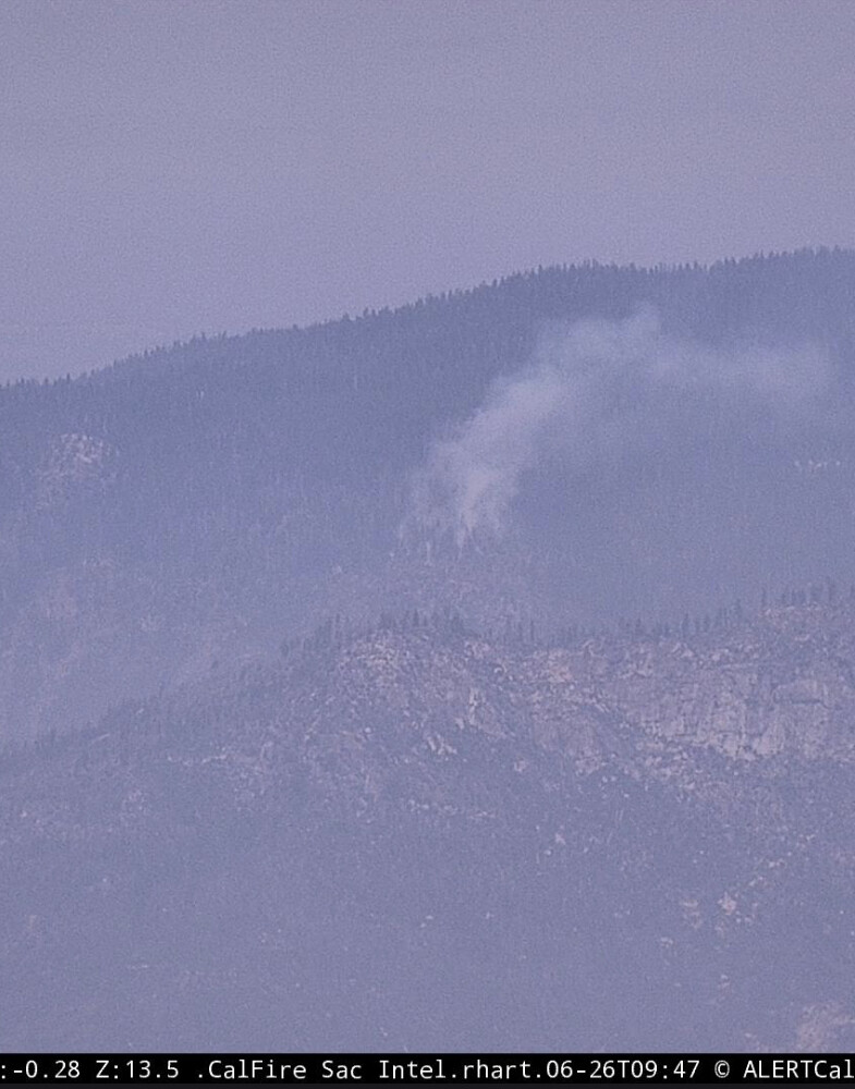
Fir fire near McKinley Grove putting up a little column. Snf crew 2, e3-51, and chumash engine 381 on scene.
4 Likes
AA 15 has ordered two type 2 copters and a type 1 tanker to the Rock. Try to box it in.
Update @ 08:50: retardant is holding spread. Heat is slow to build with 2 acres. High potential for roll out and spread to 1000 acres.
@10:00 AA15 states that it will be boxed with 4 loads from the tankers. Copters will assist mopup.
5 Likes
The SNF has some resource orders in for extended freqs that appear to be lightning complex related. Worth plugging in if you’re in the area.
Air Tactics FM - 166.3375
Air/Ground FM - 168.400
Rotor Vic - 128.625
5 Likes
New Fire in the complex from AA15:
off the 12S01 Road
Location T12S 26E section 23, don’t have location name yet
20 acres on SE aspect, moderate rate of spread
This might have been spotted by Delilah Lookout early this morning??
Will utilize the 2 Tankers off the Rock to check it.
There running it on SNF fire net, currently
I believe Calfire is sending resources, a lot of radio traffic to parse
AA15 requesting additional aircraft
3 Likes
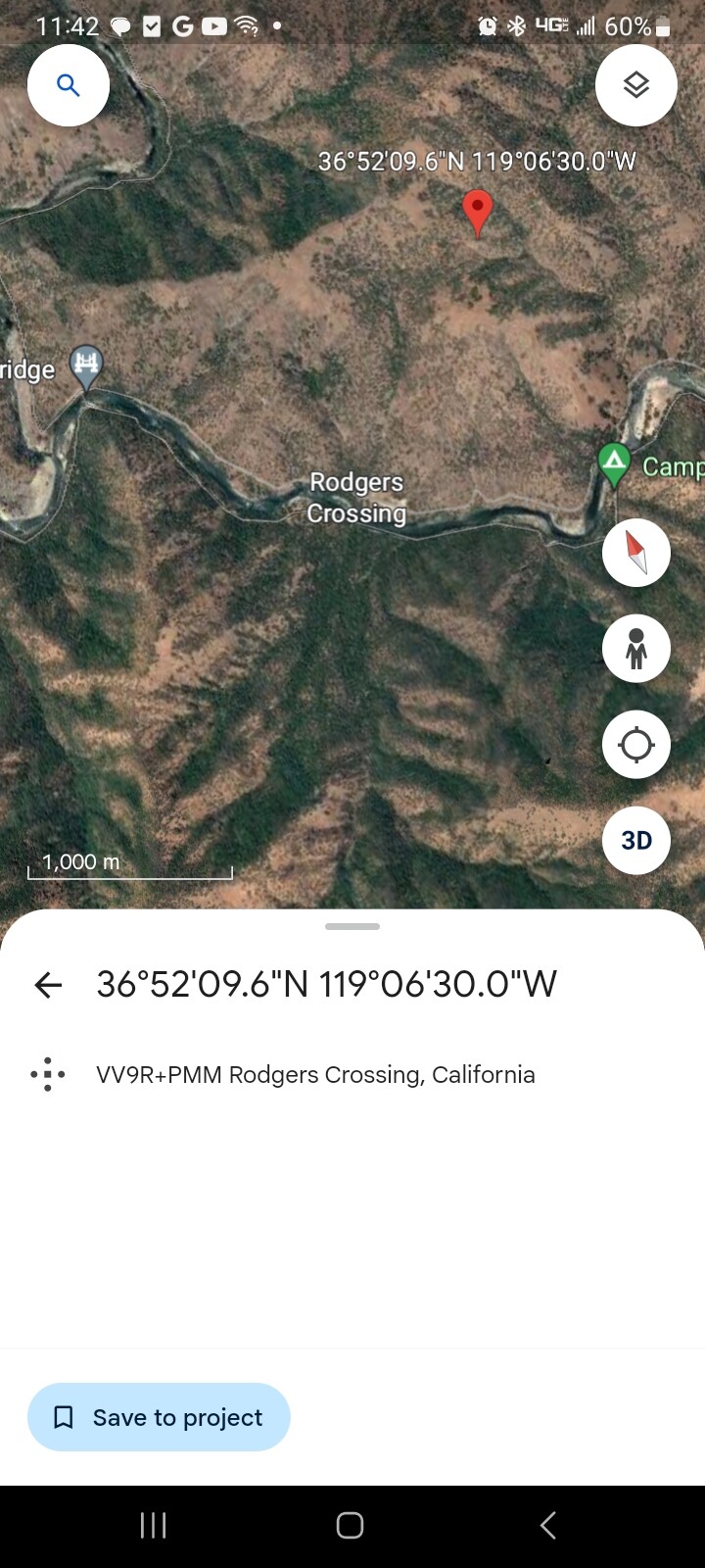
Will be the Basin Incident.
Fire is on the North Side of the River, Above Trimmer Springs Road, East of Rodgers Crossing.
2 Likes
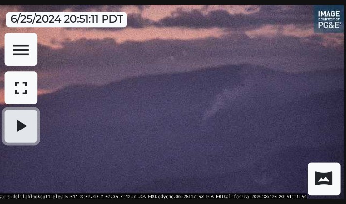
Buck Rock 1 camera has good view of it
https://ops.alertcalifornia.org/cam-console/1860
3 Likes
I believe that is a separate fire. maybe the Rock. 2 helicopters were working that earlier, and were pulled to go to the Basin. The GPS coordinates put the Basin down in the Kings River Canyon lower and in the grass and oaks, where that fire looks to be in the pines.
5 Likes
Is the 20acre fire referenced earlier on the sawmill flat side of the canyon or on the rogers ridge side ?
2 Likes
It’s on the north side of the River about 1.5 miles from the last bridge. Rodgers Ridge side.
3 Likes
3 loads of retardant on the Basin fire. Releasing Tankers due to smoke and visibility.
30-35 Acres.
Bringing the Crews from the 2 type 2 ships to staff the fire.(H-522, 534)
Buck Rock is looking at the Rock Fire, the Basin fire is getting smoked out and is down in the canyon.
Tankers are on order for the Rock fire to put retardant on it.
5 Likes
Kings river HS?
1 Like
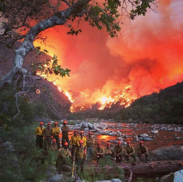
That’s the Rough fire 2015. South Fork of the Kings River. I believe just up from Boyden Cave?
4 Likes
Los prietos.
3 Likes
Yes it is.
3 Likes