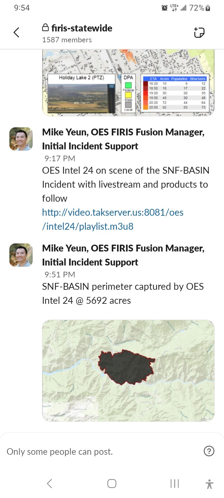
CA-SNF-Basin(CONTAINED)

State ID: CA
3 letter designator: SNF
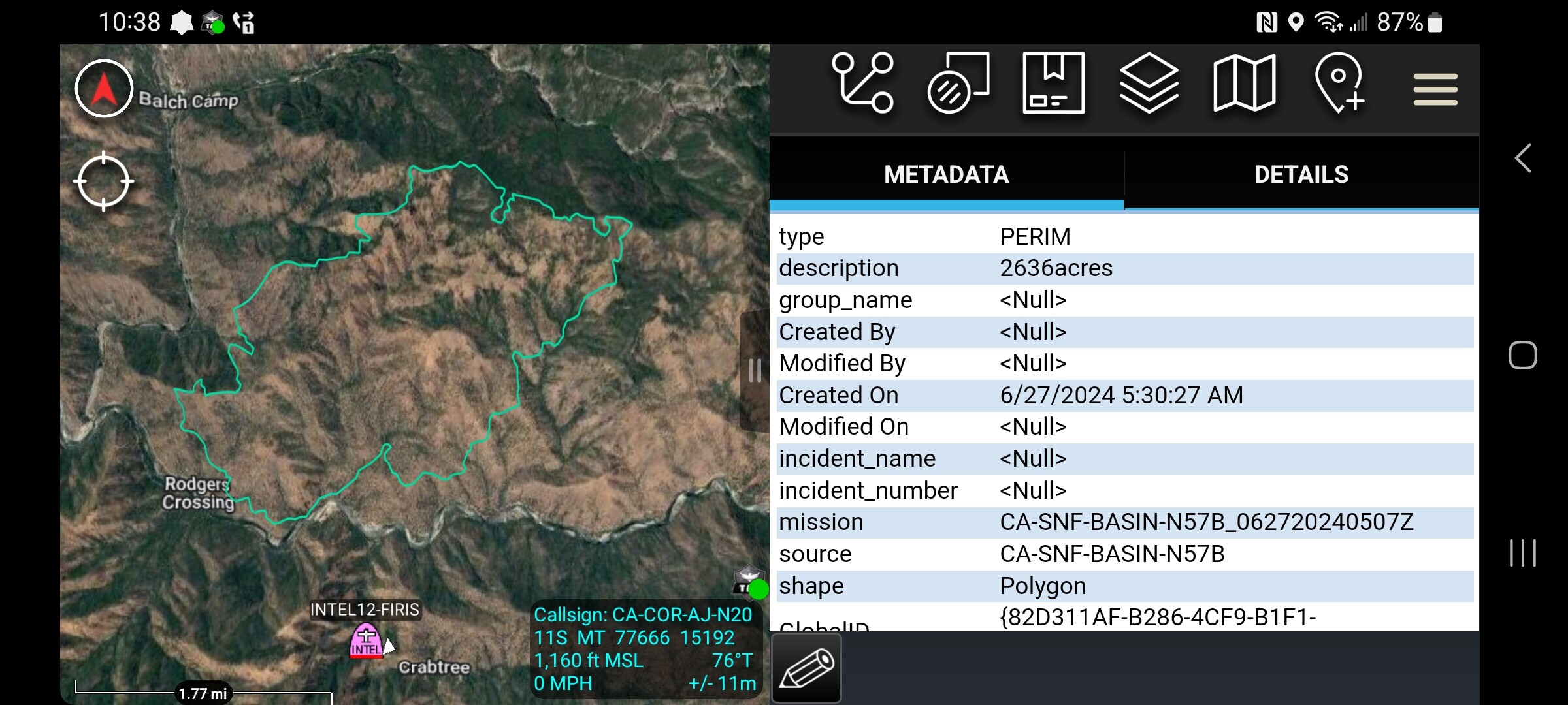
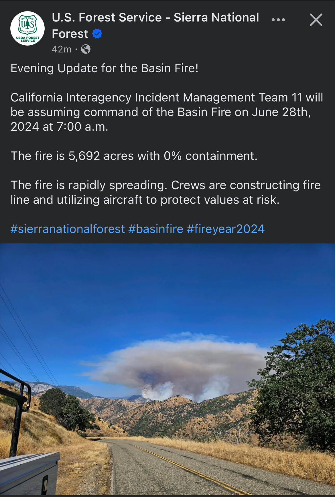
Fire name:Basin
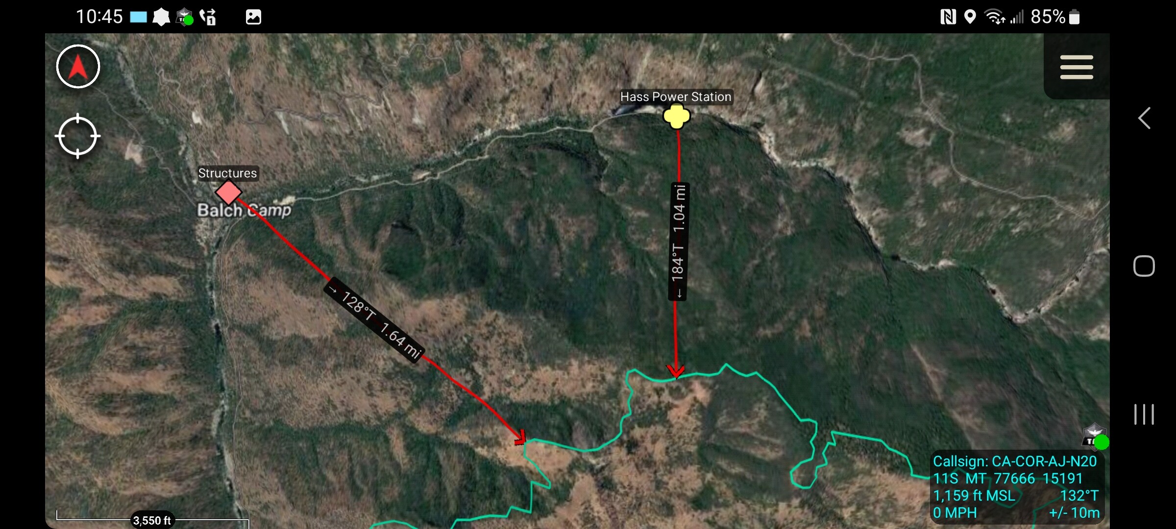
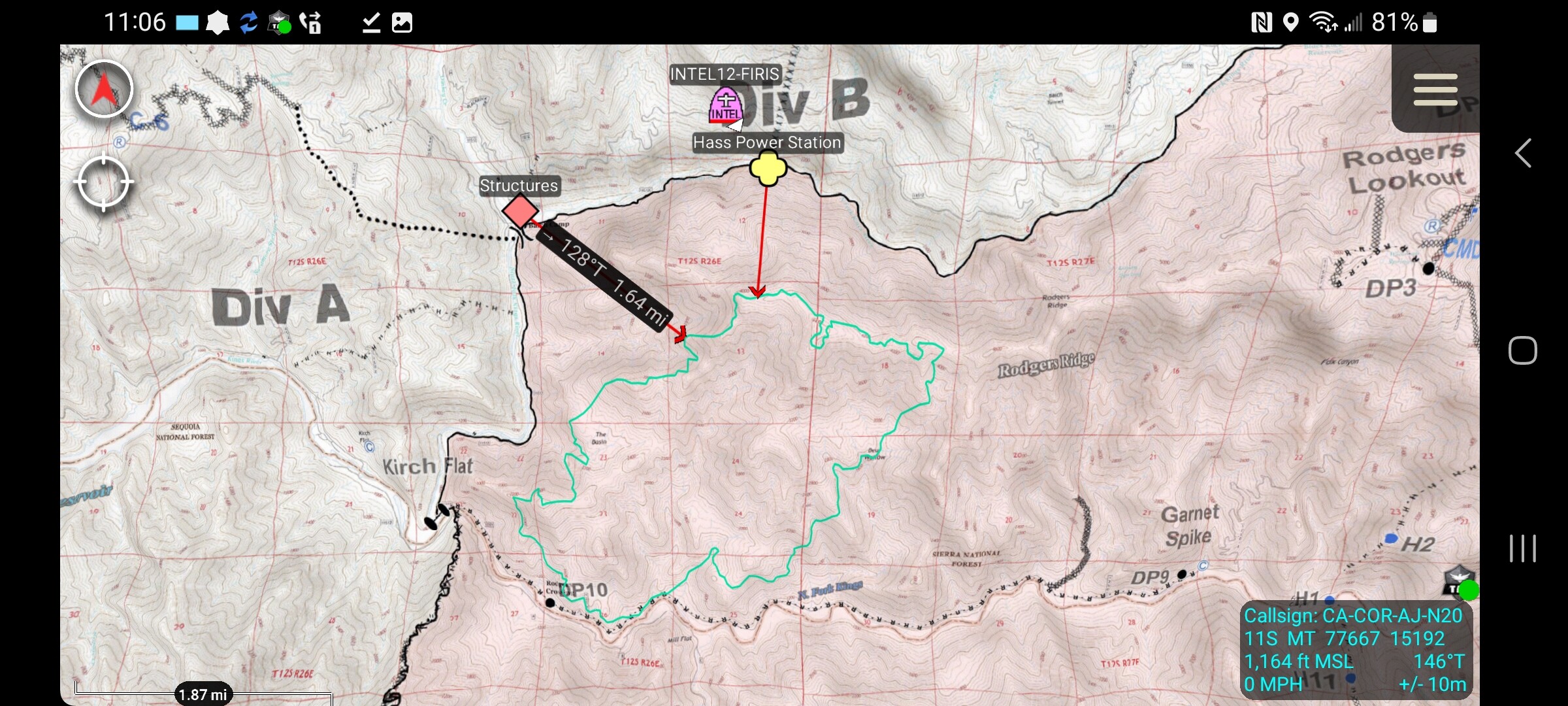
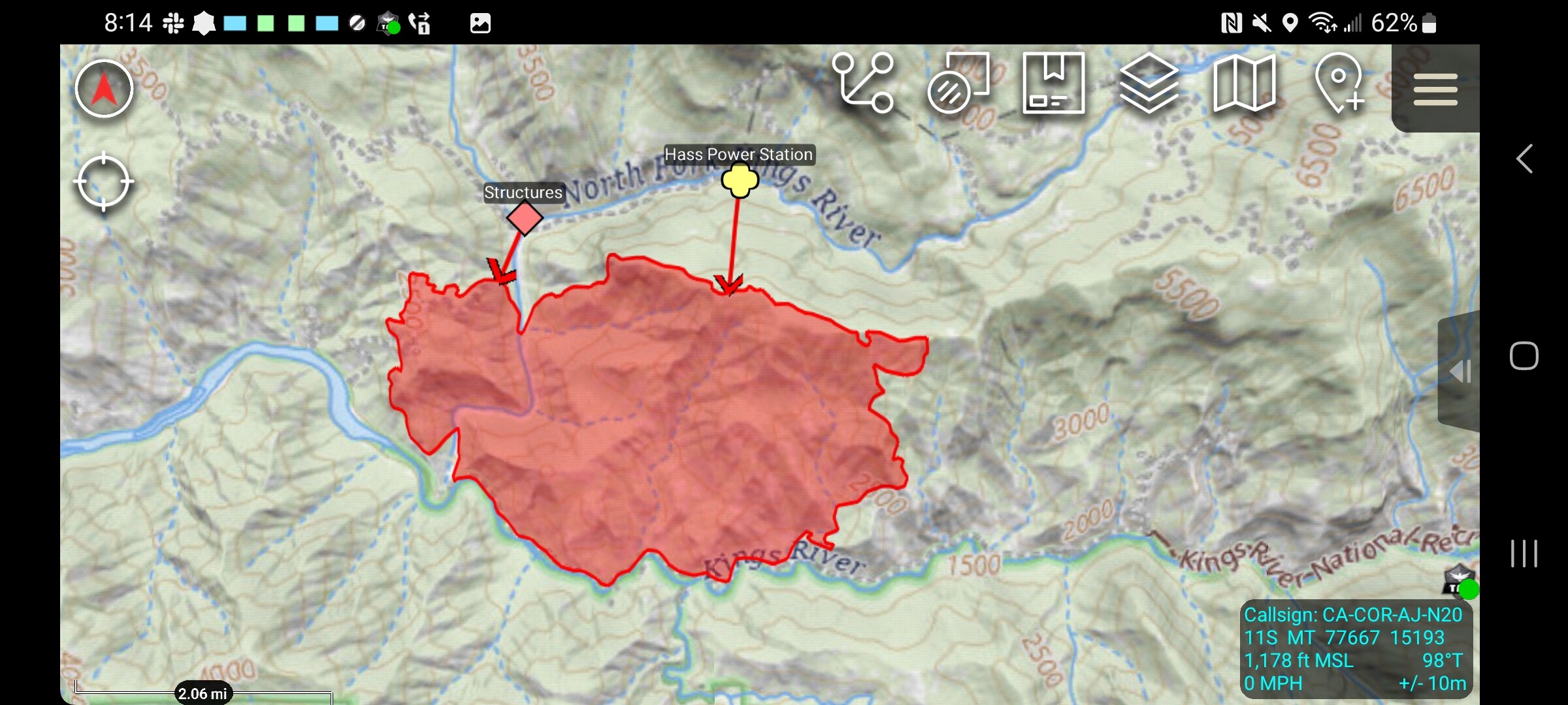
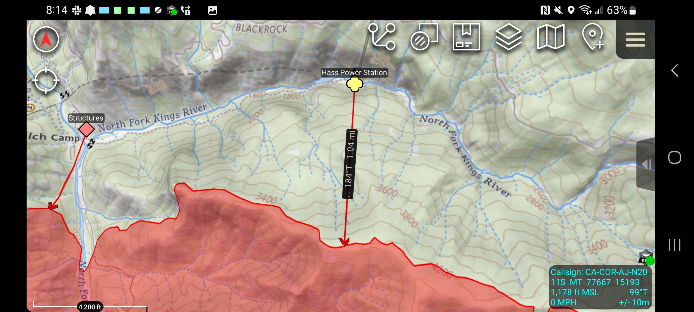
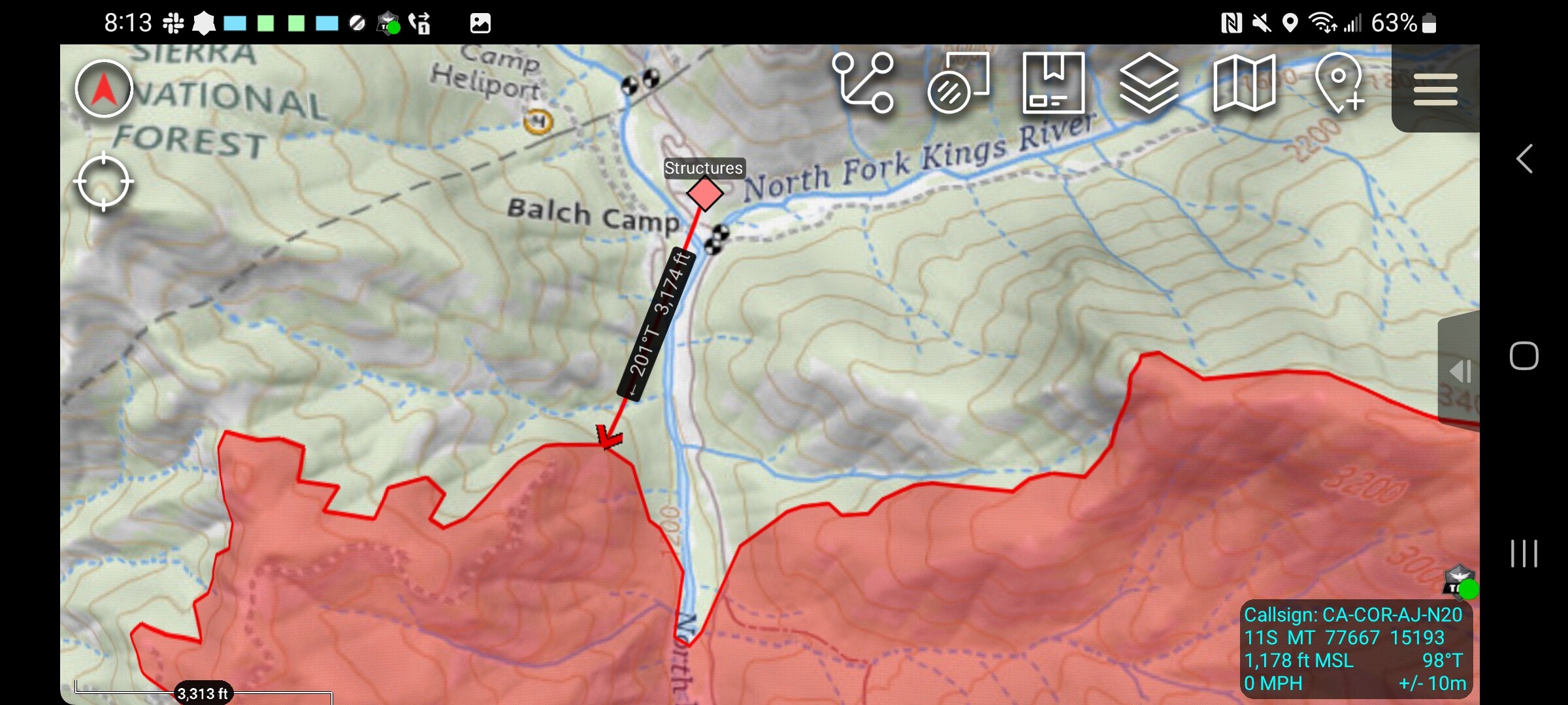
Location:Rodgers ridge S/E of Balch camp
Reported acres:1000
Rate of spread: rapid
Report on Conditions:
Structure threat:
Resources: BRUSH 33, PT42, E-84, CHU WT 284, PT43, DO DOCEV, PT41, WT 21, BOISE E-451, BRUSH 7, SNF E3-42, PT52, E-631, SNF FRSNO3
Hazards:
Weather:
Radio channels:
Scanner link:

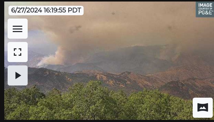
Webcam link:ALERTCalifornia - Delilah Lookout 2
Agency Website:

4 Likes

FKU forming up an immediate need strike team at Piedra for structure protection at Balch Park.
Strike team 9461C, which I assume was the cover strike team in FKU.

4 Likes

You are correct, they have been covering here

1 Like

CIMT 11 (Fogel) has been ordered for the Basin

7 Likes

Intel-12 map 2636 acres

5 Likes

3 Likes

Thank you for posting. All still within the Rough Fire scar? Which (I believe) followed along the North Fork of the Kings River.

3 Likes

Yup for ref…

7 Likes

AA15 flying into the Basin… New Air Tactics for only the Basin is 169.150

@08:20 inversion has smoked out the fire, can’t see the fire.

4 Likes

Div. A along the Kings river and Balch Road has multiple spots. Road 11S02 will be the fall back to prep and hold if needed.

Copters enroute and additional ground resources .

Auberry Helibase established.

2 Type 1 tankers building indirect retardant along east ridge top towards Balch Camp.

@15:10 spotting is over 20 acres and running to ridge…tankers now working spotting…
@ 15:20 Tankers can’t drop into this run or help, too many hazards and very rapid spread RROS…well established south side of the Kings River in section 22

AA15 requesting Lead Plane and a VLAT. Note an Inyo Fire is utilizing many air resources.

@ 15:50 IC and Div.A concur that this will quickly jump the 11S02 road and into Balch Camp Structure Group.

9 Likes

The east side of the fire has crossed the drainage below bear wallow.

5 Likes

Air Operations shut down due to dense smoke over the fire. Tanker 03 and 16 and copters on hold.

3 Likes

Rock fire to the east?

1 Like

That is the east side of the basin fire. Rock fire isnt visible due to the smoke.

1 Like

Basin at 5692 acres

4 Likes


11 Likes

5 Likes

TAK data package posted for the basin. http://maps.takserver.us

3 Likes

Day and night resources are swapping out. Really haven’t heard any other chatter. Cams look like the inversion still has smoke banked down.

5 Likes

Another hour or so the smoke will start mixing out, things have really cleared up in clovis since 9 am.

AA15 headed that way.

6 Likes