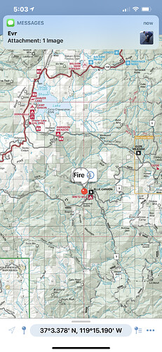
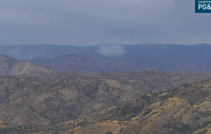
State ID:CA
3 letter designator: SNF
Fire name:Blue
Location: forest road 404 and 02 road , blue canyon (can’t find these on maps yet)
Reported acres:2
Rate of spread: moderate
Report on Conditions: heavy timber, brush, spotting
Structure threat: unknown
Resources: 5 forest engines, 3 calfire, 4 fixed wing, 2 copters and AA15
Hazards:
Weather: gusty winds from down draft thunder storms
Radio channels: 172.225
Scanner link:
Webcam link:
Agency Website:
Wildcad has the lat and long 37 1.932, -119 14.964
This fire is in Fresno County, East of Tamarack Lodge.
Extra resource request, 4 dozers, 5 engines, 2 water tenders
I find a 09S404 road, south of Huntington Lake near rock creek. Found on recreation map for Sierra NF.
https://www.fs.usda.gov/recmain/sierra/recreation
To take a positive from a negative fuels are much much lighter to none to the west and northwest.
That part of the Sierra didn’t burn during the creek.
Copter 95B, helitanker dipping out of West Lake. That might help map it too.
Copter 520 had to off load 1 person to lose weight and then respond. Too heavy for altitude.
Yup. Helped with a pretty successful burn on Barnes mnt last year
Update 10 Acres
It burned just west of there past Petersen road down to cherry flat. They hung it up firing off Burrough mountain.
Tankers 76 78 82 and 83 working AA15 overhead.
http://www.alertwildfire.org/sierra/index.html?camera=Axis-MeadowLakes&v=7a7f1c3
It’s pointed right at it.
Huntington Lake cams are not refreshing and would be closer.
Yeah, meadow lakes is just showing the smoke.
AA stating gonna try to hit the left flank but the winds are getting squirrelly if not possible gonna hit the heel.
Bear Mountain shows the fire but it’s still in patrol mode.
http://www.alertwildfire.org/sierra/index.html?camera=Axis-BearMtnFresno2&v=7a7f1c3
Bretz mill CG was a Staging area for equipment during the Creek. There is a FS Station all the way down the Peterson Road/Big Creek Road as well right next to the Camp Ground
Starting to see it from Owens mountain now.
http://www.alertwildfire.org/sierra/index.html?camera=Axis-OwensMtn&v=7a7f1c3
Pretty well tied in by roads, 15 acres and slow rate of spread with some spots, hammering it with aircraft.


