Yea he said that they always get the info from 3rd party… so he was asking me just in case i knew more. but yes it could be anything.
1 Like
I flew from Fresno to Mojave this morning at 12,000 and it was like the inside of a cotton ball. I could just see the ground straight down but no horizon anywhere and I doubt I had much more than a mile visibility in flight. Point being, I have no idea how these guys are flying these fires. I know it’s helicopter work only on the southern part of the Creek Fire, but holy schnikes it can’t be any fun…
6 Likes
Hi MedicDoug
this is my first time on this site and like thousands of others I am try to find out about the status on any homes lost on Sugarloaf Rd. just off auberry road about 2 miles down sugarloaf. My mom is elderly and is in advanced stages of cancer. She was evacuated and I would like to give her a little peace of mind; one way or the other. Do you know where I can find this out? I appreciate your posts. Be safe and godbless
Renee
savesugarload
2 Likes
Has anyone helped you yet?
This might help you out, this is a structure inspection map, for the fire area. https://calfire-forestry.maps.arcgis.com/apps/webappviewer/index.html?id=1933470ef8ea4c7e9cede56adf54efe1&extent=-13377356.4387%2C4419677.6073%2C-13142541.8878%2C4523937.7139%2C102100. Not all house has been inspected yet, but it is at least something,
5 Likes
Anyone have a link to the IAP for today?
1 Like
Good morning. It’s really hard to determine specific structure status at this point, since access is necessarily restricted. The damage assessment map that @e70 posted is probably the best resource at the moment, until someone can get to your neighborhood. Sorry we can’t be of more specific help at the moment. Good luck.
5 Likes
They’ve been moving pretty quick with assessments, they did our neighbors properties yesterday in meadow lakes and have done some on sugarloaf.
4 Likes
Thank you!
1 Like
Anyone heard of a burn show soon? Fire seems pretty quite the last few days. Or we sticking a fork in it.
1 Like
Far from done. Burn operations being conducted on a regular bases, esp. on the western part of the fire to strengthen containment lines. Active fire on the north, northeast perimeters. Air ops continue to be adversely impacted by reduced visibility. Into the grind-it-out phase of the fire…
Acreage not updated as of yet today. Looks like there may have been a technical problem with the IR data from last night. Containment still listed as 27%
5 Likes
Helitorch show planned to button up division W this afternoon if visibility allows.
5 Likes
And I’m hearing a burn operation on Div C as well. Asking for a FireHawk H507 mission for eyes.
4 Likes
They did a little there yesterday and are continuing.
4 Likes
Hi Brushslasher, heard anymore from Sugarloaf rd. her house is 2.2 miles down off auberry road…this waiting and the unknown is killing us. I don’t mean to sound self centered or ungrateful because I truly appreciate everyones efforts during this terrible crisis. I know that we are just one of so many hundreds of others out there just waiting to hear a word. thank you for all your responses and suggestions I do folllow up on everyone of them
If you live in fresno co you can check the status of your residence by the following website.
If you live in madera county, sorry they haven’t shared the records. Talk to your board of supervisors…
5 Likes
Madera County made contact with each resident of a loss or damaged house.
6 Likes
Most residents in meadow lakes can return home, road block is at honey lane and auberry road. Headed up to clean out the fridge and luckily it wasn’t horrible  . The next line was was going to be our place if it got past our three neighbors, they did the brush work I was going to do next month


10 Likes
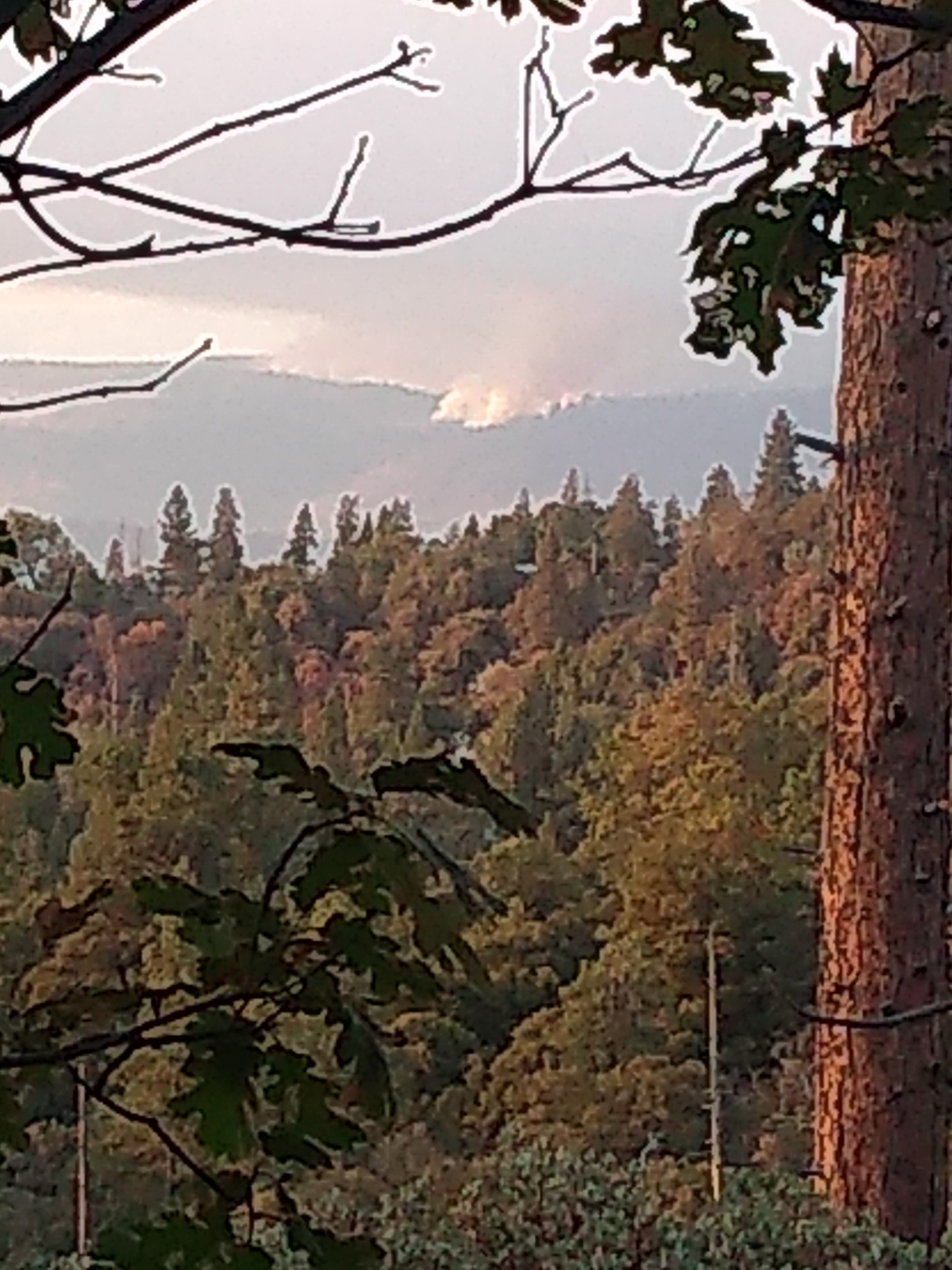
Here’s a look from our place viewing peckinpah mountain, in the foreground is where the fire was held. Got to see those drops by 10 tanker air carrier and CALFIREs S2s come down that ridge on flight radar app.
67 years my family has been up here and I thank everyone who came from all over this country and other nations to fight and tame this beast. May your bank accounts be full and may you get home to your families and friends.
17 Likes