A post was merged into an existing topic: CA-SNF-Creek ???
Hearing good dozer work on south end on Tollhouse and Peterson Rds on command.
New IAP!
There are several spot fires south of Highway 168 and Cressman. There are several spot fires in Blue Canyon which eventually will burn all the way to the Kings River if conditions don’t change. With the fire pushing west it has a potential to make it to the outskirts of the basecamp within a day or two.
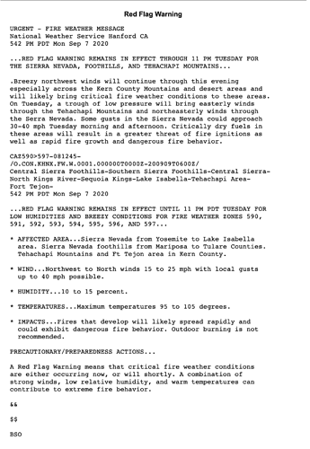
Nasty northwest winds tonight! Winds are showing 40mph winds out of northeast 12 hours from 22:48 hours.
Pushing West… That will be into SRA shortly.
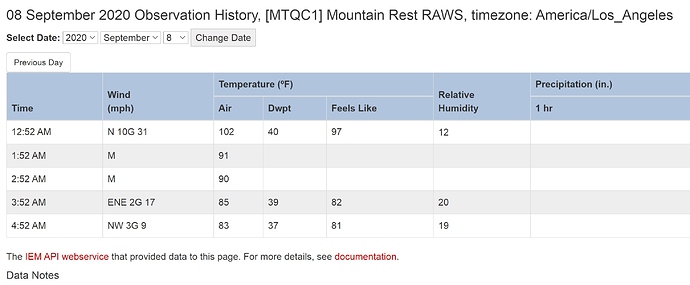
Winds aren’t real strong anywhere else. Mountain rest raws shows 36 mph gust but just down the road is 8-15. Mountain rest right now is pretty close to column.
https://www.wrh.noaa.gov/mesowest/timeseries.php?sid=MTQC1&num=72&banner=gmap&raw=0&w=325
Command went silent. I can see it from Clovis. Don’t be stubborn on this one. No structure or tree is worth a life. I’m heartbroken for everyone.
The winds peak at 10am in the morning. 30-40mph.
Right around 0115 I heard that Mountain Rest (the station) was surrounded and the dozers working Shaver Springs were bugging out (per div on cmd).
This mornings IR and 209 143,929. Many Sierra NF employees and families are evacuated, but they’re hanging in there and working hard. Today is going to be so critical, won’t be long before it hits 200,000
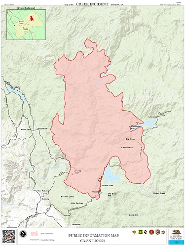
Here is today’s IR Map. You can get access to all incident published (IR, Ops Maps, IAP and more) info at https://ftp.nifc.gov/
IAP is password protected. Is there a QR for the IAP that someone can post ?
IAP is on NIFC
Go to Calif_S, 2020incidents, Creek.
Based on what happened with the wind surfacing on the fires further north and sudden intense burning expect the same with little warning as the winds mix down.


